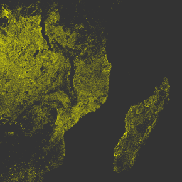
O produto de dados diários de anomalias térmicas/incêndios (VNP14A1) versão 1 do Visible Infrared Imaging Radiometer Suite (VIIRS) da NASA da Suomi National Polar-Orbiting Partnership fornece informações diárias sobre incêndios ativos e outras anomalias térmicas. O produto de dados VNP14A1 é um composto global de pixels de incêndio detectados nas bandas de 750 m do VIIRS em um período diário (24 horas) em uma grade de 1 km.
Os produtos de dados VNP14 são projetados com base no conjunto de produtos de anomalias térmicas/incêndios do espectrorradiômetro de imagens de resolução moderada (MODIS, na sigla em inglês).
Controle de qualidade da fenologia global da superfície terrestre
Bitmask para controle de qualidade
Bits 0-1: estado de terra/água
0: água
1: costa
2: terra
3: unused
Bit 2: zona de corte de solo do EDR
0: false
1: true
Bit 3: correção atmosférica realizada
0: não
1: sim
Bit 4: algoritmo dia/noite
0: noite
1: dia
Bit 5: possível pixel de incêndio
0: false
1: true
Bit 6: Unused0
0: valor não usado
Bits 7 a 10: parâmetro de tamanho da janela em segundo plano
Bits 11 a 16: flags de teste de detecção individual
0: fail
1: cartão
Bits 17-19: Unused1
0: valor não usado
Bit 20: pixel de nuvem adjacente
0: não
1: sim
Bit 21: pixel de água adjacente
0: não
1: sim
Bits 22-23: nível de brilho do sol
0: nível de brilho do sol: 1
1: Nível de brilho do sol: 2
2: Nível de brilho do sol: 3
3: Nível de brilho do sol: 4
Bits 24 a 28: flags de teste de rejeição individual
0: false
1: true
Bits 29-31: Unused2
0: valor não usado
sample
metros
Número da amostra em uma faixa
Tabela de classes FireMask
Valor
Cor
Descrição
0
Nenhum
Não processados (sem dados ou dados de má qualidade)
1
Nenhum
Não processado (exclusão de gravata borboleta)
2
Nenhum
Não utilizado
3
Nenhum
Água
4
Nenhum
Cloud
5
Nenhum
Terra
6
Nenhum
Não classificado
7
Nenhum
Pixel de incêndio com baixa confiança
8
Nenhum
Pixel de incêndio com confiança nominal
9
Nenhum
Pixel de incêndio com alta confiança
Termos de Uso
Termos de Uso
Os dados da NASA do LP DAAC são de livre acesso. No entanto, quando um autor publica esses dados ou trabalhos baseados neles, é necessário citar os conjuntos de dados no texto da publicação e incluir uma referência a eles na lista de referências.
O produto de dados diários de anomalias térmicas/incêndios (VNP14A1) da versão 1 do Visible Infrared Imaging Radiometer Suite (VIIRS) da NASA (Suomi National Polar-Orbiting Partnership) fornece informações diárias sobre incêndios ativos e outras anomalias térmicas. O produto de dados VNP14A1 é um composto global de pixels de incêndio em grade de 1 km detectados nas bandas de 750 m do VIIRS em um período de…
[null,null,[],[[["\u003cp\u003eThe NASA VIIRS VNP14A1 dataset provides daily, global, 1km data on active fires and thermal anomalies detected by the Suomi NPP satellite.\u003c/p\u003e\n"],["\u003cp\u003eThe dataset includes information on fire confidence, maximum fire radiative power, and quality control, with data available from 2012-01-19 to 2024-12-10.\u003c/p\u003e\n"],["\u003cp\u003eUsers are requested to cite the dataset appropriately when publishing results based on this data, with specific citation guidance available on the LP DAAC website.\u003c/p\u003e\n"],["\u003cp\u003eThe data is freely accessible and can be explored and analyzed using Google Earth Engine.\u003c/p\u003e\n"]]],["The NASA VIIRS VNP14A1 dataset provides daily, 1km gridded data on active fires and thermal anomalies from 2012-01-19 to 2025-02-21. Data, sourced from the VIIRS instrument, includes fire pixel confidence, maximum fire radiative power, and quality assessments. It is accessible via the NASA LP DAAC and Google Earth Engine. Users can access it, visualize and use it with the provided snippets, and cite it as requested by the provider.\n"],null,["Dataset Availability\n: 2012-01-19T00:00:00Z--2025-08-30T00:00:00Z\n\nDataset Provider\n:\n\n\n [NASA LP DAAC at the USGS EROS Center](https://doi.org/10.5067/VIIRS/VNP14A1.002)\n\nCadence\n: 1 Day\n\nTags\n:\n[fire](/earth-engine/datasets/tags/fire) [land](/earth-engine/datasets/tags/land) [nasa](/earth-engine/datasets/tags/nasa) [noaa](/earth-engine/datasets/tags/noaa) [surface](/earth-engine/datasets/tags/surface) [viirs](/earth-engine/datasets/tags/viirs) \n\nDescription \nThe daily Suomi National Polar-Orbiting Partnership NASA Visible Infrared\nImaging Radiometer Suite (VIIRS) Thermal Anomalies/Fire (VNP14A1) Version 1\ndata product provides daily information about active fires and other thermal\nanomalies. The VNP14A1 data product is a global, 1km gridded composite of\nfire pixels detected from VIIRS 750m bands over a daily (24-hour) period.\nThe VNP14 data products are designed after the Moderate Resolution Imaging\nSpectroradiometer (MODIS) Thermal Anomalies/Fire product suite.\n\nDocumentation:\n\n- [User's Guide](https://lpdaac.usgs.gov/documents/427/VNP14_User_Guide_V1.pdf)\n\n- [Algorithm Theoretical Basis Document (ATBD)](https://lpdaac.usgs.gov/documents/427/VNP14_User_Guide_V1.pdf)\n\n- [General Documentation](https://lpdaac.usgs.gov/products/vnp14a1v002/)\n\n- [Land Product Quality Assessment website](https://landweb.modaps.eosdis.nasa.gov/browse?sensor=VIIRS&sat=SNPP)\n\nBands\n\n\n**Pixel Size**\n\n1000 meters\n\n**Bands**\n\n| Name | Units | Pixel Size | Description |\n|------------|-------|------------|-----------------------------------------------|---|---|---|---|---|---|---|---|---|---|---|---|---|---|---|---|---|---|---|---|---|---|---|---|---|---|---|---|---|---|---|---|---|---|---|---|---|---|---|---|---|---|---|---|---|---|---|---|---|---|---|---|---|---|---|---|---|---|---|---|---|---|---|---|---|---|---|---|---|---|---|---|---|---|---|---|---|---|---|---|---|---|---|---|---|---|---|---|---|---|---|---|---|---|---|---|\n| `FireMask` | | meters | Confidence of fire. |\n| `MaxFRP` | MW | meters | Maximum Fire Radiative Power |\n| `QA` | | meters | Global Land Surface Phenology Quality Control |\n| Bitmask for QA - Bits 0-1: land/water state - 0: water - 1: coast - 2: land - 3: unused - Bit 2: EDR ground trim zone - 0: false - 1: true - Bit 3: atmospheric correction performed - 0: no - 1: yes - Bit 4: day/night algorithm - 0: night - 1: day - Bit 5: potential fire pixel - 0: false - 1: true - Bit 6: Unused0 - 0: Unused value - Bits 7-10: background window size parameter - Bits 11-16: individual detection test flags - 0: fail - 1: pass - Bits 17-19: Unused1 - 0: Unused value - Bit 20: adjacent cloud pixel - 0: no - 1: yes - Bit 21: adjacent water pixel - 0: no - 1: yes - Bits 22-23: Sun glint level - 0: Sun glint level - 1 - 1: Sun glint level - 2 - 2: Sun glint level - 3 - 3: Sun glint level - 4 - Bits 24-28: individual rejection test flags - 0: false - 1: true - Bits 29-31: Unused2 - 0: Unused value ||||||||||||||||||||||||||||||||||||||||||||||||||||||||||||||||||||||||||||||||||||||||||||||||||||\n| `sample` | | meters | Sample number within a swath |\n\n**FireMask Class Table**\n\n| Value | Color | Description |\n|-------|-------|----------------------------------------------|\n| 0 | None | Not processed (no data or poor quality data) |\n| 1 | None | Not processed (bowtie deletion) |\n| 2 | None | Unused |\n| 3 | None | Water |\n| 4 | None | Cloud |\n| 5 | None | Land |\n| 6 | None | Unclassified |\n| 7 | None | Low confidence fire pixel |\n| 8 | None | Nominal confidence fire pixel |\n| 9 | None | High confidence fire pixel |\n\nTerms of Use\n\n**Terms of Use**\n\nLP DAAC NASA data are freely accessible; however, when an author\npublishes these data or works based on the data, it is requested that the\nauthor cite the datasets within the text of the publication and include a\nreference to them in the reference list.\n\nCitations \nCitations:\n\n- Please visit [LP DAAC 'Citing Our Data' page](https://lpdaac.usgs.gov/citing_our_data)\n for information on citing LP DAAC datasets.\n\nDOIs\n\n- \u003chttps://doi.org/10.5067/VIIRS/VNP14A1.002\u003e\n\nExplore with Earth Engine **Important:** Earth Engine is a platform for petabyte-scale scientific analysis and visualization of geospatial datasets, both for public benefit and for business and government users. Earth Engine is free to use for research, education, and nonprofit use. To get started, please [register for Earth Engine access.](https://console.cloud.google.com/earth-engine)\n\nCode Editor (JavaScript) \n\n```javascript\nvar dataset = ee.ImageCollection('NASA/VIIRS/002/VNP14A1')\n .filter(ee.Filter.date('2017-05-01', '2017-12-30'));\nvar visualization = {\n bands:['MaxFRP'],\n min: 0.0,\n max: 1.0,\n palette: ['#00FF00', '#00FFFF', '#00FF00', '#FFFFE0', '#FFFFA0', '#FFFF00'],\n};\nvar lon = 38.06;\nvar lat = -14.22;\nMap.setCenter(lon, lat, 6);\nMap.addLayer(dataset, visualization, 'MaxFRP');\n```\n[Open in Code Editor](https://code.earthengine.google.com/?scriptPath=Examples:Datasets/NASA/NASA_VIIRS_002_VNP14A1) \n[VNP14A1.002: Thermal Anomalies/Fire Daily L3 Global 1km SIN Grid](/earth-engine/datasets/catalog/NASA_VIIRS_002_VNP14A1) \nThe daily Suomi National Polar-Orbiting Partnership NASA Visible Infrared Imaging Radiometer Suite (VIIRS) Thermal Anomalies/Fire (VNP14A1) Version 1 data product provides daily information about active fires and other thermal anomalies. The VNP14A1 data product is a global, 1km gridded composite of fire pixels detected from VIIRS 750m bands over a ... \nNASA/VIIRS/002/VNP14A1, fire,land,nasa,noaa,surface,viirs \n2012-01-19T00:00:00Z/2025-08-30T00:00:00Z \n-90 -180 90 180 \nGoogle Earth Engine \nhttps://developers.google.com/earth-engine/datasets\n\n- [https://doi.org/10.5067/VIIRS/VNP14A1.002](https://doi.org/https://doi.org/10.5067/VIIRS/VNP14A1.002)\n- [https://doi.org/10.5067/VIIRS/VNP14A1.002](https://doi.org/https://developers.google.com/earth-engine/datasets/catalog/NASA_VIIRS_002_VNP14A1)"]]