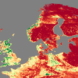
O produto de dados do índice de área foliar (LAI) e da fração de radiação fotossinteticamente ativa (FPAR) da Visible Infrared Imaging Radiometer Suite (VIIRS), versão 1, fornece informações sobre a camada de cobertura vegetal com resolução de 500 metros (VNP15A2H). O sensor VIIRS está localizado a bordo do satélite da Parceria Nacional de Órbita Polar Suomi (Suomi NPP, na sigla em inglês), da NOAA/NASA. O LAI é um índice que quantifica a área foliar unilateral de uma copa, enquanto o FPAR é a fração da energia solar recebida absorvida pela fotossíntese em 400 a 700 nanômetros. Esse produto foi projetado intencionalmente com base no algoritmo operacional de índice de área foliar (LAI, na sigla em inglês)/fração de radiação fotossinteticamente ativa (FPAR, na sigla em inglês) do espectrorradiômetro imageador de resolução moderada (MODIS, na sigla em inglês) do Terra e do Aqua para promover a continuidade da missão do Sistema de Observação da Terra (EOS, na sigla em inglês).
Controle de qualidade (QC) de transferência para FPAR
Máscara de bits para FparExtra_QC
Bits 0 a 1: detecção e confiança na nuvem
0: Confiança clara
1: Provavelmente clara
2: Provavelmente nublado
3: Confiança nublada
Bit 2: sombra da nuvem
0: sem sombra de nuvem
1: Shadow
Bit 3: cirrus finos
0: Não
1: Sim
Bits 4-5: quantidade de aerossol
0: Climatologia
1: baixa
2: média
3: alta
Bit 6: neve/gelo
0: Não
1: Sim
FparLai_QC
metros
Qualidade para LAI e FPAR
Máscara de bits para FparLai_QC
Bits 0-2: SCF_QC
0: principal método (RT) usado, melhor resultado possível (sem saturação)
1: método principal (RT) usado com saturação. Bom, muito utilizável.
2: o método principal (RT) falhou devido a geometria ruim, algoritmo empírico usado
3: O método principal (RT) falhou devido a problemas que não são de geometria. Foi usado um algoritmo empírico.
4: o pixel não foi produzido, não foi possível recuperar o valor
Bit 3: DeadDetector
0: os detectores de luz vermelha e NIR estão funcionando bem
1: Pelo menos uma faixa tem detector de dead
Bits 4 a 7: BiomeType
0: Água
1: gramíneas/cereais
2: arbustos
3: Culturas de folhas largas
4: Cerrado
5: Floresta perene de folhas largas
6: Floresta decídua de folhas largas
7: Floresta perene de coníferas
8: Floresta de coníferas decíduas
9: Não vegetada
10: urbana
11: Sem classificação
12: Valor preenchido
FparStdDev
metros
Desvio padrão de FPAR
Lai
Fração da área
metros
Índice de área foliar
LaiStdDev
Fração da área
metros
Desvio padrão para LAI
Termos de Uso
Termos de Uso
Os dados da NASA do LP DAAC são de livre acesso. No entanto, quando um autor publica esses dados ou trabalhos baseados neles, é necessário citar os conjuntos de dados no texto da publicação e incluir uma referência a eles na lista de referências.
O produto de dados da versão 1 do índice de área foliar (LAI) e da fração de radiação fotossinteticamente ativa (FPAR) do Visible Infrared Imaging Radiometer Suite (VIIRS) fornece informações sobre a camada de cobertura vegetal com resolução de 500 metros (VNP15A2H). O sensor VIIRS está localizado a bordo do satélite Suomi NPP (Suomi National Polar-Orbiting Partnership), uma parceria conjunta da NOAA/NASA. …
[null,null,[],[[["\u003cp\u003eThe NASA/VIIRS/002/VNP15A2H dataset provides Leaf Area Index (LAI) and Fraction of Photosynthetically Active Radiation (FPAR) data at 500m resolution.\u003c/p\u003e\n"],["\u003cp\u003eThis dataset, derived from the VIIRS sensor on the Suomi NPP satellite, offers insights into vegetative canopy layers from 2012 to 2024.\u003c/p\u003e\n"],["\u003cp\u003eThe product is designed for continuity with the MODIS LAI/FPAR algorithm from the Terra and Aqua missions.\u003c/p\u003e\n"],["\u003cp\u003eLAI quantifies one-sided leaf area of a canopy, while FPAR measures the fraction of solar energy absorbed for photosynthesis.\u003c/p\u003e\n"],["\u003cp\u003eData users are requested to cite the dataset appropriately in publications, following guidelines on the LP DAAC website.\u003c/p\u003e\n"]]],["The VIIRS dataset (VNP15A2H), available from 2012-01-17 to 2025-02-10, offers 8-day cadence data on the vegetative canopy. It includes Leaf Area Index (LAI) and Fraction of Photosynthetically Active Radiation (FPAR) at 500-meter resolution. Provided by NASA LP DAAC, this data is accessible via Google Earth Engine with a provided code snippet and DOIs are provided for citation, such as [https://doi.org/10.5067/VIIRS/VNP15A2H.002](https://doi.org/https://doi.org/10.5067/VIIRS/VNP15A2H.002).\n"],null,["Dataset Availability\n: 2012-01-17T00:00:00Z--2025-08-13T00:00:00Z\n\nDataset Provider\n:\n\n\n [NASA LP DAAC at the USGS EROS Center](https://doi.org/10.5067/VIIRS/VNP15A2H.002)\n\nCadence\n: 8 Days\n\nTags\n:\n[land](/earth-engine/datasets/tags/land) [nasa](/earth-engine/datasets/tags/nasa) [noaa](/earth-engine/datasets/tags/noaa) [surface](/earth-engine/datasets/tags/surface) [vegetation-indices](/earth-engine/datasets/tags/vegetation-indices) [viirs](/earth-engine/datasets/tags/viirs) \n\nDescription \nThe Visible Infrared Imaging Radiometer Suite (VIIRS) Leaf Area Index (LAI)\nand Fraction of Photosynthetically Active Radiation (FPAR) Version 1 data\nproduct provides information about the vegetative canopy layer at 500 meter\nresolution (VNP15A2H). The VIIRS sensor is located onboard the NOAA/NASA\njoint Suomi National Polar-Orbiting Partnership (Suomi NPP) satellite. LAI\nis an index that quantifies the one-sided leaf area of a canopy, while FPAR\nis the fraction of incoming solar energy absorbed through photosynthesis at\n400 to 700 nanometers. This product is intentionally designed after the\nTerra and Aqua Moderate Resolution Imaging Spectroradiometer (MODIS)\nLAI/FPAR operational algorithm to promote the continuity of the Earth\nObservation System (EOS) mission.\n\nDocumentation:\n\n- [User's Guide](https://lpdaac.usgs.gov/documents/126/VNP15_User_Guide.pdf)\n\n- [Algorithm Theoretical Basis Document (ATBD)](https://lpdaac.usgs.gov/documents/125/VNP15_ATBD.pdf)\n\n- [General Documentation](https://lpdaac.usgs.gov/products/vnp15a2hv002/)\n\n- [Land Product Quality Assessment website](https://landweb.modaps.eosdis.nasa.gov/browse?sensor=VIIRS&sat=SNPP)\n\nBands\n\n\n**Pixel Size**\n\n500 meters\n\n**Bands**\n\n| Name | Units | Pixel Size | Description |\n|----------------|---------------|------------|--------------------------------------------------|---|---|---|---|---|---|---|---|---|---|---|---|---|---|---|---|---|---|---|---|---|---|---|---|---|---|---|---|---|---|---|---|---|---|---|---|---|---|---|---|---|---|---|---|---|---|---|---|---|---|---|---|---|---|---|---|---|---|---|---|---|---|---|---|---|---|---|---|---|---|---|---|---|---|---|---|---|---|---|---|---|---|---|---|---|---|---|---|---|---|---|---|---|---|---|---|\n| `Fpar` | | meters | Fraction of Photosynthetically Active Radiation. |\n| `FparExtra_QC` | | meters | Pass-through Quality Control (QC) for FPAR |\n| Bitmask for FparExtra_QC - Bits 0-1: Cloud detection and confidence - 0: Confident clear - 1: Probably clear - 2: Probably cloudy - 3: Confident cloudy - Bit 2: Cloud shadow - 0: No cloud shadow - 1: Shadow - Bit 3: Thin cirrus - 0: No - 1: Yes - Bits 4-5: Aerosol quantity - 0: Climatology - 1: Low - 2: Average - 3: High - Bit 6: Snow/Ice - 0: No - 1: Yes ||||||||||||||||||||||||||||||||||||||||||||||||||||||||||||||||||||||||||||||||||||||||||||||||||||\n| `FparLai_QC` | | meters | Quality for LAI and FPAR |\n| Bitmask for FparLai_QC - Bits 0-2: SCF_QC - 0: Main (RT) method used, best result possible (no saturation) - 1: Main (RT) method used with saturation. Good, very usable. - 2: Main (RT) method failed due to bad geometry, empirical algorithm used - 3: Main (RT) method failed due to problems other than geometry, empirical algorithm used - 4: Pixel not produced at all, value couldn't be retrieved - Bit 3: DeadDetector - 0: Both red and NIR detectors are fine - 1: At least one band has dead detector - Bits 4-7: BiomeType - 0: Water - 1: Grasses/cereal crops - 2: Shrubs - 3: Broadleaf crops - 4: Savanna - 5: Evergreen broadleaf forest - 6: Deciduous broadleaf forest - 7: Evergreen needleleaf forest - 8: Deciduous needleleaf forest - 9: Non-vegetated - 10: Urban - 11: Unclassified - 12: Filled Value ||||||||||||||||||||||||||||||||||||||||||||||||||||||||||||||||||||||||||||||||||||||||||||||||||||\n| `FparStdDev` | | meters | Standard deviation of FPAR |\n| `Lai` | Area fraction | meters | Leaf Area Index |\n| `LaiStdDev` | Area fraction | meters | Standard deviation for LAI |\n\nTerms of Use\n\n**Terms of Use**\n\nLP DAAC NASA data are freely accessible; however, when an author\npublishes these data or works based on the data, it is requested that the\nauthor cite the datasets within the text of the publication and include a\nreference to them in the reference list.\n\nCitations \nCitations:\n\n- Please visit [LP DAAC 'Citing Our Data' page](https://lpdaac.usgs.gov/citing_our_data)\n for information on citing LP DAAC datasets.\n\nDOIs\n\n- \u003chttps://doi.org/10.5067/VIIRS/VNP15A2H.002\u003e\n\nExplore with Earth Engine **Important:** Earth Engine is a platform for petabyte-scale scientific analysis and visualization of geospatial datasets, both for public benefit and for business and government users. Earth Engine is free to use for research, education, and nonprofit use. To get started, please [register for Earth Engine access.](https://console.cloud.google.com/earth-engine)\n\nCode Editor (JavaScript) \n\n```javascript\nvar dataset = ee.ImageCollection('NASA/VIIRS/002/VNP15A2H')\n .filter(ee.Filter.date('2022-11-01', '2022-12-01'));\n\nvar visualization = {\n bands: ['Lai'],\n min: [0],\n max: [4],\n palette: [\n 'a50026',\n 'd73027',\n 'f46d43',\n 'fdae61',\n 'fee08b',\n 'ffffbf',\n 'd9ef8b',\n 'a6d96a',\n '66bd63',\n '1a9850',\n '006837',\n ]\n};\nMap.setCenter(41.2, 38.84, 3);\nMap.addLayer(dataset, visualization, 'Leaf Area Index (LAI)');\n```\n[Open in Code Editor](https://code.earthengine.google.com/?scriptPath=Examples:Datasets/NASA/NASA_VIIRS_002_VNP15A2H) \n[VNP15A2H: LAI/FPAR 8-Day L4 Global 500m SIN Grid](/earth-engine/datasets/catalog/NASA_VIIRS_002_VNP15A2H) \nThe Visible Infrared Imaging Radiometer Suite (VIIRS) Leaf Area Index (LAI) and Fraction of Photosynthetically Active Radiation (FPAR) Version 1 data product provides information about the vegetative canopy layer at 500 meter resolution (VNP15A2H). The VIIRS sensor is located onboard the NOAA/NASA joint Suomi National Polar-Orbiting Partnership (Suomi NPP) satellite. ... \nNASA/VIIRS/002/VNP15A2H, land,nasa,noaa,surface,vegetation-indices,viirs \n2012-01-17T00:00:00Z/2025-08-13T00:00:00Z \n-90 -180 90 180 \nGoogle Earth Engine \nhttps://developers.google.com/earth-engine/datasets\n\n- [https://doi.org/10.5067/VIIRS/VNP15A2H.002](https://doi.org/https://doi.org/10.5067/VIIRS/VNP15A2H.002)\n- [https://doi.org/10.5067/VIIRS/VNP15A2H.002](https://doi.org/https://developers.google.com/earth-engine/datasets/catalog/NASA_VIIRS_002_VNP15A2H)"]]