- Disponibilidade de conjuntos de dados
- 2012-01-19T00:00:00Z–2026-01-03T00:00:00Z
- Provedor de conjunto de dados
- NASA LP DAAC no USGS EROS Center
- Cadência
- 1 dia
- Tags
Descrição
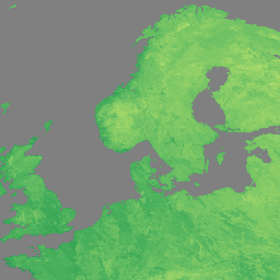
O produto da versão 1 (VNP21A1D) de temperatura e emissividade da superfície terrestre (LST&E) do Visible Infrared Imaging Radiometer Suite (VIIRS) da Suomi National Polar-Orbiting Partnership (Suomi NPP) da NASA é compilado diariamente com base em produtos intermediários em grade de nível 2 (L2G) diurnos.
O processo L2G mapeia os grânulos de faixa diários do VNP21 em uma grade sinusoidal do MODIS e armazena todas as observações que se sobrepõem a uma célula de grade em um determinado dia. O algoritmo VNP21A1 classifica todas essas observações para cada célula e estima o valor final de LST como uma média de todas as observações sem nuvens que têm boas precisões de LST. Somente observações com uma cobertura maior que um determinado limite (15%) são consideradas para essa média.
Documentação:
Bandas
Tamanho do pixel
1.000 metros
Bandas
| Nome | Unidades | Tamanho do pixel | Descrição | ||||||||||||||||||||||||||||||||||||||||||||||||||||||||||||||||||||||||||||||||||||||||||||||||
|---|---|---|---|---|---|---|---|---|---|---|---|---|---|---|---|---|---|---|---|---|---|---|---|---|---|---|---|---|---|---|---|---|---|---|---|---|---|---|---|---|---|---|---|---|---|---|---|---|---|---|---|---|---|---|---|---|---|---|---|---|---|---|---|---|---|---|---|---|---|---|---|---|---|---|---|---|---|---|---|---|---|---|---|---|---|---|---|---|---|---|---|---|---|---|---|---|---|---|---|
LST_1KM |
K | metros | Temperatura diária da superfície do solo de 1 km. |
||||||||||||||||||||||||||||||||||||||||||||||||||||||||||||||||||||||||||||||||||||||||||||||||
QC |
metros | Controle de qualidade diário para LST e emissividade |
|||||||||||||||||||||||||||||||||||||||||||||||||||||||||||||||||||||||||||||||||||||||||||||||||
Emis_14 |
metros | Emissividade diária do M14 |
|||||||||||||||||||||||||||||||||||||||||||||||||||||||||||||||||||||||||||||||||||||||||||||||||
Emis_15 |
metros | Emissividade diária de M15 |
|||||||||||||||||||||||||||||||||||||||||||||||||||||||||||||||||||||||||||||||||||||||||||||||||
Emis_16 |
metros | Emissividade diária do M16 |
|||||||||||||||||||||||||||||||||||||||||||||||||||||||||||||||||||||||||||||||||||||||||||||||||
View_Angle |
graus | metros | Ver o ângulo zenital da LST |
||||||||||||||||||||||||||||||||||||||||||||||||||||||||||||||||||||||||||||||||||||||||||||||||
View_Time |
h | metros | Horário da observação de LST |
||||||||||||||||||||||||||||||||||||||||||||||||||||||||||||||||||||||||||||||||||||||||||||||||
Termos de Uso
Termos de Uso
Os dados da NASA do LP DAAC são de livre acesso. No entanto, quando um autor publica esses dados ou trabalhos baseados neles, é necessário citar os conjuntos de dados no texto da publicação e incluir uma referência a eles na lista de referências.
Citações
Acesse a página "Como citar nossos dados" do LP DAAC para informações sobre como citar conjuntos de dados do LP DAAC.
DOIs
Explore com o Earth Engine
Editor de código (JavaScript)
var dataset = ee.ImageCollection('NASA/VIIRS/002/VNP21A1D')
                  .filter(ee.Filter.date('2022-11-01', '2022-12-01'));

var visualization = {
  bands: ['LST_1KM'],
  min: [150],
  max: [300],
  palette: [
    'a50026',
    'd73027',
    'f46d43',
    'fdae61',
    'fee08b',
    'ffffbf',
    'd9ef8b',
    'a6d96a',
    '66bd63',
    '1a9850',
    '006837',
  ]
};
Map.setCenter(41.2, 38.84, 3);
Map.addLayer(dataset, visualization, 'LST');