NASA/NOAA Suomi National Polar-orbiting Partnership (Suomi NPP) Visible Infrared Imaging Radiometer Suite (VIIRS) Nadir Bidirectional Reflectance Distribution Function (BRDF) Adjusted Reflectance (NBAR) 버전 2 제품은 500미터 해상도로 NBAR 추정치를 제공합니다. VNP43IA4 제품은 16일간의 VIIRS 데이터를 사용하여 매일 생성되며, 파일 이름에 반영된 9번째 날짜에 시간별 가중치가 부여됩니다. 보기 각도 효과가 방향 반사율에서 제거되어 안정적이고 일관된 NBAR 제품이 생성됩니다. VNP43 데이터 제품은 NASA의 중해상도 이미징 분광계 (MODIS) BRDF/Albedo 데이터 제품 모음의 연속성을 촉진하도록 설계되었습니다.
VNP43 알고리즘은 VNP43IA1의 세 가지 커널 가중치를 사용하여 표면 이방성 효과를 재구성하고 방향성 반사율을 공통 뷰 형상 (VNP43IA4)으로 보정하는 RossThick/Li-Sparse-Reciprocal (RTLSR) 반경험적 커널 기반 BRDF 모델을 사용하며, 현지 정오에 통합된 블랙 스카이 알베도 (BSA)와 화이트 스카이 알베도 (WSA) (VNP43IA3)도 계산합니다. 연구원은 간단한 다항식과 함께 BRDF 모델 매개변수를 사용하여 모든 태양 조명 각도에서 블랙 스카이 알베도를 얻을 수 있습니다. 마찬가지로 BSA 및 WSA 과학 데이터 세트 (SDS) 레이어를 모두 간단한 다항식과 함께 사용하여 순간 실제 알베도 (청천 알베도)를 수동으로 추정할 수 있습니다. 방법론에 관한 자세한 내용은 알고리즘 이론적 근거 문서(ATBD)를 참고하세요.
LP DAAC NASA 데이터는 자유롭게 액세스할 수 있지만, 저자가 이러한 데이터를 게시하거나 데이터를 기반으로 작업하는 경우 저자는 게시물의 텍스트 내에서 데이터 세트를 인용하고 참고 문헌 목록에 데이터 세트에 대한 참조를 포함해야 합니다.
인용
인용:
Schaaf, C., Z. Wang, A. Erb, I. Paynter. VIIRS/NPP BRDF/Albedo Nadir
BRDF-Adjusted Ref Daily L3 Global 500m SIN Grid V002. 2024, NASA EOSDIS Land Processes Distributed Active Archive Center에서 배포, 10.5067/VIIRS/VNP43IA4.002.
NASA/NOAA Suomi National Polar-orbiting Partnership (Suomi NPP) Visible Infrared Imaging Radiometer Suite (VIIRS) Nadir Bidirectional Reflectance Distribution Function (BRDF) Adjusted Reflectance (NBAR) 버전 2 제품은 500m 해상도로 NBAR 추정치를 제공합니다. VNP43IA4 제품은 16일간의 VIIRS 데이터를 사용하여 매일 생성되며 시간적으로 가중치가 부여되어 …
[null,null,[],[],[],null,["# VNP43IA4: BRDF/Albedo Quality Daily L3 Global 500m SIN Grid\n\nDataset Availability\n: 2012-01-17T00:00:00Z--2025-08-12T00:00:00Z\n\nDataset Provider\n:\n\n\n [NASA LP DAAC at the USGS EROS Center](https://doi.org/10.5067/VIIRS/VNP43IA4.002)\n\nCadence\n: 1 Day\n\nTags\n:\n[brdf](/earth-engine/datasets/tags/brdf) [land](/earth-engine/datasets/tags/land) [nasa](/earth-engine/datasets/tags/nasa) [noaa](/earth-engine/datasets/tags/noaa) [satellite-imagery](/earth-engine/datasets/tags/satellite-imagery) [surface](/earth-engine/datasets/tags/surface) [viirs](/earth-engine/datasets/tags/viirs) \n\n#### Description\n\nThe NASA/NOAA Suomi National Polar-orbiting Partnership (Suomi NPP) Visible\nInfrared Imaging Radiometer Suite (VIIRS) Nadir Bidirectional Reflectance\nDistribution Function (BRDF) Adjusted Reflectance (NBAR) Version 2 product\nprovides NBAR estimates at 500 meter resolution. The VNP43IA4 product is\nproduced daily using 16 days of VIIRS data and is weighted temporally to the\nninth day, which is reflected in the file name. The view angle effects are\nremoved from the directional reflectances, resulting in a stable and\nconsistent NBAR product. The VNP43 data products are designed to promote the\ncontinuity of NASA's Moderate Resolution Imaging Spectroradiometer (MODIS)\nBRDF/Albedo data product suite.\n\nThe VNP43 algorithm uses the RossThick/Li-Sparse-Reciprocal (RTLSR)\nsemi-empirical kernel-driven BRDF model, with the three kernel weights from\nVNP43IA1 to reconstruct surface anisotropic effects, correcting the\ndirectional reflectance to a common view geometry (VNP43IA4), while\nalso computing integrated black-sky albedo (BSA) at local solar noon and\nwhite-sky albedo (WSA) (VNP43IA3). Researchers can use the BRDF model\nparameters with a simple polynomial, to obtain black-sky albedo at any solar\nillumination angle. Likewise, both the BSA and WSA Science Dataset (SDS)\nlayers can be used with a simple polynomial, to manually estimate\ninstantaneous actual albedo (blue-sky albedo). Additional details regarding\nthe methodology are available in the Algorithm Theoretical Basis Document\n(ATBD).\n\nDocumentation:\n\n- [User's Guide](https://www.umb.edu/spectralmass/viirs-user-guides-c1-and-c2/vnp43ia4-and-vnpma4-nbar-products/)\n\n- [Algorithm Theoretical Basis Document (ATBD)](https://lpdaac.usgs.gov/documents/194/VNP43_ATBD_V1.pdf)\n\n- [General Documentation](https://lpdaac.usgs.gov/products/vnp43ia4v002/)\n\n### Bands\n\n\n**Pixel Size**\n\n500 meters\n\n**Bands**\n\n| Name | Pixel Size | Description |\n|-----------------------------------------|------------|---------------------------------------------------------------|\n| `BRDF_Albedo_Band_Mandatory_Quality_I1` | meters | BRDF/Albedo mandatory quality for band I1 |\n| `BRDF_Albedo_Band_Mandatory_Quality_I2` | meters | BRDF/Albedo mandatory quality for band I2 |\n| `BRDF_Albedo_Band_Mandatory_Quality_I3` | meters | BRDF/Albedo mandatory quality for band I3 |\n| `Nadir_Reflectance_I1` | meters | Nadir BRDF/Albedo Reflectance at local solar noon for band I1 |\n| `Nadir_Reflectance_I2` | meters | Nadir BRDF/Albedo Reflectance at local solar noon for band I2 |\n| `Nadir_Reflectance_I3` | meters | Nadir BRDF/Albedo Reflectance at local solar noon for band I3 |\n\n### Terms of Use\n\n**Terms of Use**\n\nLP DAAC NASA data are freely accessible; however, when an author\npublishes these data or works based on the data, it is requested that the\nauthor cite the datasets within the text of the publication and include a\nreference to them in the reference list.\n\n### Citations\n\nCitations:\n\n- Schaaf, C., Z. Wang, A. Erb, I. Paynter. VIIRS/NPP BRDF/Albedo Nadir\n BRDF-Adjusted Ref Daily L3 Global 500m SIN Grid V002. 2024, distributed by\n NASA EOSDIS Land Processes Distributed Active Archive Center,\n [10.5067/VIIRS/VNP43IA4.002](https://doi.org/10.5067/VIIRS/VNP43IA4.002).\n\n### DOIs\n\n- \u003chttps://doi.org/10.5067/VIIRS/VNP43IA4.002\u003e\n\n### Explore with Earth Engine\n\n| **Important:** Earth Engine is a platform for petabyte-scale scientific analysis and visualization of geospatial datasets, both for public benefit and for business and government users. Earth Engine is free to use for research, education, and nonprofit use. To get started, please [register for Earth Engine access.](https://console.cloud.google.com/earth-engine)\n\n### Code Editor (JavaScript)\n\n```javascript\n
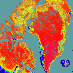
var dataset = ee.ImageCollection('NASA/VIIRS/002/VNP43IA4')\n .filter(ee.Filter.date('2021-06-01', '2021-06-03'));\n\nvar nadir_reflectance_I1 = dataset.select('Nadir_Reflectance_I1').first();\nvar palette = [\n '000080',\n '0000d9',\n '4000ff',\n '8000ff',\n '0080ff',\n '00ffff',\n '00ff80',\n '80ff00',\n 'daff00',\n 'ffff00',\n 'fff500',\n 'ffda00',\n 'ffb000',\n 'ffa400',\n 'ff4f00',\n 'ff2500',\n 'ff0a00',\n 'ff00ff',\n];\nvar visParams = {\n min: 0,\n max: 10000,\n palette: palette,\n};\n\n// cadetblue\nvar background = ee.Image.rgb(95, 158, 160).visualize({min: 0, max: 255});\nvar image = nadir_reflectance_I1.visualize(visParams);\n\nvar lon = -8;\nvar lat = 60;\n\nMap.addLayer(background, {}, 'background');\nMap.addLayer(image, {}, 'Nadir BRDF/Albedo Reflectance I1');\nMap.setCenter(lon, lat, 3);\n```\n[Open in Code Editor](https://code.earthengine.google.com/?scriptPath=Examples:Datasets/NASA/NASA_VIIRS_002_VNP43IA4) \n[VNP43IA4: BRDF/Albedo Quality Daily L3 Global 500m SIN Grid](/earth-engine/datasets/catalog/NASA_VIIRS_002_VNP43IA4) \nThe NASA/NOAA Suomi National Polar-orbiting Partnership (Suomi NPP) Visible Infrared Imaging Radiometer Suite (VIIRS) Nadir Bidirectional Reflectance Distribution Function (BRDF) Adjusted Reflectance (NBAR) Version 2 product provides NBAR estimates at 500 meter resolution. The VNP43IA4 product is produced daily using 16 days of VIIRS data and is weighted temporally to ... \nNASA/VIIRS/002/VNP43IA4, brdf,land,nasa,noaa,satellite-imagery,surface,viirs \n2012-01-17T00:00:00Z/2025-08-12T00:00:00Z \n-90 -180 90 180 \nGoogle Earth Engine \nhttps://developers.google.com/earth-engine/datasets\n\n- [https://doi.org/10.5067/VIIRS/VNP43IA4.002](https://doi.org/https://doi.org/10.5067/VIIRS/VNP43IA4.002)\n- [https://doi.org/10.5067/VIIRS/VNP43IA4.002](https://doi.org/https://developers.google.com/earth-engine/datasets/catalog/NASA_VIIRS_002_VNP43IA4)"]]