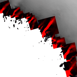
Esse conjunto de dados, parte do programa da NASA Making Earth System Data Records for Use in Research Environments (MEaSUREs), consiste em mapas de velocidade média mensal para áreas selecionadas de saída de geleiras.
Os mapas são gerados rastreando recursos visíveis entre pares de imagens ópticas adquiridas pelo Thematic Mapper (TM) do Landsat 4 e 5, pelo Enhanced Thematic Mapper Plus (ETM+) do Landsat 7, pelo Operational Land Imager (OLI) do Landsat 8 e pelo Advanced Spaceborne Thermal Emission and Reflection Radiometer (ASTER).
Observação
As médias mensais são calculadas com base em imagens, que podem ter datas de aquisição do mês anterior ou seguinte. Para a convenção de nomenclatura, o mês é determinado de acordo com o período em que as datas julianas do ponto médio se enquadram.
Por exemplo, as médias mensais de setembro podem ter sido geradas com imagens adquiridas em agosto ou outubro, mas a data juliana intermediária entre as imagens fica em setembro. As datas exatas usadas são incluídas como campos de metadados por imagem.
Lista de datas julianas centrais para pares de imagens usadas na imagem.
FIRST_IMAGE_DATES
STRING_LIST
Lista das datas da primeira imagem usada na imagem.
NOMINAL_TIMES
STRING_LIST
Lista de tempos de observação nominais para pares de imagens.
PRODUCTION_DATE
STRING
Data de produção.
SECOND_IMAGE_DATES
STRING_LIST
Lista de datas da segunda imagem usadas na imagem.
SENSORES
STRING_LIST
Lista de pares de sensores usados na imagem.
Termos de Uso
Termos de Uso
Como condição para usar esses dados, você precisa citar o uso do conjunto de dados com a citação fornecida.
Citações
Citações:
Howat, I. 2017. MEaSUREs Greenland Ice Velocity: Selected
Glacier Site Velocity Maps from Optical Images, Version 2.
[Subconjunto de dados usado]. Boulder, Colorado, EUA. National Snow and Ice Data Center / Distributed Active Archive Center da NASA.
doi:10.5067/VM5DZ20MYF5C.
[Data de acesso].
Esse conjunto de dados, parte do programa da NASA "Making Earth System Data Records for Use in Research Environments" (MEaSUREs), consiste em mapas de velocidade média mensal para áreas selecionadas de saída de geleiras. Os mapas são gerados rastreando recursos visíveis entre pares de imagens ópticas adquiridas pelo Landsat 4 e 5 Thematic Mapper…
[null,null,[],[[["\u003cp\u003eThis dataset provides monthly velocity maps of selected Greenland glacier outlets from 1985 to 2016, derived from Landsat and ASTER imagery.\u003c/p\u003e\n"],["\u003cp\u003eIce flow velocity is represented in meters per year, with separate bands for x and y components, along with corresponding error estimates.\u003c/p\u003e\n"],["\u003cp\u003eThe data is part of NASA's MEaSUREs program and is available at a 100-meter resolution.\u003c/p\u003e\n"],["\u003cp\u003eUsers must cite the dataset appropriately when using this data, following provided guidelines.\u003c/p\u003e\n"],["\u003cp\u003eThe dataset can be accessed and analyzed through Google Earth Engine.\u003c/p\u003e\n"]]],[],null,["# MEaSUREs Greenland Ice Velocity: Selected Glacier Site Velocity Maps from Optical Images Version 2\n\nDataset Availability\n: 1985-03-01T00:00:00Z--2016-09-30T00:00:00Z\n\nDataset Provider\n:\n\n\n [NASA NSIDC DAAC at CIRES](https://doi.org/10.5067/VM5DZ20MYF5C)\n\nTags\n:\n[arctic](/earth-engine/datasets/tags/arctic) [cryosphere](/earth-engine/datasets/tags/cryosphere) [gimp](/earth-engine/datasets/tags/gimp) [greenland](/earth-engine/datasets/tags/greenland) [ice](/earth-engine/datasets/tags/ice) [nasa](/earth-engine/datasets/tags/nasa) [polar](/earth-engine/datasets/tags/polar) [velocity](/earth-engine/datasets/tags/velocity) \n\n#### Description\n\nThis dataset, part of the NASA Making Earth System Data\nRecords for Use in Research Environments (MEaSUREs) program,\nconsists of mean monthly velocity maps for selected glacier outlet areas.\nThe maps are generated by tracking visible features between optical\nimage pairs acquired by the Landsat 4 and 5 Thematic Mapper (TM),\nthe Landsat 7 Enhanced Thematic Mapper Plus (ETM+), the Landsat 8\nOperational Land Imager (OLI), and the Advanced Spaceborne Thermal\nEmission and Reflection Radiometer (ASTER).\n\n**Note**\n\nMonthly means are calculated from images, which may have acquisition\ndates from the preceding or succeeding month. For the naming convention,\nthe month is determined from where the midpoint Julian dates fall.\nFor example, September monthly means may have been generated from\nimages that were acquired in August or in October but the midpoint\nJulian date between the images falls within September. The exact\ndates used are included as per-image metadata fields.\n\n[General documentation](https://doi.org/10.5067/VM5DZ20MYF5C)\n\n### Bands\n\n\n**Pixel Size**\n\n100 meters\n\n**Bands**\n\n| Name | Units | Pixel Size | Description |\n|--------------|------------|------------|---------------------|\n| `velocity_x` | meter/year | meters | Ice flow x velocity |\n| `velocity_y` | meter/year | meters | Ice flow y velocity |\n| `error_x` | meter/year | meters | Ice flow x error |\n| `error_y` | meter/year | meters | Ice flow y error |\n\n### Image Properties\n\n**Image Properties**\n\n| Name | Type | Description |\n|----------------------|-------------|------------------------------------------------------------|\n| CENTRAL_JULIAN_DATES | STRING_LIST | List of central Julian date for image pairs used in image. |\n| FIRST_IMAGE_DATES | STRING_LIST | List of first image dates used in image. |\n| NOMINAL_TIMES | STRING_LIST | List of nominal observation times for pairs of images. |\n| PRODUCTION_DATE | STRING | Production date. |\n| SECOND_IMAGE_DATES | STRING_LIST | List of second image dates used in image. |\n| SENSORS | STRING_LIST | List of sensor pairs used in image. |\n\n### Terms of Use\n\n**Terms of Use**\n\nAs a condition of using these data, you must cite the use of this\ndata set using the given citation.\n\n### Citations\n\nCitations:\n\n- Howat, I. 2017. MEaSUREs Greenland Ice Velocity: Selected\n Glacier Site Velocity Maps from Optical Images, Version 2.\n \\[Indicate subset used\\]. Boulder, Colorado USA. NASA National\n Snow and Ice Data Center Distributed Active Archive Center.\n [doi:10.5067/VM5DZ20MYF5C](https://doi.org/10.5067/VM5DZ20MYF5C).\n \\[Date Accessed\\].\n\n### DOIs\n\n- \u003chttps://doi.org/10.5067/VM5DZ20MYF5C\u003e\n\n### Explore with Earth Engine\n\n| **Important:** Earth Engine is a platform for petabyte-scale scientific analysis and visualization of geospatial datasets, both for public benefit and for business and government users. Earth Engine is free to use for research, education, and nonprofit use. To get started, please [register for Earth Engine access.](https://console.cloud.google.com/earth-engine)\n\n### Code Editor (JavaScript)\n\n```javascript\nvar dataset = ee.ImageCollection('OSU/GIMP/ICE_VELOCITY_OPT')\n .filter(ee.Filter.date('2016-01-01', '2016-09-15'));\nvar iceVelocityVis = {\n min: [-1000],\n max: [1000],\n palette: ['red', 'black', 'blue'],\n bands: ['velocity_x']\n};\nMap.setCenter(-66.82, 76.151, 7);\nMap.addLayer(dataset, iceVelocityVis, 'Ice Velocity');\n```\n[Open in Code Editor](https://code.earthengine.google.com/?scriptPath=Examples:Datasets/OSU/OSU_GIMP_ICE_VELOCITY_OPT) \n[MEaSUREs Greenland Ice Velocity: Selected Glacier Site Velocity Maps from Optical Images Version 2](/earth-engine/datasets/catalog/OSU_GIMP_ICE_VELOCITY_OPT) \nThis dataset, part of the NASA Making Earth System Data Records for Use in Research Environments (MEaSUREs) program, consists of mean monthly velocity maps for selected glacier outlet areas. The maps are generated by tracking visible features between optical image pairs acquired by the Landsat 4 and 5 Thematic Mapper ... \nOSU/GIMP/ICE_VELOCITY_OPT, arctic,cryosphere,gimp,greenland,ice,nasa,polar,velocity \n1985-03-01T00:00:00Z/2016-09-30T00:00:00Z \n58.79601275381146 -89.3211593425295 83.95386175580668 7.555941634834938 \nGoogle Earth Engine \nhttps://developers.google.com/earth-engine/datasets\n\n- [https://doi.org/10.5067/VM5DZ20MYF5C](https://doi.org/https://doi.org/10.5067/VM5DZ20MYF5C)\n- [https://doi.org/10.5067/VM5DZ20MYF5C](https://doi.org/https://developers.google.com/earth-engine/datasets/catalog/OSU_GIMP_ICE_VELOCITY_OPT)"]]