- ডেটাসেট উপলব্ধতা
- 2001-02-01T00:00:00Z-2015-01-01T00:00:00Z
- ডেটাসেট প্রদানকারী
- অক্সফোর্ড ম্যালেরিয়া অ্যাটলাস প্রকল্প
- ক্যাডেন্স
- 1 মাস
- ট্যাগ
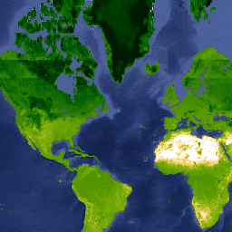
- মানচিত্র
বর্ণনা
এই ফাঁক-ভরা ট্যাসেলড ক্যাপ ওয়েটনেস (TCW) ডেটাসেটটি MODIS BRDF-সংশোধিত চিত্রে (MCD43B4) লবসার এবং কোহেন (2007) এ সংজ্ঞায়িত ট্যাসেলড-ক্যাপ সমীকরণ প্রয়োগ করে তৈরি করা হয়েছে। ওয়েইস এট আল-এ বর্ণিত পদ্ধতির মাধ্যমে প্রাপ্ত তথ্যগুলি ফাঁক-ভরা ছিল। (2014) ক্লাউড কভারের মতো কারণগুলির কারণে অনুপস্থিত ডেটা দূর করতে এবং তারপরে মাসিক ≈5km পণ্য তৈরি করতে অস্থায়ীভাবে এবং স্থানিকভাবে ডেটা একত্রিত করা হয়েছিল।
এই ডেটাসেটটি ম্যালেরিয়া অ্যাটলাস প্রকল্পের হ্যারি গিবসন এবং ড্যানিয়েল ওয়েইস (বিগ ডেটা ইনস্টিটিউট, অক্সফোর্ড বিশ্ববিদ্যালয়, যুক্তরাজ্য, https://malariaatlas.org/ ) দ্বারা উত্পাদিত হয়েছিল।
ব্যান্ড
পিক্সেল সাইজ
5000 মিটার
ব্যান্ড
| নাম | ইউনিট | মিন | সর্বোচ্চ | পিক্সেল সাইজ | বর্ণনা |
|---|---|---|---|---|---|
Mean | -0.84* | 0.96* | মিটার | প্রতিটি একত্রিত পিক্সেলের জন্য ট্যাসেলড ক্যাপ ভেজাতার গড় মান। | |
FilledProportion | % | 0* | 100* | মিটার | একটি কোয়ালিটি কন্ট্রোল ব্যান্ড যা প্রতিটি ফলিত পিক্সেলের শতকরা হার নির্দেশ করে যা কাঁচা ডেটা (শূন্য ভরা অনুমানের বিপরীতে) নিয়ে গঠিত। |
ব্যবহারের শর্তাবলী
ব্যবহারের শর্তাবলী
উদ্ধৃতি
ওয়েইস, ডিজে, পিএম অ্যাটকিনসন, এস. ভাট, বি. ম্যাপিন, এসআই হে এবং পিডব্লিউ গেথিং (2014) মহাদেশীয় স্কেল দূরবর্তীভাবে অনুভূত সময়-সিরিজের ফাঁক পূরণের জন্য একটি কার্যকর পদ্ধতি। ISPRS জার্নাল অফ ফটোগ্রামমেট্রি এবং রিমোট সেন্সিং, 98, 106-118।
Lobser, SE & Cohen, WB (2007) MODIS tasselled cap: ভূমি আবরণ বৈশিষ্ট্য রূপান্তরিত MODIS ডেটার মাধ্যমে প্রকাশ করা হয়েছে। ইন্টারন্যাশনাল জার্নাল অফ রিমোট সেন্সিং, 28, 5079-5101।
আর্থ ইঞ্জিন দিয়ে অন্বেষণ করুন
কোড এডিটর (জাভাস্ক্রিপ্ট)
var dataset = ee.ImageCollection('Oxford/MAP/TCW_5km_Monthly')
                  .filter(ee.Filter.date('2013-01-01', '2013-12-31'));
var tcw = dataset.select('Mean');
var tcwVis = {
  min: -0.6,
  max: 0.5,
  palette: [
    'ffffff', 'fcd163', '99b718', '66a000', '3e8601', '207401', '056201',
    '004c00', '011301'
  ],
};
Map.setCenter(-44.65, 22.59, 2);
Map.addLayer(tcw, tcwVis, 'TCW');