As áreas de tabulação de CEP (ZCTAs, na sigla em inglês) são representações aproximadas de áreas dos CEPs de cinco dígitos do Serviço Postal dos EUA (USPS, na sigla em inglês).
O Census Bureau define as ZCTAs atribuindo cada bloco do censo que contém endereços a uma única área de tabulação de CEP, geralmente à ZCTA que reflete o CEP mais frequente dos endereços dentro desse bloco. Os quarteirões que não contêm endereços, mas estão completamente cercados por uma única área de tabulação de CEP (enclaves), são atribuídos à ZCTA ao redor. Os que estão cercados por várias ZCTAs são adicionados a uma única ZCTA com base na maior fronteira compartilhada.
O Census Bureau identifica áreas de tabulação de CEP de cinco dígitos usando um código numérico de cinco caracteres que representa o CEP do USPS mais frequente nessa ZCTA. Esse código pode conter zeros à esquerda.
Os usuários de dados não devem usar ZCTAs para identificar o CEP oficial do USPS para entrega de correspondências. O USPS faz mudanças periódicas nos CEPs para oferecer uma entrega de correspondências mais eficiente. Os CEPs que abrangem principalmente endereços não residenciais ou de caixas postais podem não ter uma ZCTA correspondente porque o processo de delimitação usa principalmente endereços residenciais, resultando em uma tendência para CEPs usados para entrega de correspondência no estilo da cidade.
Status funcional do censo de 2010.
(Sempre "S", para "Entidade estatística".)
GEOID10
STRING
Identificador da área de tabulação do CEP de cinco dígitos do censo de 2010
INTPTLAT10
STRING
Latitude do ponto interno do censo de 2010
INTPTLON10
STRING
Longitude do ponto interno do censo de 2010
MTFCC10
STRING
Código da classe de atributos MAF/TIGER (sempre "G6350").
ZCTA5CE10
STRING
Código da área de tabulação do CEP de cinco dígitos do censo de 2010
Termos de Uso
Termos de Uso
O Bureau do Censo dos EUA oferece alguns dos dados públicos em formato legível por máquina por meio de uma interface de programação de aplicativos (API). Todo o conteúdo, documentação, código e materiais relacionados disponibilizados a você pela API estão sujeitos a estes termos e condições.
Citações
Citações:
Para a criação de relatórios, publicações, novos conjuntos de dados, produtos ou serviços derivados do conjunto de dados, os usuários precisam citar o US Census Bureau (em inglês).
As áreas de tabulação de CEP (ZCTAs, na sigla em inglês) são representações aproximadas de áreas dos CEPs de cinco dígitos do Serviço Postal dos EUA (USPS, na sigla em inglês). O Census Bureau define as ZCTAs alocando cada bloco do censo que contém endereços a uma única área de tabulação de CEP, geralmente à ZCTA que reflete o CEP mais frequente para…
[null,null,[],[[["\u003cp\u003eThe TIGER/2010/ZCTA5 dataset provides approximate area representations of U.S. Postal Service 5-digit ZIP Codes based on the 2010 Census.\u003c/p\u003e\n"],["\u003cp\u003eZCTAs are defined by allocating Census blocks to the most frequently occurring ZIP Code within that block, primarily using residential addresses.\u003c/p\u003e\n"],["\u003cp\u003eThis dataset includes attributes such as land and water area, Census class code, geographic identifier, and latitude/longitude of the internal point.\u003c/p\u003e\n"],["\u003cp\u003eUsers should not use ZCTAs to determine official USPS ZIP Codes for mail delivery as they are subject to change.\u003c/p\u003e\n"],["\u003cp\u003eThe dataset is available in Earth Engine as a FeatureCollection and a FeatureView for visualization and analysis.\u003c/p\u003e\n"]]],["The US Census Bureau provides 2010 ZIP Code Tabulation Areas (ZCTAs) data, representing approximate 5-digit ZIP Codes. ZCTAs are defined by assigning census blocks to the most frequent ZIP Code, excluding non-residential areas. The dataset, available from 2010-01-01T00:00:00Z to 2010-01-02T00:00:00Z, includes land and water areas, identifiers, and internal point coordinates. Users can explore the data in Google Earth Engine using `FeatureCollection` or `FeatureView` and visualize it with provided JavaScript code, subject to Census Bureau terms and conditions.\n"],null,["# TIGER: US Census 5-digit ZIP Code Tabulation Areas 2010\n\nDataset Availability\n: 2010-01-01T00:00:00Z--2010-01-02T00:00:00Z\n\nDataset Provider\n:\n\n\n [United States Census Bureau](https://www.census.gov/programs-surveys/geography/guidance/tiger-data-products-guide.html)\n\nTags\n:\n [census](/earth-engine/datasets/tags/census) [infrastructure-boundaries](/earth-engine/datasets/tags/infrastructure-boundaries) [table](/earth-engine/datasets/tags/table) [tiger](/earth-engine/datasets/tags/tiger) [us](/earth-engine/datasets/tags/us) \n zcta \nzip-code \n\n#### Description\n\nZIP Code tabulation areas (ZCTAs) are approximate area representations of\nU.S. Postal Service (USPS) 5-digit ZIP Codes.\nThe Census Bureau defines ZCTAs by allocating each\nCensus block that contains addresses to a single ZIP Code tabulation area, usually\nto the ZCTA that reflects the most frequently occurring ZIP Code for the\naddresses within that block. Blocks that do not contain addresses but that\nare completely surrounded by a single ZIP Code tabulation area (enclaves)\nare assigned to the surrounding ZCTA; those surrounded by multiple ZCTAs\nwill be added to a single ZCTA based on the longest shared border.\n\nThe Census Bureau identifies 5-digit ZIP Code tabulation areas using a 5-\ncharacter numeric code that represents the most frequently occurring USPS\nZIP Code within that ZCTA. This code may contain leading zeros.\n\nData users should not use ZCTAs to identify the official USPS ZIP Code for\nmail delivery. The USPS makes periodic changes to ZIP Codes to support more\nefficient mail delivery. ZIP Codes that cover primarily nonresidential or\npost office box addresses may not have a corresponding ZCTA because the\ndelineation process uses primarily residential addresses, resulting in a\nbias towards ZIP Codes used for city-style mail delivery.\n\nFor full technical details on all TIGER 2010 products, see the [TIGER\ntechnical documentation](https://www2.census.gov/geo/pdfs/maps-data/data/tiger/tgrshp2010/TGRSHP10SF1.pdf).\n\n### Table Schema\n\n**Table Schema**\n\n| Name | Type | Description |\n|------------|--------|-----------------------------------------------------------------------|\n| ALAND10 | DOUBLE | 2010 Census Land area |\n| AWATER10 | DOUBLE | 2010 Census Water area |\n| CLASSFP10 | STRING | 2010 Census FIPS 55 class code |\n| FUNCSTAT10 | STRING | 2010 Census functional status (Always \"S\", for \"Statistical entity\".) |\n| GEOID10 | STRING | 2010 Census 5-digit ZIP Code Tabulation Area identifier |\n| INTPTLAT10 | STRING | 2010 Census latitude of the internal point |\n| INTPTLON10 | STRING | 2010 Census longitude of the internal point |\n| MTFCC10 | STRING | MAF/TIGER feature class code (Always \"G6350\".) |\n| ZCTA5CE10 | STRING | 2010 Census 5-digit ZIP Code Tabulation Area code |\n\n### Terms of Use\n\n**Terms of Use**\n\nThe U.S. Census Bureau offers some of its public data\nin machine-readable format via an Application Programming Interface\n(API). All of the content, documentation, code and related materials\nmade available to you through the API are subject to [these terms and\nconditions](https://www.census.gov/data/developers/about/terms-of-service.html).\n\n### Citations\n\nCitations:\n\n- For the creation of any reports, publications, new data sets, derived\n products, or services resulting from the data set, users should\n [cite the US Census Bureau](https://www.census.gov/about/policies/citation.html).\n\n### Explore with Earth Engine\n\n| **Important:** Earth Engine is a platform for petabyte-scale scientific analysis and visualization of geospatial datasets, both for public benefit and for business and government users. Earth Engine is free to use for research, education, and nonprofit use. To get started, please [register for Earth Engine access.](https://console.cloud.google.com/earth-engine)\n\n### Code Editor (JavaScript)\n\n```javascript\n
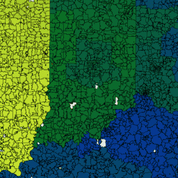
var dataset = ee.FeatureCollection('TIGER/2010/ZCTA5');\nvar visParams = {\n palette: ['black', 'purple', 'blue', 'green', 'yellow', 'orange', 'red'],\n min: 500000,\n max: 1000000000,\n};\n\nvar zctaOutlines = ee.Image().float().paint({\n featureCollection: dataset,\n color: 'black',\n width: 1\n});\n\nvar image = ee.Image().float().paint(dataset, 'ALAND10');\nMap.setCenter(-93.8008, 40.7177, 6);\nMap.addLayer(image, visParams, 'TIGER/2010/ZCTA5');\nMap.addLayer(zctaOutlines, {}, 'borders');\nMap.addLayer(dataset, {}, 'for Inspector', false);\n```\n[Open in Code Editor](https://code.earthengine.google.com/?scriptPath=Examples:Datasets/TIGER/TIGER_2010_ZCTA5)\n\n### Visualize as a FeatureView\n\n\nA `FeatureView` is a view-only, accelerated representation of a\n`FeatureCollection`. For more details, visit the\n[`FeatureView` documentation.](/earth-engine/guides/featureview_overview)\n| **Important:** Earth Engine is a platform for petabyte-scale scientific analysis and visualization of geospatial datasets, both for public benefit and for business and government users. Earth Engine is free to use for research, education, and nonprofit use. To get started, please [register for Earth Engine access.](https://console.cloud.google.com/earth-engine)\n\n### Code Editor (JavaScript)\n\n```javascript\nvar fvLayer = ui.Map.FeatureViewLayer('TIGER/2010/ZCTA5_FeatureView');\n\nvar visParams = {\n opacity: 1,\n polygonStrokeColor: 'black',\n polygonFillColor: {\n property: 'ALAND10',\n mode: 'linear',\n palette: ['black', 'purple', 'blue', 'green', 'yellow', 'orange', 'red'],\n min: 5e5,\n max: 5e9\n }\n};\n\nfvLayer.setVisParams(visParams);\nfvLayer.setName('US census zip codes');\n\nMap.setCenter(-93.8008, 40.7177, 6);\nMap.add(fvLayer);\n```\n[Open in Code Editor](https://code.earthengine.google.com/?scriptPath=Examples:Datasets/TIGER/TIGER_2010_ZCTA5_FeatureView) \n[TIGER: US Census 5-digit ZIP Code Tabulation Areas 2010](/earth-engine/datasets/catalog/TIGER_2010_ZCTA5) \nZIP Code tabulation areas (ZCTAs) are approximate area representations of U.S. Postal Service (USPS) 5-digit ZIP Codes. The Census Bureau defines ZCTAs by allocating each Census block that contains addresses to a single ZIP Code tabulation area, usually to the ZCTA that reflects the most frequently occurring ZIP Code for ... \nTIGER/2010/ZCTA5, census,infrastructure-boundaries,table,tiger,us \n2010-01-01T00:00:00Z/2010-01-02T00:00:00Z \n-14.69 -180 71.567 -64.435 \nGoogle Earth Engine \nhttps://developers.google.com/earth-engine/datasets\n\n- [](https://doi.org/https://www.census.gov/programs-surveys/geography/guidance/tiger-data-products-guide.html)\n- [](https://doi.org/https://developers.google.com/earth-engine/datasets/catalog/TIGER_2010_ZCTA5)"]]