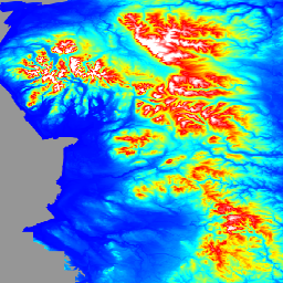
LIDAR 컴포지트 DTM/DSM은 2022년 영국 환경청에서 제작한 1m 공간 해상도로 영국의 약 99% 를 커버하는 래스터 지형 모델입니다. 모델에는 디지털 지형 모델(DTM), 첫 번째 반환 디지털 표면 모델 (DSM), 마지막 반환 DSM의 3개 지형 데이터 밴드가 포함되어 있습니다.
DTM은 센서에 반환된 마지막 또는 유일한 레이저 펄스로부터 생성됩니다. 맞춤 알고리즘과 데이터의 수동 편집을 사용하여 DSM에서 표면 객체를 삭제하여 표면만 있는 지형 모델을 생성합니다. DTM은 EA 타임스탬프가 지정된 보관 파일과 National LIDAR Program 설문조사를 결합하여 도출되며, 이는 가능한 최상의 커버리지를 제공하기 위해 병합되고 재샘플링되었습니다. 반복 설문조사가 실시된 경우 최신 고해상도 데이터가 사용됩니다. 데이터가 리샘플링된 경우 병합되기 전에 양선형 보간이 사용되었습니다. 2022년 LiDAR 컴포지트에는 2000년 6월 6일과 2022년 4월 2일 사이에 실시된 측량이 포함되어 있습니다.
첫 번째 반환 DSM은 센서에 반환된 첫 번째 또는 유일한 레이저 펄스로부터 생성되며 차량, 건물, 식물과 같은 물체의 높이와 첫 번째 또는 유일한 반환이 지면인 지형 표면을 포함합니다. 첫 번째 반환 DSM은 2016년 11월 11일과 2022년 5월 5일 사이에 National LIDAR Program의 일부로 캡처된 데이터에서 파생됩니다. 이 프로그램은 2016년부터 연속된 겨울 동안 설문조사를 위해 잉글랜드를 약 300개의 블록으로 나누었습니다. 이러한 측량은 중첩 영역을 따라 페더링 기법을 사용하여 병합되어 측량 간의 고도 차이를 제거하는 첫 번째 반환 LIDAR 컴포지트를 만듭니다.
LIDAR 컴포지트 제작에 사용된 설문조사가 표시되는 모든 위치에 대해 데이터 제공업체의 메타데이터 색인 카탈로그를 참고하세요.
마지막 반환 DSM은 National LIDAR Program과 Timeseries 조사 모두에서 생성된 마지막 반환 DSM 컴포지트이므로 첫 번째 반환 DSM은 범위나 범위가 마지막 반환 DSM과 일치하지 않습니다.
마지막 반환 DSM은 센서에 반환된 마지막 또는 유일한 레이저 펄스로부터 생성되며 차량, 건물, 식물과 같은 물체의 높이와 지형 표면을 포함합니다. 마지막 반환 DTM은 EA 타임스탬프가 지정된 보관 파일과 National LIDAR Program 설문조사를 결합하여 도출되며, 가능한 최상의 커버리지를 제공하기 위해 병합되고 다시 샘플링되었습니다. 반복 설문조사가 실시된 경우 최신 고해상도 데이터가 사용됩니다. 데이터가 리샘플링된 경우 병합되기 전에 양선형 보간이 사용되었습니다. 2022년 LIDAR 컴포지트에는 2000년 6월 6일과 2022년 4월 2일 사이에 실시된 측량이 포함되어 있습니다. LIDAR 컴포지트 제작에 사용된 설문조사를 보여주는 데이터 제공업체의 메타데이터 색인 카탈로그를 참고하세요.
데이터는 OS National 그리드에 맞춰 정렬되고 미터 단위로 표시되며, Ordinance Survey Newlyn을 참조하고 OSTN'15 변환 방법을 사용합니다. 컴포지트 제작에 사용된 모든 개별 LIDAR 조사의 수직 정확도는 평균 제곱근 오차 +/-15cm입니다.
대역
Pixel Size 1 meter
대역
이름
단위
픽셀 크기
설명
dtm
m
미터
디지털 지형 모델
dsm_first
m
미터
첫 번째 반환 디지털 표면 모델
dsm_last
m
미터
마지막 반환 디지털 표면 모델
이용약관
이용약관
귀하는 정보를 복사, 게시, 배포, 전송할 수 있으며, 정보를 적응시키고, 다른 정보와 결합하거나 자체 제품 또는 애플리케이션에 포함하는 등 상업적 및 비상업적 목적으로 정보를 활용할 수 있습니다.
정보 제공자가 지정한 저작자 표시 문구를 포함하거나 이에 연결하여 제품 또는 애플리케이션에서 정보의 출처를 명시해야 하며, 가능한 경우 라이선스 링크를 제공해야 합니다.
저작자 표시: Environment Agency 저작권 및/또는 데이터베이스 권리 2022. All rights reserved.
LIDAR Composite DTM/DSM은 2022년에 영국 환경청에서 제작한 1m 공간 해상도로 영국의 약 99% 를 커버하는 래스터 지형 모델입니다. 모델에는 디지털 지형 모델 (DTM), 첫 번째 반환 디지털 표면 모델 (DSM), 마지막 반환 DSM의 3개 지형 데이터 밴드가 포함되어 있습니다. …
[null,null,[],[[["\u003cp\u003eThe UK Environment Agency's LIDAR Composite DTM/DSM provides 1-meter resolution terrain data for ~99% of England.\u003c/p\u003e\n"],["\u003cp\u003eThe dataset includes a Digital Terrain Model (DTM), and first and last return Digital Surface Models (DSMs).\u003c/p\u003e\n"],["\u003cp\u003eData originates from surveys between June 6, 2000 and April 2, 2022, with newer, higher-resolution data prioritized.\u003c/p\u003e\n"],["\u003cp\u003eIt's freely available for use with attribution under the Open Government Licence.\u003c/p\u003e\n"],["\u003cp\u003eEarth Engine users can access and analyze the dataset via the \u003ccode\u003eee.Image("UK/EA/ENGLAND_1M_TERRAIN/2022")\u003c/code\u003e snippet.\u003c/p\u003e\n"]]],[],null,["# England 1m Composite DTM/DSM (Environment Agency)\n\nDataset Availability\n: 2000-06-06T00:00:00Z--2022-04-02T00:00:00Z\n\nDataset Provider\n:\n\n\n [UK Environment Agency](https://www.data.gov.uk/dataset/f0db0249-f17b-4036-9e65-309148c97ce4/national-lidar-programme)\n\nTags\n:\n[dem](/earth-engine/datasets/tags/dem) [elevation](/earth-engine/datasets/tags/elevation) [elevation-topography](/earth-engine/datasets/tags/elevation-topography) [lidar](/earth-engine/datasets/tags/lidar) \n\n#### Description\n\nThe LIDAR Composite DTM/DSM is a raster terrain model covering \\~99% of\nEngland at 1m spatial resolution, produced by the UK Environment Agency in\n2022. The model contains 3 bands of terrain data: a Digital Terrain Model\n(DTM), a first return Digital Surface Model (DSM), and a last return DSM.\n\nThe DTM is produced from the last or only laser pulse returned to the\nsensor. Surface objects are removed from the DSM, using bespoke algorithms\nand manual editing of the data, to produce a terrain model of just the\nsurface. The DTM is derived from a combination of EA Time Stamped archive\nand National LIDAR Program surveys, which have been merged and re-sampled\nto give the best possible coverage. Where repeat surveys have been\nundertaken the newest, best resolution data is used. Where data was\nresampled a bilinear interpolation was used before being merged. The 2022\nLIDAR Composite contains surveys undertaken between 6th June 2000 and 2nd\nApril 2022.\n\nThe first return DSM is produced from the first or only laser pulse returned\nto the sensor and includes heights of objects, such as vehicles, buildings\nand vegetation, as well as the terrain surface where the first or only\nreturn was the ground. The first return DSM is derived from data captured as\npart of the National LIDAR Program between 11 November 2016 and 5th May\n2022. This program divided England into \\~300 blocks for survey over\ncontinuous winters from 2016 onwards. These surveys are merged together to\ncreate the first return LIDAR composite using a feathering technique along\nthe overlaps to remove any small differences in elevation between surveys.\nPlease refer to the data provider's metadata index catalogs which show for\nany location which survey was used in the production of the LIDAR composite.\nThe first return DSM will not match in coverage or extent of the last return\nDSM, as the last return DSM composite is produced from both the National\nLIDAR Program and Timeseries surveys.\n\nThe last return DSM is produced from the last or only laser pulse returned\nto the sensor and includes heights of objects, such as vehicles, buildings\nand vegetation, as well as the terrain surface. The last return DTM is\nderived from a combination of EA Time Stamped archive and National LIDAR\nProgram surveys, which have been merged and re-sampled to give the best\npossible coverage. Where repeat surveys have been undertaken the newest,\nbest resolution data is used. Where data was resampled a bilinear\ninterpolation was used before being merged. The 2022 LIDAR Composite\ncontains surveys undertaken between 6th June 2000 and 2nd April 2022. Please\nrefer to the data provider's metadata index catalogs which show for any\nlocation which survey was used in the production of the LIDAR composite.\n\nThe data is aligned to the OS National grid and presented in metres,\nreferenced to Ordinance Survey Newlyn and using the OSTN'15 transformation\nmethod. All individual LIDAR surveys going into the production of the\ncomposites had a vertical accuracy of +/-15cm root-mean-square error.\n\n### Bands\n\n\n**Pixel Size**\n\n1 meter\n\n**Bands**\n\n| Name | Units | Pixel Size | Description |\n|-------------|-------|------------|------------------------------------|\n| `dtm` | m | meters | Digital Terrain Model |\n| `dsm_first` | m | meters | First Return Digital Surface Model |\n| `dsm_last` | m | meters | Last Return Digital Surface Model |\n\n### Terms of Use\n\n**Terms of Use**\n\nYou are free to: copy, publish, distribute and transmit the Information;\nadapt the Information; exploit the Information commercially and\nnon-commercially for example, by combining it with other Information, or\nby including it in your own product or application.\n\nYou must acknowledge the source of the Information in your product or\napplication by including or linking to any attribution statement specified\nby the Information Provider(s) and, where possible, provide a link to the\n[license](https://www.nationalarchives.gov.uk/doc/open-government-licence/version/3/).\nAttribution statement: Environment Agency copyright and/or database right\n2022. All rights reserved.\n\n### Explore with Earth Engine\n\n| **Important:** Earth Engine is a platform for petabyte-scale scientific analysis and visualization of geospatial datasets, both for public benefit and for business and government users. Earth Engine is free to use for research, education, and nonprofit use. To get started, please [register for Earth Engine access.](https://console.cloud.google.com/earth-engine)\n\n### Code Editor (JavaScript)\n\n```javascript\nvar img = ee.Image('UK/EA/ENGLAND_1M_TERRAIN/2022').select('dtm');\nvar visParam = {\n palette: ['0000ff', '00ffff', 'ffff00', 'ff0000', 'ffffff'],\n max: 630,\n min: -5,\n};\n\nvar lon = -2.5;\nvar lat = 54;\n\nMap.addLayer(img, visParam, 'dtm');\nMap.setCenter(lon, lat, 5);\n```\n[Open in Code Editor](https://code.earthengine.google.com/?scriptPath=Examples:Datasets/UK/UK_EA_ENGLAND_1M_TERRAIN_2022) \n[England 1m Composite DTM/DSM (Environment Agency)](/earth-engine/datasets/catalog/UK_EA_ENGLAND_1M_TERRAIN_2022) \nThe LIDAR Composite DTM/DSM is a raster terrain model covering \\~99% of England at 1m spatial resolution, produced by the UK Environment Agency in 2022. The model contains 3 bands of terrain data: a Digital Terrain Model (DTM), a first return Digital Surface Model (DSM), and a last return DSM. ... \nUK/EA/ENGLAND_1M_TERRAIN/2022, dem,elevation,elevation-topography,lidar \n2000-06-06T00:00:00Z/2022-04-02T00:00:00Z \n-90 -180 90 180 \nGoogle Earth Engine \nhttps://developers.google.com/earth-engine/datasets\n\n- [](https://doi.org/https://www.data.gov.uk/dataset/f0db0249-f17b-4036-9e65-309148c97ce4/national-lidar-programme)\n- [](https://doi.org/https://developers.google.com/earth-engine/datasets/catalog/UK_EA_ENGLAND_1M_TERRAIN_2022)"]]