- Disponibilidade do conjunto de dados
- 2017-12-29T00:00:00Z–2017-12-29T00:00:00Z
- Produtor de conjunto de dados
- Departamento de Estado dos Estados Unidos, Escritório do Geógrafo
- Tags
Descrição
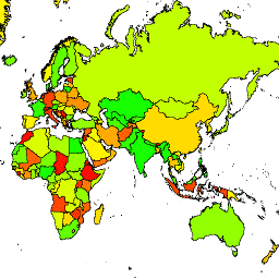
O Escritório do Geógrafo dos Estados Unidos fornece o conjunto de dados de fronteira internacional em grande escala (LSIB, na sigla em inglês). Ele é derivado de dois outros conjuntos de dados: um arquivo vetorial de linha do LSIB e o World Vector Shorelines (WVS) da National Geospatial-Intelligence Agency (NGA). Os limites internos refletem as políticas do governo dos EUA sobre limites, disputas de limites e soberania. Os limites externos são derivados do WVS, mas os dados da costa do WVS estão desatualizados e geralmente mudam de várias centenas de metros para mais de um quilômetro. Cada recurso é a área poligonal delimitada por limites internos e litorais externos, quando aplicável. Muitos países consistem em vários recursos, um por região desconexa. Cada um dos 180.741 recursos faz parte da geometria de um dos 284 países descritos neste conjunto de dados.
Esquema da tabela
Esquema da tabela
| Nome | Tipo | Descrição |
|---|---|---|
| OBJECTID | STRING | ID do objeto |
| COUNTRY_NA | STRING | Nome de país reconhecido pelos EUA |
Termos de Uso
Termos de Uso
Não há restrições de uso desses dados de domínio público dos EUA.
Explore com o Earth Engine
Editor de código (JavaScript)
var dataset = ee.FeatureCollection('USDOS/LSIB/2017');
var styleParams = {
  fillColor: 'b5ffb4',
  color: '00909F',
  width: 3,
};
var countries = dataset.style(styleParams);
Map.setCenter(16.35, 48.83, 4);
Map.addLayer(countries, {}, 'USDOS/LSIB/2017', true, 0.8);
Visualizar como uma FeatureView
Um FeatureView é uma representação acelerada e somente leitura de um FeatureCollection. Para mais detalhes, consulte a
documentação do FeatureView.
Editor de código (JavaScript)
var fvLayer = ui.Map.FeatureViewLayer('USDOS/LSIB/2017_FeatureView');

var visParams = {
  color: '00909F',
  fillColor: 'b5ffb4',
  width: 3,
  opacity: 1
};

fvLayer.setVisParams(visParams);
fvLayer.setName('USDOS/LSIB/2017');

Map.setCenter(16.35, 48.83, 4);
Map.add(fvLayer);