- Disponibilidade do conjunto de dados
- 2000-02-11T00:00:00Z–2000-02-22T00:00:00Z
- Produtor do conjunto de dados
- NASA / USGS / JPL-Caltech
- Tags
Descrição
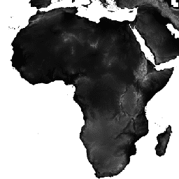
Os dados de elevação digital da Shuttle Radar Topography Mission (SRTM, consulte Farr et al., 2007) são um esforço de pesquisa internacional que obteve modelos de elevação digital em uma escala quase global. Esse produto SRTM V3 (SRTM Plus) é fornecido pelo NASA JPL com uma resolução de 1 segundo de arco (aproximadamente 30 m).
Esse conjunto de dados passou por um processo de preenchimento de lacunas usando dados de código aberto (ASTER GDEM2, GMTED2010 e NED), ao contrário de outras versões que contêm lacunas ou foram preenchidas com fontes comerciais. Para mais informações sobre as diferentes versões, consulte o Guia rápido da SRTM.
Documentação:
Bandas
Bandas
Tamanho do pixel: 30 metros (todas as bandas)
| Nome | Unidades | Mín. | Máx. | Tamanho do pixel | Descrição |
|---|---|---|---|---|---|
elevation |
m | -10* | 6500* | 30 metros | Elevação |
Termos de Uso
Termos de Uso
A menos que indicado de outra forma, as imagens e os vídeos em sites públicos do JPL (sites públicos que terminam com um endereço jpl.nasa.gov) podem ser usados para qualquer finalidade sem permissão prévia. Para mais informações e exceções, acesse o site da Política de uso de imagens do JPL.
Citações
Farr, T.G., Rosen, P.A., Caro, E., Crippen, R., Duren, R., Hensley, S., Kobrick, M., Paller, M., Rodriguez, E., Roth, L., Seal, D., Shaffer, S., Shimada, J., Umland, J., Werner, M., Oskin, M., Burbank, D., and Alsdorf, D.E., 2007, The shuttle radar topography mission: Reviews of Geophysics, v. 45, no. 2, RG2004, em https://doi.org/10.1029/2005RG000183.
Explore com o Earth Engine
Editor de código (JavaScript)
var dataset = ee.Image('USGS/SRTMGL1_003');
var elevation = dataset.select('elevation');
var slope = ee.Terrain.slope(elevation);
Map.setCenter(-112.8598, 36.2841, 10);
Map.addLayer(slope, {min: 0, max: 60}, 'slope');
import ee
import geemap.core as geemap
Colab (Python)
dataset = ee.Image('USGS/SRTMGL1_003')
elevation = dataset.select('elevation')
slope = ee.Terrain.slope(elevation)

m = geemap.Map()
m.set_center(-112.8598, 36.2841, 10)
m.add_layer(slope, {'min': 0, 'max': 60}, 'slope')
m