- ডেটাসেটের উপলভ্যতা
- ২০২৩-০৯-১৪T০০:০০:০০Z–২০২৩-০৯-১৪T০০:০০:০০Z
- ডেটাসেট প্রযোজক
- উইলিয়াম এবং মেরি জিওল্যাব
- ট্যাগ
বিবরণ
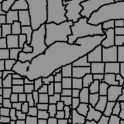
রাজনৈতিক প্রশাসনিক সীমানার জিওবাউন্ডারিজ গ্লোবাল ডাটাবেস হল বিশ্বের প্রতিটি দেশের জন্য সীমানার (অর্থাৎ, রাজ্য, কাউন্টি) একটি অনলাইন, উন্মুক্ত লাইসেন্স রিসোর্স। বর্তমানে মোট ১৯৯টি সত্তা ট্র্যাক করা হয়, যার মধ্যে ১৯৫টি জাতিসংঘের সদস্য রাষ্ট্র, গ্রিনল্যান্ড, তাইওয়ান, নিউ এবং কসোভো অন্তর্ভুক্ত।
কম্প্রিহেনসিভ গ্লোবাল অ্যাডমিনিস্ট্রেটিভ জোনস (CGAZ) হল প্রশাসনিক সীমানার জন্য বিশ্বব্যাপী কম্পোজিটগুলির একটি সেট। মার্কিন পররাষ্ট্র দপ্তরের সংজ্ঞা অনুসরণ করে বিতর্কিত এলাকাগুলি সরানো হয় এবং বহুভুজ দিয়ে প্রতিস্থাপিত করা হয়। এর তিনটি সীমানা স্তর ADM0, ADM1, এবং ADM2 রয়েছে, যা আন্তর্জাতিক সীমানার (মার্কিন পররাষ্ট্র দপ্তর) সাথে সংযুক্ত, সীমানার মধ্যে ফাঁক পূরণ করে।
এই ডেটাসেটটি CGAZ-এর অংশ। এটি DBF_DATE_LAST_UPDATE=2023-09-13 সহ গ্লোবাল কম্পোজিট ফাইলের 6.0.0 সংস্করণ থেকে অন্তর্ভুক্ত করা হয়েছে। এটি ADM2 (পৌরসভা-স্তরের সীমানা) স্তরে সীমানা দেখায়।
টেবিল স্কিমা
টেবিল স্কিমা
| নাম | আদর্শ | বিবরণ |
|---|---|---|
| আকৃতিগ্রুপ | স্ট্রিং | অনন্য দেশের কোড |
| আকৃতির নাম | স্ট্রিং | প্রশাসনিক অঞ্চলের নাম |
| আকৃতির ধরণ | স্ট্রিং | সীমানার ধরণ:
|
| আকৃতি আইডি | দ্বিগুণ | আকৃতিতে বরাদ্দ করা অনন্য আইডি |
ব্যবহারের শর্তাবলী
ব্যবহারের শর্তাবলী
জিওবাউন্ডারি ডেটাসেটগুলি CC BY 4.0 লাইসেন্সের অধীনে সরবরাহ করা হয়, যা বেশিরভাগ বাণিজ্যিক, অ-বাণিজ্যিক এবং একাডেমিক ব্যবহারের অনুমতি দেয়। সরবরাহকারীর ব্যবহারের শর্তাবলী দেখুন।
আর্থ ইঞ্জিনের সাহায্যে ঘুরে দেখুন
কোড এডিটর (জাভাস্ক্রিপ্ট)
var dataset = ee.FeatureCollection('WM/geoLab/geoBoundaries/600/ADM2');

Map.setCenter(-100.0, 38.5, 4);

var styleParams = {
  fillColor: 'b5ffb4',
  color: '00909F',
  width: 1.0,
};

dataset = dataset.style(styleParams);

Map.addLayer(dataset, {}, 'ADM2 Boundaries');