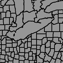
La base de datos global de límites administrativos políticos de geoBoundaries es un recurso en línea con licencia abierta de límites (es decir, estado, condado) para todos los países del mundo. Actualmente, se hace un seguimiento de 199 entidades en total, incluidos los 195 estados miembros de la ONU, Groenlandia, Taiwán, Niue y Kosovo.
Las zonas administrativas globales integrales (CGAZ) son un conjunto de compuestos globales para los límites administrativos. Se quitan las áreas en disputa y se reemplazan por polígonos que siguen las definiciones del Departamento de Estado de EE.UU. Tiene tres niveles de límites: ADM0, ADM1 y ADM2, recortados según los límites internacionales (Departamento de Estado de EE.UU.), con brechas completadas entre las fronteras.
Este conjunto de datos forma parte de CGAZ. Se transfirió desde la versión 6.0.0 de los archivos compuestos globales con DBF_DATE_LAST_UPDATE=2023-09-13.
Muestra los límites en el nivel ADM2 (límites a nivel del municipio).
Esquema de la tabla
Esquema de la tabla
Nombre
Tipo
Descripción
shapeGroup
STRING
Código de país único
shapeName
STRING
Nombre de la región administrativa
shapeType
STRING
Tipo de límite:
ADM0: Nivel de país
ADM1: Nivel de distrito
ADM2: Nivel de municipio
shapeID
DOUBLE
ID único asignado a la forma
Condiciones de Uso
Condiciones de Uso
Los conjuntos de datos de geoBoundaries se proporcionan bajo la licencia CC BY 4.0, que permite la mayoría de los usos comerciales, no comerciales y académicos. Consulta las condiciones de uso del proveedor.
La base de datos global de límites administrativos y políticos de geoBoundaries es un recurso en línea con licencia abierta de límites (es decir, estatales y de condados) para todos los países del mundo. Actualmente, se hace un seguimiento de 199 entidades en total, incluidos los 195 Estados miembros de la ONU, Groenlandia, Taiwán, Niue y Kosovo. Las zonas administrativas globales integrales (CGAZ) son…
[null,null,[],[[["\u003cp\u003eThe geoBoundaries dataset provides municipality-level (ADM2) political administrative boundaries for 199 countries and territories worldwide.\u003c/p\u003e\n"],["\u003cp\u003eIt is based on the CGAZ dataset with disputed areas removed and replaced with polygons following US Department of State definitions.\u003c/p\u003e\n"],["\u003cp\u003eThe dataset is licensed under CC BY 4.0, allowing for most commercial, noncommercial, and academic uses.\u003c/p\u003e\n"],["\u003cp\u003eData is provided in a FeatureCollection format and can be accessed through Google Earth Engine.\u003c/p\u003e\n"],["\u003cp\u003eIt includes attributes like unique country code, administrative region name, boundary type, and unique shape ID.\u003c/p\u003e\n"]]],["The geoBoundaries Global Database, version 6.0.0, provides open-license political administrative boundaries for 199 global entities. This dataset, part of the Comprehensive Global Administrative Zones (CGAZ), offers municipality-level (ADM2) boundaries, clipped to international borders as defined by the US Department of State. It is accessible via Earth Engine using `ee.FeatureCollection(\"WM/geoLab/geoBoundaries/600/ADM2\")` or `ui.Map.FeatureViewLayer(\"WM/geoLab/geoBoundaries/600/ADM2_FeatureView\")`. The data, updated as of September 13, 2023, includes attributes like shapeGroup, shapeName, shapeType, and shapeID.\n"],null,["# geoBoundaries: Political administrative boundaries at Municipality level (ADM2), v6.0.0\n\nDataset Availability\n: 2023-09-14T00:00:00Z--2023-09-14T00:00:00Z\n\nDataset Provider\n:\n\n\n [William and Mary geoLab](https://www.geoboundaries.org/index.html)\n\nTags\n:\n[borders](/earth-engine/datasets/tags/borders) [countries](/earth-engine/datasets/tags/countries) [infrastructure-boundaries](/earth-engine/datasets/tags/infrastructure-boundaries) [table](/earth-engine/datasets/tags/table) \n\n#### Description\n\nThe geoBoundaries Global Database of Political Administrative Boundaries\nDatabase is an online, open license resource of boundaries (i.e., state,\ncounty) for every country in the world. Currently 199 total entities are\ntracked, including all 195 UN member states, Greenland, Taiwan, Niue, and\nKosovo.\n\nComprehensive Global Administrative Zones (CGAZ) is a set of global\ncomposites for administrative boundaries. Disputed areas are removed and\nreplaced with polygons following US Department of State definitions. It has\nthree boundary levels ADM0, ADM1, and ADM2, clipped to international\nboundaries (US Department of State), with gaps filled between borders.\n\nThis dataset is part of CGAZ. It was ingested from\n[version 6.0.0](https://github.com/wmgeolab/geoBoundaries/tree/1289e40e366c7b320550be1ee0614a9472d572d4)\nof Global Composite Files with DBF_DATE_LAST_UPDATE=2023-09-13.\nIt shows boundaries at level\nADM2 (municipality-level boundaries).\n\n### Table Schema\n\n**Table Schema**\n\n| Name | Type | Description |\n|------------|--------|----------------------------------------------------------------------------------------|\n| shapeGroup | STRING | Unique country code |\n| shapeName | STRING | Administrative region name |\n| shapeType | STRING | Boundary type: - ADM0: Country level - ADM1: District level - ADM2: Municipality level |\n| shapeID | DOUBLE | Unique ID assigned to the shape |\n\n### Terms of Use\n\n**Terms of Use**\n\ngeoBoundaries datasets are provided under the CC BY 4.0 license, which\nallows for most commmercial, noncommercial, and academic uses. See\n[provider terms of use](https://www.geoboundaries.org/index.html#usage).\n\n### Explore with Earth Engine\n\n| **Important:** Earth Engine is a platform for petabyte-scale scientific analysis and visualization of geospatial datasets, both for public benefit and for business and government users. Earth Engine is free to use for research, education, and nonprofit use. To get started, please [register for Earth Engine access.](https://console.cloud.google.com/earth-engine)\n\n### Code Editor (JavaScript)\n\n```javascript\nvar dataset = ee.FeatureCollection('WM/geoLab/geoBoundaries/600/ADM2');\n\nMap.setCenter(-100.0, 38.5, 4);\n\nvar styleParams = {\n fillColor: 'b5ffb4',\n color: '00909F',\n width: 1.0,\n};\n\ndataset = dataset.style(styleParams);\n\nMap.addLayer(dataset, {}, 'ADM2 Boundaries');\n```\n[Open in Code Editor](https://code.earthengine.google.com/?scriptPath=Examples:Datasets/WM/WM_geoLab_geoBoundaries_600_ADM2) \n[geoBoundaries: Political administrative boundaries at Municipality level (ADM2), v6.0.0](/earth-engine/datasets/catalog/WM_geoLab_geoBoundaries_600_ADM2) \nThe geoBoundaries Global Database of Political Administrative Boundaries Database is an online, open license resource of boundaries (i.e., state, county) for every country in the world. Currently 199 total entities are tracked, including all 195 UN member states, Greenland, Taiwan, Niue, and Kosovo. Comprehensive Global Administrative Zones (CGAZ) is a ... \nWM/geoLab/geoBoundaries/600/ADM2, borders,countries,infrastructure-boundaries,table \n2023-09-14T00:00:00Z/2023-09-14T00:00:00Z \n-90 -180 90 180 \nGoogle Earth Engine \nhttps://developers.google.com/earth-engine/datasets\n\n- [](https://doi.org/https://www.geoboundaries.org/index.html)\n- [](https://doi.org/https://developers.google.com/earth-engine/datasets/catalog/WM_geoLab_geoBoundaries_600_ADM2)"]]