- Dostępność zbioru danych
- 2000-02-11T00:00:00Z–2000-02-22T00:00:00Z
- Dostawca zbioru danych
- WWF
- Tagi
Opis
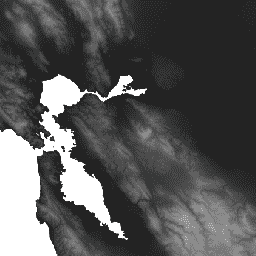
HydroSHEDS to produkt mapowy, który zawiera informacje hydrograficzne do zastosowań regionalnych i globalnych w spójnym formacie. Zawiera on zestaw zbiorów danych geograficznych (wektorowych i rastrowych) o różnej skali, w tym sieci rzeczne, granice działów wód, kierunki odpływu i akumulacje przepływu. HydroSHEDS opiera się na danych o wysokości uzyskanych w 2000 roku przez misję NASA Shuttle Radar Topography Mission (SRTM).
Ten zbiór danych o wysokości z wypełnionymi lukami to pierwszy krok w kierunku utworzenia warunkowych zbiorów danych DEM. W danych SRTM wykryto i usunięto piki i zagłębienia. Niewielkie luki zostały wypełnione przez interpolację otaczających je wysokości. Poziom oceanu został ustawiony na 0 metrów, a jeziora, wyspy i rzeki zostały wypełnione przy użyciu innych technik. Szczegółowe informacje o bazowym cyfrowym modelu terenu znajdziesz na stronie internetowej i w dokumentacji HydroSHEDS.
Ten zbiór danych ma rozdzielczość 3 sekund łuku. Zbiory danych dostępne w rozdzielczości 3 sekund łuku to wypełniony model DEM, model DEM z uwzględnieniem warunków hydrologicznych i kierunek odpływu (przepływu).
Należy pamiętać, że jakość danych HydroSHEDS jest znacznie niższa w przypadku regionów powyżej 60 stopni szerokości geograficznej północnej, ponieważ nie są dostępne dane o wysokości SRTM, a zatem użyto DEM o niższej rozdzielczości (HYDRO1k dostarczony przez USGS).
HydroSHEDS został opracowany przez program Conservation Science organizacji World Wildlife Fund (WWF) we współpracy z U.S. Geological Survey, International Centre for Tropical Agriculture, The Nature Conservancy oraz Center for Environmental Systems Research na Uniwersytecie w Kassel w Niemczech.
Pasma
Pasma
Rozmiar piksela: 92,77 m (wszystkie pasma)
| Nazwa | Jednostki | Min. | Maks. | Rozmiar piksela | Opis |
|---|---|---|---|---|---|
b1 |
m | –424* | 8642* | 92,77 m | Wysokość |
Warunki korzystania z usługi
Warunki usługi
Dane HydroSHEDS są dostępne bezpłatnie do użytku niekomercyjnego i komercyjnego. Więcej informacji znajdziesz w umowie licencyjnej.
Cytaty
Lehner, B., Verdin, K., Jarvis, A. (2008): New global hydrography derived from spaceborne elevation data. Eos, Transactions, AGU, 89(10): 93-94.
Odkrywaj za pomocą Earth Engine
Edytor kodu (JavaScript)
var dataset = ee.Image('WWF/HydroSHEDS/03VFDEM');
var elevation = dataset.select('b1');
var elevationVis = {
  min: -50.0,
  max: 3000.0,
  gamma: 2.0,
};
Map.setCenter(-121.652, 38.022, 8);
Map.addLayer(elevation, elevationVis, 'Elevation');