- Disponibilidade do conjunto de dados
- 2000-02-11T00:00:00Z–2000-02-22T00:00:00Z
- Produtor de conjunto de dados
- WWF
- Tags
Descrição
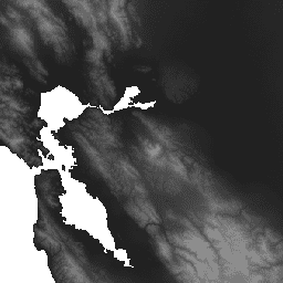
O HydroSHEDS é um produto de mapeamento que fornece informações hidrográficas para aplicações regionais e globais em um formato consistente. Ele oferece um conjunto de dados georreferenciados (vetor e raster) em várias escalas, incluindo redes de rios, limites de bacias hidrográficas, direções de drenagem e acúmulos de fluxo. O HydroSHEDS é baseado em dados de elevação obtidos em 2000 pela Shuttle Radar Topography Mission (SRTM) da NASA.
Esse conjunto de dados de elevação condicionado hidrologicamente é o resultado de um processo iterativo de condicionamento e correção. O processo de condicionamento altera o DEM original e pode torná-lo incorreto para aplicações que não sejam a derivação de direções de drenagem. As bacias endorreicas (depressões continentais) são "inseridas" com uma célula sem dados no ponto mais baixo para interromper o fluxo. Os detalhes completos do modelo digital de elevação estão disponíveis no site e na documentação do HydroSHEDS.
Esse conjunto de dados tem resolução de 15 segundos de arco. Os conjuntos de dados disponíveis em 15 segundos de arco são o DEM condicionado hidrologicamente, a direção de drenagem (fluxo) e o acúmulo de fluxo.
A qualidade dos dados do HydroSHEDS é significativamente menor para regiões acima de 60 graus de latitude norte, já que não há dados de elevação do SRTM disponíveis. Assim, um DEM de resolução mais baixa foi usado (HYDRO1k fornecido pelo USGS).
O HydroSHEDS foi desenvolvido pelo Programa de Ciência da Conservação do World Wildlife Fund (WWF) em parceria com o Serviço Geológico dos EUA, o Centro Internacional de Agricultura Tropical, a Nature Conservancy e o Centro de Pesquisa de Sistemas Ambientais da Universidade de Kassel, na Alemanha.
Bandas
Tamanho do pixel
463,83 metros
Bandas
| Nome | Unidades | Mín. | Máx. | Tamanho do pixel | Descrição |
|---|---|---|---|---|---|
b1 |
m | -415* | 8454* | metros | Elevação |
Termos de Uso
Termos de Uso
Os dados do HydroSHEDS são sem custo financeiro para uso não comercial e comercial. Para mais informações, consulte o contrato de licença.
Citações
Lehner, B., Verdin, K., Jarvis, A. (2008): New global hydrography derived from spaceborne elevation data. Eos, Transactions, AGU, 89(10): 93-94.
Explore com o Earth Engine
Editor de código (JavaScript)
var dataset = ee.Image('WWF/HydroSHEDS/15CONDEM');
var elevation = dataset.select('b1');
var elevationVis = {
  min: -50.0,
  max: 3000.0,
  gamma: 2.0,
};
Map.setCenter(-121.652, 38.022, 8);
Map.addLayer(elevation, elevationVis, 'Elevation');