- Catalog Owner
- Forest Data Partnership
- Dataset Availability
- 2020-01-01T00:00:00Z–2023-12-31T23:59:59Z
- Dataset Provider
- Produced by Google for the Forest Data Partnership
- Earth Engine Snippet
-
ee.ImageCollection("projects/forestdatapartnership/assets/community_palm/20240312")
- Tags
Description
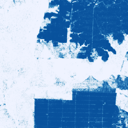
This image collection provides per-pixel probability that the underlying area is occupied by palm.
These probability estimates are provided at 10 meter resolution, and have been generated by a machine learning model. Labeled examples of known palm and non-palm were supplied by community contributors to the Forest Data Partnership. The predictors are annual composites built from publicly available satellite imagery provided by Sentinel-1, Sentinel-2, and ALOS DSM. Probability predictions are provided for an individual year, denoted by the start and end time on each image in the collection. For the initial version, predictions based on mosaics of 2020 imagery and 2023 imagery are included. Methods are described in this preprint.
The community data product is meant to evolve over time, as more data comes in from the community and the community model to produce the maps continuously improves. If you would like to provide feedback on these layers, please visit our Collect Earth Online project to contribute.
If you are interested in contributing datasets to this effort, please reach out through this form.
This dataset corresponds to the output from the 20240312 model on GitHub.
For more information about the Forest Data Partnership, visit our website.
Bands
Resolution
10 meters
Bands
| Name | Min | Max | Description |
|---|---|---|---|
probability |
0 | 1 | Probability that the pixels includes oil palm plantation for the given year. |
Terms of Use
Terms of Use
This dataset is licensed under CC-BY 4.0 and requires the following attribution: "This dataset is produced by Google for the Forest Data Partnership."
Contains modified Copernicus Sentinel data [2015-present]. See the Sentinel Data Legal Notice.
Citations
N. Clinton, et al. A community palm model. 2024. Online
Explore with Earth Engine
Code Editor (JavaScript)
var imageCollection = ee.ImageCollection(
    'projects/forestdatapartnership/assets/community_palm/20240312');

// View 2020 palm inferences
var palm2020 =
    imageCollection.filterDate(ee.Date('2020-01-01'), ee.Date('2020-12-31'));

Map.addLayer(palm2020, {
  min: 0.0,
  max: 1.0,
  palette: ['#eff3ff', '#bdd7e7', '#6baed6', '#3182bd', '#08519c']
});

Map.setCenter(110, 0);
Map.setZoom(4);
