Tetap teratur dengan koleksi
Simpan dan kategorikan konten berdasarkan preferensi Anda.
info
Kumpulan data ini adalah bagian dari Katalog Publisher, dan tidak dikelola oleh Google Earth Engine.
Hubungi forestdatapartnership@googlegroups.com
untuk melaporkan bug atau melihat lebih banyak set data
dari Katalog Kemitraan Data Hutan. Pelajari lebih lanjut Set data penayang.
Catatan: Kumpulan data ini belum ditinjau oleh pakar. Lihat
README GitHub
ini untuk mengetahui informasi selengkapnya.
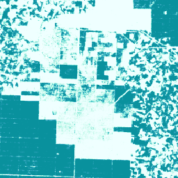
Kumpulan gambar ini memberikan perkiraan probabilitas per piksel bahwa area di bawahnya ditempati oleh komoditas. Estimasi probabilitas diberikan pada resolusi 10 meter, dan telah dibuat oleh model machine learning. Untuk mengetahui detailnya, lihat dokumentasi teknis di
repo Forest Data Partnership
di GitHub.
Tujuan utama pengumpulan gambar ini adalah untuk mendukung misi Forest Data Partnership yang bertujuan untuk menghentikan dan membalikkan hilangnya hutan akibat produksi komoditas dengan meningkatkan kualitas pemantauan global, pelacakan supply chain, dan restorasi secara kolaboratif.
Saat ini, set data ini mencakup negara berikut: Indonesia, Malaysia,
Thailand, Nigeria, Kolombia, Brasil, Côte d'Ivoire, Ghana, Ekuador, dan
Honduras.
Produk data komunitas ini dimaksudkan untuk berkembang seiring waktu, karena makin banyak data yang tersedia dari komunitas dan model yang digunakan untuk menghasilkan peta terus ditingkatkan. Jika Anda ingin memberikan masukan umum atau
kumpulan data tambahan untuk meningkatkan kualitas lapisan ini, hubungi kami melalui
formulir ini.
Batasan: Output model terbatas pada negara yang dipilih sebagai komposit tahun kalender untuk tahun 2020 dan 2023. Tidak semua bagian output direpresentasikan dengan baik oleh data pelatihan. Akurasi dilaporkan secara gabungan, dan akan bervariasi secara geografis dan dengan nilai minimum yang dipilih pengguna. Artefak sensor berdasarkan
ketersediaan data, ketidakseragaman lintas jalur, atau kelembapan mungkin
terlihat secara visual dalam probabilitas output dan mengakibatkan kesalahan
klasifikasi pada beberapa nilai minimum.
Perhatikan bahwa kumpulan data ini memiliki persyaratan penggunaan terpisah untuk pengguna komersial Earth Engine. Lihat tab "Persyaratan Penggunaan" untuk mengetahui detailnya.
Band
Ukuran Piksel 10 meter
Band
Nama
Min
Maks
Ukuran Piksel
Deskripsi
probability
0
1
meter
Probabilitas bahwa piksel mencakup pohon palem untuk tahun tertentu.
Persyaratan Penggunaan
Untuk pengguna non-komersial Earth Engine, penggunaan set data tunduk pada lisensi CC-BY 4.0 NC dan memerlukan atribusi berikut: "Diproduksi oleh Google untuk Forest Data Partnership".
Catatan: Set data ini belum ditinjau oleh pakar. Lihat README GitHub ini untuk mengetahui informasi selengkapnya. Kumpulan gambar ini memberikan perkiraan probabilitas per piksel bahwa area yang mendasarinya ditempati oleh komoditas. Estimasi probabilitas disediakan pada resolusi 10 meter, dan telah dibuat oleh model machine learning. Untuk …
[null,null,[],[],[],null,["# Palm Probability model 2025a\n\ninfo\n\n\nThis dataset is part of a Publisher Catalog, and not managed by Google Earth Engine.\n\nContact forestdatapartnership@googlegroups.com\n\nfor bugs or [view more datasets](https://developers.google.com/earth-engine/datasets/publisher/forestdatapartnership)\nfrom the Forest Data Partnership Catalog. [Learn more about Publisher datasets](/earth-engine/datasets/publisher). \n[](https://forestdatapartnership.org) \n\nCatalog Owner\n: Forest Data Partnership\n\nDataset Availability\n: 2020-01-01T00:00:00Z--2023-12-31T23:59:59Z\n\nDataset Provider\n:\n\n\n [Produced by Google for the Forest Data Partnership](https://www.forestdatapartnership.org/)\n\nTags\n:\n[agriculture](/earth-engine/datasets/tags/agriculture) [biodiversity](/earth-engine/datasets/tags/biodiversity) [conservation](/earth-engine/datasets/tags/conservation) [crop](/earth-engine/datasets/tags/crop) [eudr](/earth-engine/datasets/tags/eudr) [forestdatapartnership](/earth-engine/datasets/tags/forestdatapartnership) [landuse](/earth-engine/datasets/tags/landuse) [palm](/earth-engine/datasets/tags/palm) [plantation](/earth-engine/datasets/tags/plantation) [publisher-dataset](/earth-engine/datasets/tags/publisher-dataset) \n\n#### Description\n\n**Note: This dataset is not yet peer-reviewed. Please see this\n[GitHub README](https://github.com/google/forest-data-partnership/tree/main/models)\nfor more information.**\n\nThis image collection provides estimated per-pixel probability that the\nunderlying area is occupied by the commodity. The probability estimates are\nprovided at 10 meter resolution, and have been generated by a machine\nlearning model. For details, see the technical documentation on the\n[Forest Data Partnership repo](https://github.com/google/forest-data-partnership/tree/main)\non Github.\n\nThe primary purpose of this image collection is to support the mission of\nthe [Forest Data Partnership](https://www.forestdatapartnership.org/) which\naims to halt and reverse forest loss from commodity production by\ncollaboratively improving global monitoring, supply chain tracking, and\nrestoration.\n\nThis dataset currently covers the following countries: Indonesia, Malaysia,\nThailand, Nigeria, Colombia, Brazil, Côte d'Ivoire, Ghana, Ecuador, and\nHonduras.\n\nThis community data product is meant to evolve over time, as more data\nbecomes available from the community and the model used to produce the maps\ncontinuously improves. If you would like to provide general feedback or\nadditional datasets to improve these layers, please reach out through\n[this form](https://goo.gle/fdap-data).\n\nLimitations: Model output is limited to selected countries as calendar year\ncomposites for 2020 and 2023. Not all regions of the output are well\nrepresented by training data. Accuracy is reported in aggregate, and will\nvary geographically and with user chosen thresholds. Sensor artifacts based\non data availability, cross-track nonuniformity, or cloudiness may be\nvisually apparent in output probabilities and result in classification\nerrors at some thresholds.\n\n**Note that this dataset has separate terms of use for commercial users of\nEarth Engine. Please see \"Terms of Use\" tab for details.**\n\n### Bands\n\n\n**Pixel Size**\n\n10 meters\n\n**Bands**\n\n| Name | Min | Max | Pixel Size | Description |\n|---------------|-----|-----|------------|--------------------------------------------------------------------|\n| `probability` | 0 | 1 | meters | Probability that the pixel includes palm trees for the given year. |\n\n### Terms of Use\n\n**Terms of Use**\n\nFor non-commercial users of Earth Engine, use of the dataset is subject to\nCC-BY 4.0 NC license and requires the following attribution:\n\"Produced by Google for the Forest Data Partnership\".\n\nFor commercial use of the dataset you may request access using\n[this form](https://docs.google.com/forms/d/e/1FAIpQLSe7L3eh6t2JIPqEtAQwXwY7ZmW52v8W5vrIi4QN_XYgTNJZLw/viewform?resourcekey=0-db8WFCPwr2AZRhnrnH2SFg).\nAccess will be granted or denied on a case-by-case basis. Commercial use of\nthe dataset is subject to the [Forest Data Partnership Datasets Commercial\nTerms of Use](https://services.google.com/fh/files/misc/forest_data_partnership_datasets_commerical_terms_of_use.pdf).\n\nContains modified Copernicus Sentinel data \\[2015-present\\]. See the\n[Sentinel Data Legal Notice](https://sentinels.copernicus.eu/documents/247904/690755/Sentinel_Data_Legal_Notice).\n\n### Citations\n\nCitations:\n\n- Forest Data Partnership. 2025. Community models 2025a. [Online](https://github.com/google/forest-data-partnership/tree/main/models/README.md)\n\n### Explore with Earth Engine\n\n| **Important:** Earth Engine is a platform for petabyte-scale scientific analysis and visualization of geospatial datasets, both for public benefit and for business and government users. Earth Engine is free to use for research, education, and nonprofit use. To get started, please [register for Earth Engine access.](https://console.cloud.google.com/earth-engine)\n\n### Code Editor (JavaScript)\n\n```javascript\nMap.setCenter(110, 0, 11);\n\nvar collection = ee.ImageCollection(\n 'projects/forestdatapartnership/assets/palm/model_2025a');\n\nvar p2020 = collection.filterDate('2020-01-01', '2020-12-31').mosaic();\nMap.addLayer(\n p2020.selfMask(), {min: 0.5, max: 1, palette: 'white,blue'}, 'palm 2020');\n\nvar p2023 = collection.filterDate('2023-01-01', '2023-12-31').mosaic();\nMap.addLayer(\n p2023.selfMask(), {min: 0.5, max: 1, palette: 'white,green'}, 'palm 2023');\n```\n[Open in Code Editor](https://code.earthengine.google.com/?scriptPath=Examples:Datasets/forestdatapartnership/projects_forestdatapartnership_assets_palm_model_2025a) \n[Palm Probability model 2025a](/earth-engine/datasets/catalog/projects_forestdatapartnership_assets_palm_model_2025a) \nNote: This dataset is not yet peer-reviewed. Please see this GitHub README for more information. This image collection provides estimated per-pixel probability that the underlying area is occupied by the commodity. The probability estimates are provided at 10 meter resolution, and have been generated by a machine learning model. For ... \nprojects/forestdatapartnership/assets/palm/model_2025a, agriculture,biodiversity,conservation,crop,eudr,forestdatapartnership,landuse,palm,plantation,publisher-dataset \n2020-01-01T00:00:00Z/2023-12-31T23:59:59Z \n-90 -180 90 180 \nGoogle Earth Engine \nhttps://developers.google.com/earth-engine/datasets\n\n- [](https://doi.org/https://www.forestdatapartnership.org/)\n- [](https://doi.org/https://developers.google.com/earth-engine/datasets/catalog/projects_forestdatapartnership_assets_palm_model_2025a)"]]