Planet 每天提供衛星資料,協助企業、政府、研究人員和記者瞭解實體世界並採取行動。透過挪威的國際氣候與森林倡議 (NICFI),使用者現在可以存取 Planet 的高解析度全球熱帶地區馬賽克影像,並進行分析,以協助減少和扭轉熱帶森林的損失、對抗氣候變遷、保護生物多樣性,以及促進非商業用途的可持續發展。
-
NICFI 衛星資料計畫:熱帶森林監測底圖 - 非洲

這項圖像集提供熱帶地區的高解析度衛星監測資料,主要目的是減少和扭轉熱帶森林的損失,有助於對抗氣候變遷、保護生物多樣性、促進森林再生、復育和改善,以及推動永續發展,所有這些都有助於… basemaps forest nicfi planet planet-nicfi publisher-dataset -
NICFI 衛星資料計畫:美洲熱帶森林監測基本地圖
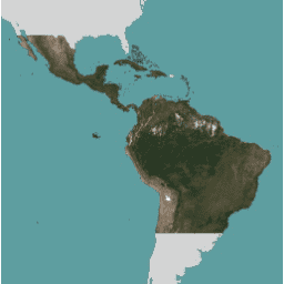
這項圖像集提供熱帶地區的高解析度衛星監測資料,主要目的是減少和扭轉熱帶森林的損失,有助於對抗氣候變遷、保護生物多樣性、促進森林再生、復育和改善,以及推動永續發展,所有這些都有助於… basemaps forest nicfi planet planet-nicfi publisher-dataset -
NICFI 衛星資料計畫:熱帶森林監測基本地圖 - 亞洲
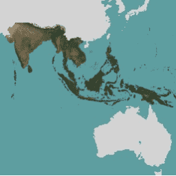
這項圖像集提供熱帶地區的高解析度衛星監測資料,主要目的是減少和扭轉熱帶森林的損失,有助於對抗氣候變遷、保護生物多樣性、促進森林再生、復育和改善,以及推動永續發展,所有這些都有助於… basemaps forest nicfi planet planet-nicfi publisher-dataset