-
USGS 3DEP 10m National Map Seamless (1/3 Arc-Second)
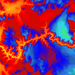
यह अमेरिका के लिए 3DEP DEM का डेटासेट है. इसमें अमेरिका के 48 राज्यों, हवाई, और अमेरिका के क्षेत्रों का पूरा कवरेज शामिल है. फ़िलहाल, अलास्का के कुछ हिस्सों में ही यह सुविधा उपलब्ध है. हालांकि, अलास्का मैपिंग इनिशिएटिव के तहत, इसे पूरे राज्य में उपलब्ध कराया जा रहा है. ग्राउंड स्पेसिंग … है 3dep dem elevation elevation-topography geophysical topography -
USGS 3DEP 1m National Map

यह 3D एलिवेशन प्रोग्राम (3DEP) से ली गई, 10 लाख पिक्सल साइज़ वाली इमेज का टाइल किया गया कलेक्शन है. 3DEP डेटा होल्डिंग, The National Map की ऊंचाई वाली लेयर के तौर पर काम करती है. साथ ही, यह पृथ्वी विज्ञान से जुड़ी स्टडी और मैपिंग ऐप्लिकेशन के लिए, ऊंचाई की बुनियादी जानकारी उपलब्ध कराती है. 3dep dem elevation elevation-topography geophysical topography -
USGS 3DEP National Map Spatial Metadata 1/3 Arc-Second (10m)

यह 3DEP 10m DEM ऐसेट के मेटाडेटा वाली टेबल है. वर्क यूनिट एक्सटेंट स्पैटियल मेटाडेटा (डब्ल्यूईएसएम) में, लिडार के मौजूदा डेटा की उपलब्धता और लिडार प्रोजेक्ट के बारे में बुनियादी जानकारी होती है. इसमें लिडार की क्वालिटी का लेवल, डेटा हासिल करने की तारीखें, और प्रोजेक्ट-लेवल के मेटाडेटा के लिंक शामिल होते हैं. ज़्यादा जानकारी देखें … 3dep elevation-topography table usgs
Datasets tagged 3dep in Earth Engine
[null,null,[],[],["The USGS 3DEP dataset offers seamless DEM data for the US, including the 48 contiguous states, Hawaii, and US territories, with partial coverage of Alaska that is being expanded. This data is available at 10m and 1m resolution. The 10m DEM has corresponding metadata table for lidar data availability. This 3DEP information serves as the elevation layer for the National Map and supports earth science studies and mapping applications.\n"]]