
-
全球年度红树林范围 (1984-2023)

CGMD-Extent30(连续全球红树林动态 - 年度红树林范围,分辨率为 30 米)数据集提供 1984 年至 2023 年的全球年度红树林范围。该数据集以单个 Earth Engine FeatureCollection 的形式分发,每个地图项代表特定年份的红树林多边形。该数据集… annual coastal forest-biomass global landsat-derived landuse-landcover -
全球年度红树林冠层覆盖率 (1984-2023)

此数据集提供 1984 年至 2023 年的全球年度红树林冠层覆盖率 (FCC),空间分辨率为 30 米,可用于大规模分析长期红树林动态,包括冠层退化和恢复、蓝碳评估以及沿海生态系统监控。FCC 可量化每个 Landsat 的比例… annual coastal forest-biomass global landsat-derived mangrove -
全球红树林分布,第 1 版 (2000)

该数据库是使用 2000 年的 Landsat 卫星数据准备的。我们使用混合监督和无监督数字图像分类技术对从 USGS 地球资源观测和科学中心 (EROS) 获取的 1,000 多个 Landsat 场景进行了分类。该数据库是第一个也是最… annual ciesin forest-biomass global landsat-derived mangrove -
JRC 年度水分类历史记录,第 1.4 版

此数据集包含 1984 年至 2021 年地表水的时空分布地图,并提供有关这些水域的范围和变化情况的统计信息。如需了解详情,请参阅相关期刊文章:High-resolution mapping of global surface water and its … annual geophysical google history jrc landsat-derived -
MOD44B.061 Terra 植被连续场年度全球 250 米

Terra MODIS 植被连续场 (VCF) 产品是全球地表植被覆盖率估计的亚像素级表示。它旨在以基本植被特征的比例连续表示地球的陆地表面,并提供三个地表覆盖成分的渐变:树木覆盖率百分比、… annual geophysical global landuse-landcover modis nasa -
Open Buildings 时序 V1
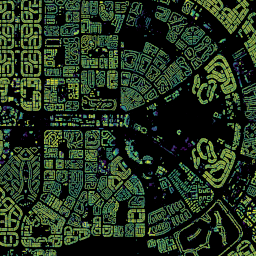
Open Buildings 2.5D 时序数据集包含有关建筑物存在、建筑物数量分数和建筑物高度的数据,有效空间分辨率为 4 米(栅格以 0.5 米分辨率提供),时间范围为 2016-2023 年,每年更新一次。该数据集由… africa annual asia built-up height open-buildings -
卫星嵌入 V1
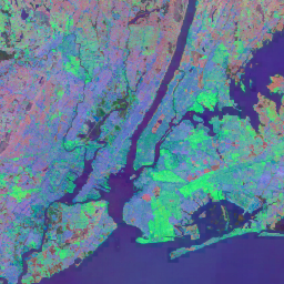
Google 卫星嵌入数据集是一个全球性的、可用于分析的已学习地理空间嵌入集合。此数据集中的每个 10 米像素都是一个 64 维表示,或“嵌入向量”,用于对该像素及其周围的地表状况的时间轨迹进行编码,这些轨迹由各种地球观测… annual global google landsat-derived satellite-imagery sentinel1-derived -
VIIRS 夜间/日间年度波段合成 V2.1

年度全球 VIIRS 夜间灯光数据集是一个时序,由 2013 年至 2021 年的每月无云平均辐射网格生成。2022 年的数据可在 NOAA/VIIRS/DNB/ANNUAL_V22 数据集中找到。初始过滤步骤移除了阳光照射、月光照射和多云的像素,从而生成粗略的合成图像,… annual dnb eog lights nighttime noaa -
VIIRS 夜间/日间年度波段合成 V2.2

年度全球 VIIRS 夜间灯光数据集是一个时序,由 2022 年的每月无云平均辐射网格生成。较早年份的数据可在 NOAA/VIIRS/DNB/ANNUAL_V21 数据集中找到。初始过滤步骤移除了阳光照射、月光照射和多云的像素,从而生成粗略的合成图像,… annual dnb eog lights nighttime noaa
Datasets tagged annual in Earth Engine
[null,null,[],[],["The datasets provide annual global information on various Earth features. The Open Buildings dataset offers building presence, counts, and heights from 2016-2023. JRC data maps surface water distribution and changes from 1984-2021. Another dataset, based on data from 2000, details mangrove forest distribution. MODIS data provides continuous vegetation cover estimates, including tree cover percentages. Lastly, VIIRS data sets map annual nighttime light composites from 2013-2022, based on cloud-free average radiance grids.\n"]]