-
Evapotranspirasi Aktual untuk Australia (CMRSET Landsat V2.2)

Set data ini memberikan evapotranspirasi aktual (AET atau ETa) yang akurat untuk Australia menggunakan algoritma CMRSET. Band AET (bernama 'ETa') berisi nilai harian rata-rata dari model CMRSET untuk semua pengamatan Landsat bebas awan dalam bulan tersebut (ditunjukkan dengan nilai 3 dalam Data AET … agriculture australia csiro evaporation evapotranspiration landsat-derived -
DEM 5M Australia

Grid Model Elevasi Digital (DEM) 5 meter Australia yang berasal dari model LiDAR merepresentasikan DEM 5 meter Nasional (tanah kosong) yang berasal dari sekitar 236 survei LiDAR individual antara tahun 2001 dan 2015 yang mencakup area seluas lebih dari 245.000 kilometer persegi. … australia dem elevation elevation-topography ga geophysical -
DEM-H: Model Elevasi Digital yang Diterapkan secara Hidrologis SRTM Australia

Hydrologically Enforced Digital Elevation Model (DEM-H) berasal dari data SRTM yang diperoleh NASA pada Februari 2000. Model telah dikondisikan secara hidrologis dan drainasenya telah diterapkan. DEM-H merekam jalur aliran berdasarkan elevasi SRTM dan garis aliran yang dipetakan, serta mendukung pembatasan … australia dem elevation elevation-topography ga geophysical -
DEM-S: Model Elevasi Digital yang Dihaluskan di Australia

Smoothed Digital Elevation Model (DEM-S) berasal dari data SRTM yang diperoleh NASA pada Februari 2000. DEM-S merepresentasikan topografi permukaan tanah (tidak termasuk fitur vegetasi) dan telah dihaluskan untuk mengurangi derau dan meningkatkan representasi bentuk permukaan. Proses adaptif yang diterapkan lebih … australia dem elevation elevation-topography ga geophysical -
Pratinjau National Intertidal Digital Elevation Model 25m 1.0.0

National Intertidal Digital Elevation Model (NIDEM; Bishop-Taylor et al. 2018, 2019) adalah set data elevasi skala kontinental untuk zona pasang surut terbuka di Australia. NIDEM memberikan representasi tiga dimensi pertama dari pantai dan pesisir berpasir intertidal, dataran pasang surut, serta pesisir dan terumbu karang berbatu di Australia pada 25 m … australia dem elevation-topography ga -
SLGA: Soil and Landscape Grid of Australia (Atribut Tanah)
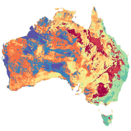
Soil and Landscape Grid of Australia (SLGA) adalah set data komprehensif tentang atribut tanah di seluruh Australia pada resolusi 3 detik busur (~90 m piksel). Permukaan adalah hasil dari pemodelan yang menjelaskan distribusi spasial atribut tanah menggunakan data tanah dan lingkungan yang ada … australia csiro soil tern
Datasets tagged australia in Earth Engine
[null,null,[],[],["Several datasets provide detailed geographic and environmental information about Australia. Digital Elevation Models (DEMs) include a 5-meter grid from LiDAR surveys, a hydrologically enforced model, and a smoothed model from SRTM data, as well as a national intertidal DEM. Additional data includes the Soil and Landscape Grid of Australia (SLGA) with soil attributes. Landsat data is processed to show actual evapotranspiration (AET), land cover, water observations, and statistical analysis.\n"]]