-
加拿大 AAFC 年度作物库存
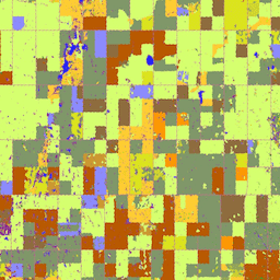
自 2009 年起,加拿大农业及农业食品部 (AAFC) 科学技术分部 (STB) 的地球观测团队开始生成年度作物类型数字地图。以 2009 年和 2010 年的草原省份为重点,一种基于决策树 (DT) 的方法… 农业 加拿大 农作物 地表覆盖 -
Canadian Digital Elevation Model
加拿大数字高程模型 (CDEM) 是加拿大自然资源部 (NRCan) 高程测量系统的一部分,源自现有的加拿大数字高程数据 (CDED)。在这些数据中,高程可以是地面高程,也可以是反射面高程。CDEM 由多个 DEM 组成,具有… 加拿大 DEM 海拔 海拔-地形 地球物理 地形 -
加拿大 2019 年基于 Landsat 的森林年龄数据

加拿大原始森林数据集是一份基于卫星的森林年龄地图,涵盖加拿大所有森林生态区,空间分辨率为 30 米,时间为 2019 年。我们利用来自 Landsat(扰动、地表反射率合成影像、森林结构)和 MODIS(初级生产总值)的遥感数据来确定年龄。森林年龄可以是… 加拿大 森林 森林生物质 -
SCANFI:加拿大空间化国家森林清查数据产品 1.2

此数据发布包含一组 30 米分辨率的栅格文件,表示 2020 年加拿大全境的广义土地覆盖类型、森林树冠高度、郁闭度和地上树木生物量地图,以及几种主要树种的物种组成。The Spatialized CAnadian National … 加拿大 森林 森林生物质 发布者-数据集 树木覆盖率
Datasets tagged canada in Earth Engine
[null,null,[],[],["Agriculture and Agri-Food Canada (AAFC) initiated annual crop type mapping in 2009, starting with the Prairie Provinces, using a Decision Tree methodology. A 2019 satellite-based forest age map of Canada was created utilizing Landsat and MODIS data at a 30-meter resolution. Natural Resources Canada's (NRCan) Canadian Digital Elevation Model (CDEM), part of the altimetry system, provides elevation data comprising multiple Digital Elevation Models (DEMs).\n"]]