-
Segments CCDC globaux Google basés sur Landsat (1999-2019)
Cette collection contient des résultats précalculés obtenus en exécutant l'algorithme de détection et de classification des changements continus (CCDC) sur 20 ans de données de réflectance de surface Landsat. Le CCDC est un algorithme de recherche de points d'inflexion qui utilise un ajustement harmonique avec un seuil RMSE dynamique pour détecter les points d'inflexion dans les données de séries temporelles. Le… change-detection google landcover landsat-derived landuse landuse-landcover -
Calques de cartographie des eaux de surface dans le monde, version 1.4 du JRC
Cet ensemble de données contient des cartes de l'emplacement et de la distribution temporelle des eaux de surface de 1984 à 2021, et fournit des statistiques sur l'étendue et l'évolution de ces surfaces d'eau. Pour en savoir plus, consultez l'article de revue associé: High-resolution mapping of global surface water and its … détection de changement géophysique google jrc dérivé de Landsat surface -
MCD64A1.061 MODIS Burned Area Monthly Global 500m
Le produit de données sur la zone brûlée MCD64A1 version 6.1 combiné Terra et Aqua est un produit mensuel, global, à grille de 500 m contenant des informations sur la zone brûlée et la qualité par pixel. L'approche de cartographie des zones brûlées MCD64A1 utilise des images de réflectance de surface MODIS à 500 m couplées à des observations d'incendies actifs MODIS à 1 km. L'algorithme… burn change-detection fire geophysical global mcd64a1 -
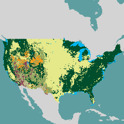
USFS Landscape Change Monitoring System v2024.10 (CONUS et OCONUS)
Ce produit fait partie de la suite de données du système de surveillance des changements paysagers (LCMS). Il présente les changements, la couverture et/ou les classes d'utilisation des sols modélisés par le LCMS pour chaque année. Il couvre les États-Unis continentaux (CONUS) ainsi que les zones situées en dehors de cette zone (OCONUS), y compris l'Alaska (AK), Porto Rico (PR), les îles Vierges des États-Unis (USVI) et les îles … change-detection forest gtac landcover landuse landuse-landcover -
VNP64A1: grille SIN globale de 500 m de résolution mensuelle de la zone brûlée au niveau L4
Le produit de données de la version 1 de la zone brûlée (VNP64A1) du radiomètre imageur infrarouge visible (VIIRS) de la NASA, Suomi NPP (Suomi National Polar-Orbiting Partnership), est un produit mensuel global à grille de 500 m contenant des informations sur la zone brûlée et la qualité par pixel. L'approche de cartographie des zones brûlées VNP64 utilise des images VIIRS de 750 m … burn change-detection fire land nasa noaa
Datasets tagged change-detection in Earth Engine
[null,null,[],[[["\u003cp\u003eThis webpage features curated datasets focused on land change detection using satellite imagery.\u003c/p\u003e\n"],["\u003cp\u003eDatasets provide insights into surface water changes, burned areas, and land cover/use transformations.\u003c/p\u003e\n"],["\u003cp\u003eData sources include Landsat, MODIS, VIIRS, and algorithms like CCDC for analyzing temporal patterns.\u003c/p\u003e\n"],["\u003cp\u003eGlobal and regional coverage is offered, with examples such as the USFS Landscape Change Monitoring System.\u003c/p\u003e\n"],["\u003cp\u003eThe collection spans multiple decades, enabling long-term change analysis and monitoring efforts.\u003c/p\u003e\n"]]],[],null,["# Datasets tagged change-detection in Earth Engine\n\n-\n\n |---------------------------------------------------------------------------------------------------------------------------------------------------------------------------------------------------------------------------------------------------------------------------------------------------------------------------------------------------|\n | [### Google Global Landsat-based CCDC Segments (1999-2019)](/earth-engine/datasets/catalog/GOOGLE_GLOBAL_CCDC_V1) |\n | This collection contains precomputed results from running the Continuous Change Detection and Classification (CCDC) algorithm on 20 years of Landsat surface reflectance data. CCDC is a break-point finding algorithm that uses harmonic fitting with a dynamic RMSE threshold to detect breakpoints in time-series data. The ... |\n | [change-detection](/earth-engine/datasets/tags/change-detection) [google](/earth-engine/datasets/tags/google) [landcover](/earth-engine/datasets/tags/landcover) [landsat-derived](/earth-engine/datasets/tags/landsat-derived) [landuse](/earth-engine/datasets/tags/landuse) [landuse-landcover](/earth-engine/datasets/tags/landuse-landcover) |\n\n-\n\n |---------------------------------------------------------------------------------------------------------------------------------------------------------------------------------------------------------------------------------------------------------------------------------------------------------------------------|\n | [### JRC Global Surface Water Mapping Layers, v1.4](/earth-engine/datasets/catalog/JRC_GSW1_4_GlobalSurfaceWater) |\n | This dataset contains maps of the location and temporal distribution of surface water from 1984 to 2021 and provides statistics on the extent and change of those water surfaces. For more information see the associated journal article: High-resolution mapping of global surface water and its ... |\n | [change-detection](/earth-engine/datasets/tags/change-detection) [geophysical](/earth-engine/datasets/tags/geophysical) [google](/earth-engine/datasets/tags/google) [jrc](/earth-engine/datasets/tags/jrc) [landsat-derived](/earth-engine/datasets/tags/landsat-derived) [surface](/earth-engine/datasets/tags/surface) |\n\n-\n\n |-----------------------------------------------------------------------------------------------------------------------------------------------------------------------------------------------------------------------------------------------------------------------------------------------------------------------------------------|\n | [### MCD64A1.061 MODIS Burned Area Monthly Global 500m](/earth-engine/datasets/catalog/MODIS_061_MCD64A1) |\n | The Terra and Aqua combined MCD64A1 Version 6.1 Burned Area data product is a monthly, global gridded 500m product containing per-pixel burned-area and quality information. The MCD64A1 burned-area mapping approach employs 500m MODIS Surface Reflectance imagery coupled with 1km MODIS active fire observations. The algorithm ... |\n | [burn](/earth-engine/datasets/tags/burn) [change-detection](/earth-engine/datasets/tags/change-detection) [fire](/earth-engine/datasets/tags/fire) [geophysical](/earth-engine/datasets/tags/geophysical) [global](/earth-engine/datasets/tags/global) [mcd64a1](/earth-engine/datasets/tags/mcd64a1) |\n\n-\n\n |-----------------------------------------------------------------------------------------------------------------------------------------------------------------------------------------------------------------------------------------------------------------------------------------------------------------------------|\n | [### USFS Landscape Change Monitoring System v2024.10 (CONUS and OCONUS)](/earth-engine/datasets/catalog/USFS_GTAC_LCMS_v2024-10) |\n | This product is part of the Landscape Change Monitoring System (LCMS) data suite. It shows LCMS-modeled change, land cover, and/or land use classes for each year and covers the Conterminous United States (CONUS) as well as areas outside the CONUS (OCONUS) including Alaska (AK), Puerto ... |\n | [change-detection](/earth-engine/datasets/tags/change-detection) [forest](/earth-engine/datasets/tags/forest) [gtac](/earth-engine/datasets/tags/gtac) [landcover](/earth-engine/datasets/tags/landcover) [landuse](/earth-engine/datasets/tags/landuse) [landuse-landcover](/earth-engine/datasets/tags/landuse-landcover) |\n\n-\n\n |---------------------------------------------------------------------------------------------------------------------------------------------------------------------------------------------------------------------------------------------------------------------------------------------------------------------------------------|\n | [### VNP64A1: Burned Area Monthly L4 Global 500m SIN Grid](/earth-engine/datasets/catalog/NOAA_VIIRS_001_VNP64A1) |\n | The daily Suomi National Polar-Orbiting Partnership (Suomi NPP) NASA Visible Infrared Imaging Radiometer Suite (VIIRS) Burned Area (VNP64A1) Version 1 data product is a monthly, global gridded 500m product containing per-pixel burned area and quality information. The VNP64 burned area mapping approach employs 750m VIIRS ... |\n | [burn](/earth-engine/datasets/tags/burn) [change-detection](/earth-engine/datasets/tags/change-detection) [fire](/earth-engine/datasets/tags/fire) [land](/earth-engine/datasets/tags/land) [nasa](/earth-engine/datasets/tags/nasa) [noaa](/earth-engine/datasets/tags/noaa) |"]]