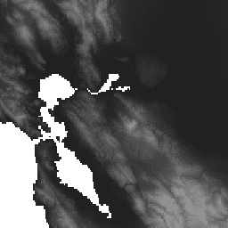
-
WWF HydroSHEDS 수문학적 조건부 DEM, 15초
HydroSHEDS는 지역 및 전 세계 규모의 애플리케이션에 수문학 정보를 일관된 형식으로 제공하는 지도 제작 제품입니다. 이 데이터 세트는 강망, 유역 경계, 배수 방향, 유량 누적을 비롯하여 다양한 규모의 지리적 참조 데이터 세트 (벡터 및 래스터)를 제공합니다. HydroSHEDS는 다음을 기반으로 합니다. 조건부 dem elevation geophysical hydrography hydrology -
WWF HydroSHEDS 수문학적 조건부 DEM, 3아크초
HydroSHEDS는 지역 및 전 세계 규모의 애플리케이션에 수문학 정보를 일관된 형식으로 제공하는 지도 제작 제품입니다. 이 데이터 세트는 강망, 유역 경계, 배수 방향, 유량 누적을 비롯하여 다양한 규모의 지리적 참조 데이터 세트 (벡터 및 래스터)를 제공합니다. HydroSHEDS는 다음을 기반으로 합니다. 조건부 dem elevation geophysical hydrography hydrology -
WWF HydroSHEDS 수문학적 조건부 DEM, 30초 방위각
HydroSHEDS는 지역 및 전 세계 규모의 애플리케이션에 수문학 정보를 일관된 형식으로 제공하는 지도 제작 제품입니다. 이 데이터 세트는 강망, 유역 경계, 배수 방향, 유량 누적을 비롯하여 다양한 규모의 지리적 참조 데이터 세트 (벡터 및 래스터)를 제공합니다. HydroSHEDS는 다음을 기반으로 합니다. 조건부 dem elevation geophysical hydrography hydrology
Datasets tagged conditioned in Earth Engine
[null,null,[],[[["\u003cp\u003eHydroSHEDS provides hydrographic information like river networks and watershed boundaries for regional and global applications.\u003c/p\u003e\n"],["\u003cp\u003eIt offers various geo-referenced datasets (vector and raster) at different scales (3, 15, and 30 arc-seconds).\u003c/p\u003e\n"],["\u003cp\u003eThe datasets include crucial hydrological features such as drainage directions and flow accumulations, valuable for water resource management and environmental studies.\u003c/p\u003e\n"],["\u003cp\u003eHydroSHEDS uses a consistent format, allowing for seamless integration and comparison across different regions.\u003c/p\u003e\n"]]],[],null,["# Datasets tagged conditioned in Earth Engine\n\n-\n\n |-------------------------------------------------------------------------------------------------------------------------------------------------------------------------------------------------------------------------------------------------------------------------------------------------------------------------------------------------------|\n | [### WWF HydroSHEDS Hydrologically Conditioned DEM, 15 Arc-Seconds](/earth-engine/datasets/catalog/WWF_HydroSHEDS_15CONDEM) |\n | HydroSHEDS is a mapping product that provides hydrographic information for regional and global-scale applications in a consistent format. It offers a suite of geo-referenced datasets (vector and raster) at various scales, including river networks, watershed boundaries, drainage directions, and flow accumulations. HydroSHEDS is based on ... |\n | [conditioned](/earth-engine/datasets/tags/conditioned) [dem](/earth-engine/datasets/tags/dem) [elevation](/earth-engine/datasets/tags/elevation) [geophysical](/earth-engine/datasets/tags/geophysical) [hydrography](/earth-engine/datasets/tags/hydrography) [hydrology](/earth-engine/datasets/tags/hydrology) |\n\n-\n\n |-------------------------------------------------------------------------------------------------------------------------------------------------------------------------------------------------------------------------------------------------------------------------------------------------------------------------------------------------------|\n | [### WWF HydroSHEDS Hydrologically Conditioned DEM, 3 Arc-Seconds](/earth-engine/datasets/catalog/WWF_HydroSHEDS_03CONDEM) |\n | HydroSHEDS is a mapping product that provides hydrographic information for regional and global-scale applications in a consistent format. It offers a suite of geo-referenced datasets (vector and raster) at various scales, including river networks, watershed boundaries, drainage directions, and flow accumulations. HydroSHEDS is based on ... |\n | [conditioned](/earth-engine/datasets/tags/conditioned) [dem](/earth-engine/datasets/tags/dem) [elevation](/earth-engine/datasets/tags/elevation) [geophysical](/earth-engine/datasets/tags/geophysical) [hydrography](/earth-engine/datasets/tags/hydrography) [hydrology](/earth-engine/datasets/tags/hydrology) |\n\n-\n\n |-------------------------------------------------------------------------------------------------------------------------------------------------------------------------------------------------------------------------------------------------------------------------------------------------------------------------------------------------------|\n | [### WWF HydroSHEDS Hydrologically Conditioned DEM, 30 Arc-Seconds](/earth-engine/datasets/catalog/WWF_HydroSHEDS_30CONDEM) |\n | HydroSHEDS is a mapping product that provides hydrographic information for regional and global-scale applications in a consistent format. It offers a suite of geo-referenced datasets (vector and raster) at various scales, including river networks, watershed boundaries, drainage directions, and flow accumulations. HydroSHEDS is based on ... |\n | [conditioned](/earth-engine/datasets/tags/conditioned) [dem](/earth-engine/datasets/tags/dem) [elevation](/earth-engine/datasets/tags/elevation) [geophysical](/earth-engine/datasets/tags/geophysical) [hydrography](/earth-engine/datasets/tags/hydrography) [hydrology](/earth-engine/datasets/tags/hydrology) |"]]