-
FLDAS:Famine Early Warning Systems Network (FEWS NET) Land Data Assimilation System

FLDAS 数据集(McNally 等人,2017 年)旨在帮助在数据稀疏的发展中国家环境中进行粮食安全评估。它包含许多与气候相关的变量的信息,包括水分含量、湿度、蒸散量、平均土壤温度、总降水率等。FLDAS 数据集有多种不同的版本;… climate cryosphere evapotranspiration humidity ldas monthly -
GLDAS-2.1:全球陆面数据同化系统

NASA 全球陆面数据同化系统第 2 版 (GLDAS-2) 包含三个组成部分:GLDAS-2.0、GLDAS-2.1 和 GLDAS-2.2。GLDAS-2.0 完全由普林斯顿气象强迫输入数据强迫,并提供 1948 年至 2014 年的时间上一致的序列。GLDAS-2.1 采用模型… 3 小时 气候 冰冻圈 蒸发 强迫 地球物理 -
GLDAS-2.2:全球陆面数据同化系统

NASA 全球陆面数据同化系统第 2 版 (GLDAS-2) 包含三个组成部分:GLDAS-2.0、GLDAS-2.1 和 GLDAS-2.2。GLDAS-2.0 完全由普林斯顿气象强迫输入数据强迫,并提供 1948 年至 2014 年的时间上一致的序列。GLDAS-2.1 采用模型… 3 小时 气候 冰冻圈 蒸发 强迫 地球物理 -
GLIMS 2023:从太空获取的全球陆地冰测量数据
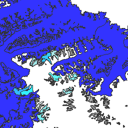
“全球陆地冰测量计划”(GLIMS) 是一项国际计划,旨在反复调查全球约 20 万条冰川。该项目旨在创建一份全球全面的陆地冰川清单,包括冰川面积、几何形状、地表速度和雪线的测量结果… 冰冻圈 冰川 glims 冰 landcover nasa -
GLIMS Current:Global Land Ice Measurements From Space

“全球陆地冰测量计划”(GLIMS) 是一项国际计划,旨在反复调查全球约 20 万条冰川。该项目旨在创建一份全球全面的陆地冰川清单,包括冰川面积、几何形状、地表速度和雪线的测量结果… 冰冻圈 冰川 glims 冰 landcover nasa -
格陵兰冰盖和海洋掩码 - 格陵兰测绘项目 (GIMP)

此数据集提供了格陵兰冰盖的完整陆地冰和海洋分类掩码(分辨率为 15 米)。冰盖是使用以下影像绘制的:USGS 分发的 Landsat 7 Enhanced Thematic Mapper Plus (ETM+) 的正射校正全色(波段 8)影像,以及… 北极 冰冻圈 gimp 格陵兰 冰 nasa -
MERRA-2 M2T1NXLND:陆地表面诊断 V5.12.4

M2T1NXLND(或 tavg1_2d_lnd_Nx)是现代回顾性研究和应用分析第 2 版 (MERRA-2) 中的每小时时间平均数据集合。此集合包含陆地表面诊断变量,例如基流通量、径流、地表土壤湿度、根区土壤湿度、地表层的水、… climate cryosphere evaporation ice merra precipitation -
MEaSUREs Greenland Ice Velocity: Selected Glacier Site Velocity Maps from Optical Images Version 2

此数据集是 NASA“在研究环境中制作地球系统数据记录”(MEaSUREs) 计划的一部分,包含所选冰川出口区域的平均月度速度地图。这些地图是通过跟踪 Landsat … 北极 冰冻圈 gimp 格陵兰 冰 nasa -
MOD10A1.061 Terra 积雪每日全球 500 米

MOD10A1 V6.1 积雪每日全球 500 米产品包含积雪、积雪反照率、积雪覆盖率和质量评估 (QA) 数据。积雪覆盖率数据基于一种积雪测绘算法,该算法采用归一化差异积雪指数 (NDSI) 和其他标准测试。常规… albedo cryosphere daily geophysical global modis -
MOD10A2.061 Terra Snow Cover 8-Day L3 Global 500m

MOD10A2 是 Terra 卫星上 MODIS 的积雪覆盖数据集。该数据集以 500 米的分辨率报告 8 天期间的最大积雪覆盖范围。之所以选择 8 天的合成周期,是因为这是精确的地面轨道重复周期。 冰冻圈 每日 地球物理 全球 modis nasa -
MYD10A1.061 Aqua 积雪每日全球 500 米

MYD10A1 V6 积雪每日全球 500 米产品包含积雪、积雪反照率、积雪覆盖率和质量评估 (QA) 数据。积雪数据基于采用归一化差值积雪指数 (NDSI) 和其他标准测试的积雪测绘算法。一般… albedo aqua cryosphere daily geophysical global -
重新处理的 GLDAS-2.0:全球陆面数据同化系统

NASA 全球陆面数据同化系统第 2 版 (GLDAS-2) 包含三个组成部分:GLDAS-2.0、GLDAS-2.1 和 GLDAS-2.2。GLDAS-2.0 完全由普林斯顿气象强迫输入数据强迫,并提供 1948 年至 2014 年的时间上一致的序列。GLDAS-2.1 采用模型… 3 小时 气候 冰冻圈 蒸发 强迫 地球物理
Datasets tagged cryosphere in Earth Engine
[null,null,[],[],[]]