মিথেনস্যাট L3 কনসেন্ট্রেশন পাবলিক প্রিভিউ V1.0.0 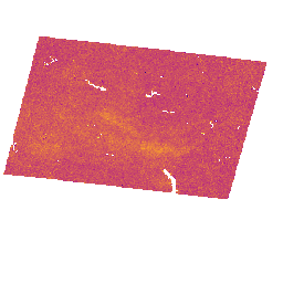
এই প্রাথমিক "পাবলিক প্রিভিউ" ডেটাসেটটি বায়ুমণ্ডলে মিথেনের কলাম-গড় শুষ্ক-বাতাসের মোল ভগ্নাংশ, "XCH4" এর জন্য ভূ-স্থানিক তথ্য প্রদান করে, যা মিথেনস্যাট ইমেজিং স্পেকট্রোমিটার দ্বারা পরিমাপ থেকে প্রাপ্ত। XCH4 কে মোট কলামের পরিমাণ (একটি ইউনিট পৃষ্ঠের ক্ষেত্রফলের উপরে অণুর সংখ্যা) হিসাবে সংজ্ঞায়িত করা হয় ... বায়ুমণ্ডল জলবায়ু edf edf-মিথেনেস্যাট-ইই নির্গমন ghg মিথেনস্যাট L4 এরিয়া সোর্স পাবলিক প্রিভিউ V1.0.0 
বিচ্ছুরিত এলাকা নির্গমন মডেলটি এখনও বিকাশাধীন এবং এটি কোনও চূড়ান্ত পণ্যের প্রতিনিধিত্ব করে না। এই প্রাথমিক "পাবলিক প্রিভিউ" ডেটাসেটটি বিচ্ছুরিত এলাকার উৎস থেকে মিথেন নির্গমনের জন্য উচ্চ নির্ভুলতার তথ্য প্রদান করে। এই নির্গমন তথ্যগুলি অ্যাপালাচিয়ান, পার্মিয়ান এবং উইন্টা অববাহিকা থেকে আসে … বায়ুমণ্ডল জলবায়ু edf edf-মিথেনেস্যাট-ইই নির্গমন ghg মিথেনস্যাট L4 এরিয়া সোর্স পাবলিক প্রিভিউ V2.0.0 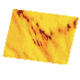
বিচ্ছুরিত এলাকা নির্গমন মডেলটি এখনও বিকাশাধীন এবং এটি কোনও চূড়ান্ত পণ্যের প্রতিনিধিত্ব করে না। এই প্রাথমিক "পাবলিক প্রিভিউ" ডেটাসেটটি বিচ্ছুরিত এলাকার উৎস থেকে মিথেন নির্গমনের জন্য উচ্চ নির্ভুলতা তথ্য সরবরাহ করে। এই অভিনব পরিমাপগুলি উচ্চ ... সহ মোট মিথেন নির্গমনের পরিমাণ নির্ধারণের গুরুত্ব প্রদর্শন করে। বায়ুমণ্ডল জলবায়ু edf edf-মিথেনেস্যাট-ইই নির্গমন ghg মিথেনস্যাট L4 পয়েন্ট সোর্স পাবলিক প্রিভিউ V1.0.0 
এই প্রাথমিক "পাবলিক প্রিভিউ" ডেটাসেটটি বিচ্ছিন্ন বিন্দু উৎস থেকে মিথেন নির্গমনের জন্য উচ্চ নির্ভুলতা ডেটা সরবরাহ করে। এই মিথেন নির্গমন প্রবাহগুলি উচ্চ স্থানিক রেজোলিউশন, বিস্তৃত স্থানিক কভারেজ এবং উচ্চ নির্ভুলতা কাজে লাগানোর জন্য বিশেষায়িত একটি বিন্দু উৎস সনাক্তকরণ এবং নির্গমন পরিমাপ কাঠামো ব্যবহার করে তৈরি করা হয়েছিল ... বায়ুমণ্ডল জলবায়ু edf edf-মিথেনেস্যাট-ইই নির্গমন ghg
Datasets tagged edf-methanesat-ee in Earth Engine
[null,null,[],[],[]]