Page Summary
-
NLS Orthophotos are aerial photo datasets covering all of Finland.
-
These datasets are provided by either Mavi (Agency for Rural Affairs) or SMK (The Energy Agency).
-
An orthophoto is formed by combining multiple individual aerial photos.
-
Finland NRG NLS orthophotos 50 cm by Mavi
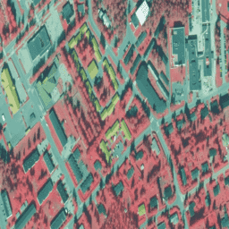
NLS Orthophotos are an aerial photo dataset covering the whole of Finland. This data is provided by Mavi(Agency for Rural Affairs). An orthophoto is a combination of several individual aerial photos. The aerial photo dataset in orthophoto format is available as the most recent dataset … falsecolor finland nrg orthophotos -
Finland NRG NLS orthophotos 50 cm by SMK

NLS Orthophotos are an aerial photo dataset covering the whole of Finland. This data is provided by SMK(The Energy Agency, formerly abbreviated SMK). An orthophoto is a combination of several individual aerial photos. The aerial photo dataset in orthophoto format is available as the most … falsecolor finland nrg orthophotos smk -
Finland RGB NLS orthophotos 50 cm by SMK

NLS Orthophotos are an aerial photo dataset covering the whole of Finland. This data is provided by SMK(The Energy Agency, formerly abbreviated SMK). An orthophoto is a combination of several individual aerial photos. The aerial photo data set in orthophoto format is available as the … finland orthophotos rgb smk