FAO GAUL ৫০০ মিটার সরলীকৃত: গ্লোবাল অ্যাডমিনিস্ট্রেটিভ ইউনিট লেয়ারস ২০১৫, দেশের সীমানা 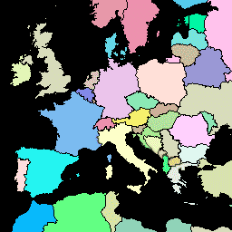
GAUL ডেটাসেটের এই সংস্করণটি 500m-এ সরলীকৃত। গ্লোবাল অ্যাডমিনিস্ট্রেটিভ ইউনিট লেয়ারস (GAUL) বিশ্বের সকল দেশের জন্য প্রশাসনিক ইউনিট সম্পর্কে সেরা উপলব্ধ তথ্য সংকলন এবং প্রচার করে, যা প্রশাসনিক ইউনিটগুলির প্রতিনিধিত্বকারী স্থানিক ডেটাসেটের মানকীকরণে অবদান রাখে। … সীমান্ত দেশ ফাও গল অবকাঠামো-সীমানা টেবিল FAO GAUL ৫০০ মিটার সরলীকৃত: গ্লোবাল অ্যাডমিনিস্ট্রেটিভ ইউনিট লেয়ারস ২০১৫, প্রথম-স্তরের অ্যাডমিনিস্ট্রেটিভ ইউনিট 
GAUL ডেটাসেটের এই সংস্করণটি 500m-এ সরলীকৃত। গ্লোবাল অ্যাডমিনিস্ট্রেটিভ ইউনিট লেয়ারস (GAUL) বিশ্বের সকল দেশের জন্য প্রশাসনিক ইউনিট সম্পর্কে সেরা উপলব্ধ তথ্য সংকলন এবং প্রচার করে, যা প্রশাসনিক ইউনিটগুলির প্রতিনিধিত্বকারী স্থানিক ডেটাসেটের মানকীকরণে অবদান রাখে। … সীমান্ত বিভাগ ফাও গল অবকাঠামো-সীমানা প্রদেশসমূহ FAO GAUL ৫০০ মিটার সরলীকৃত: গ্লোবাল অ্যাডমিনিস্ট্রেটিভ ইউনিট লেয়ারস ২০১৫, দ্বিতীয়-স্তরের অ্যাডমিনিস্ট্রেটিভ ইউনিট 
GAUL ডেটাসেটের এই সংস্করণটি 500m-এ সরলীকৃত। গ্লোবাল অ্যাডমিনিস্ট্রেটিভ ইউনিট লেয়ারস (GAUL) বিশ্বের সকল দেশের জন্য প্রশাসনিক ইউনিট সম্পর্কে সেরা উপলব্ধ তথ্য সংকলন এবং প্রচার করে, যা প্রশাসনিক ইউনিটগুলির প্রতিনিধিত্বকারী স্থানিক ডেটাসেটের মানকীকরণে অবদান রাখে। … কাউন্টি জেলাগুলির সীমানা ফাও গল অবকাঠামো-সীমানা FAO GAUL: বৈশ্বিক প্রশাসনিক ইউনিট স্তর ২০১৫, দেশের সীমানা 
গ্লোবাল অ্যাডমিনিস্ট্রেটিভ ইউনিট লেয়ারস (GAUL) বিশ্বের সকল দেশের জন্য প্রশাসনিক ইউনিট সম্পর্কে সর্বোত্তম উপলব্ধ তথ্য সংকলন এবং প্রচার করে, যা প্রশাসনিক ইউনিটগুলির প্রতিনিধিত্বকারী স্থানিক ডেটাসেটের মানকীকরণে অবদান রাখে। GAUL সর্বদা একটি ঐক্যবদ্ধ ... সহ বিশ্বব্যাপী স্তরগুলি বজায় রাখে। সীমান্ত দেশ ফাও গল অবকাঠামো-সীমানা টেবিল FAO GAUL: গ্লোবাল অ্যাডমিনিস্ট্রেটিভ ইউনিট লেয়ারস ২০১৫, প্রথম-স্তরের অ্যাডমিনিস্ট্রেটিভ ইউনিট 
গ্লোবাল অ্যাডমিনিস্ট্রেটিভ ইউনিট লেয়ারস (GAUL) বিশ্বের সকল দেশের জন্য প্রশাসনিক ইউনিট সম্পর্কে সর্বোত্তম উপলব্ধ তথ্য সংকলন এবং প্রচার করে, যা প্রশাসনিক ইউনিটগুলির প্রতিনিধিত্বকারী স্থানিক ডেটাসেটের মানকীকরণে অবদান রাখে। GAUL সর্বদা একটি ঐক্যবদ্ধ ... সহ বিশ্বব্যাপী স্তরগুলি বজায় রাখে। সীমান্ত বিভাগ ফাও গল অবকাঠামো-সীমানা প্রদেশসমূহ FAO GAUL: গ্লোবাল অ্যাডমিনিস্ট্রেটিভ ইউনিট লেয়ারস ২০১৫, দ্বিতীয় স্তরের অ্যাডমিনিস্ট্রেটিভ ইউনিট 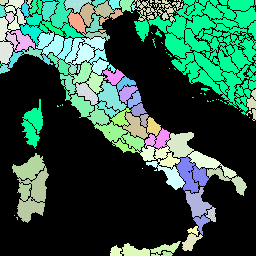
গ্লোবাল অ্যাডমিনিস্ট্রেটিভ ইউনিট লেয়ারস (GAUL) বিশ্বের সকল দেশের জন্য প্রশাসনিক ইউনিট সম্পর্কে সর্বোত্তম উপলব্ধ তথ্য সংকলন এবং প্রচার করে, যা প্রশাসনিক ইউনিটগুলির প্রতিনিধিত্বকারী স্থানিক ডেটাসেটের মানকীকরণে অবদান রাখে। GAUL সর্বদা একটি ঐক্যবদ্ধ ... সহ বিশ্বব্যাপী স্তরগুলি বজায় রাখে। কাউন্টি জেলাগুলির সীমানা ফাও গল অবকাঠামো-সীমানা
Datasets tagged gaul in Earth Engine
[null,null,[],[],[]]