Характеристика пожара/горячей точки серии GOES-19 FDCC ABI уровня 2 CONUS 
Спутники GOES — геостационарные метеорологические спутники, находящиеся в ведении NOAA. Продукт Fire (HSC) содержит четыре изображения: одно в виде маски пожара и три других со значениями пикселей, определяющими температуру, площадь и мощность излучения пожара. Метаданные ABI L2+ FHS… abi fdc огонь идет идет-19 идет-восток Характеристика пожара/горячей точки GOES-19 серии FDCF, уровень 2, полный диск 
Продукт Fire (HSC) содержит четыре изображения: одно в виде маски пожара и три других со значениями пикселей, определяющими температуру, площадь и мощность излучения пожара. Маска метаданных ABI L2+ FHS присваивает флаг каждому пикселю, полученному с помощью наземной навигации, который… abi fdc огонь идет идет-19 идет-восток Снимки облаков и влажности серии GOES-19 MCMIPC ABI уровня 2, CONUS 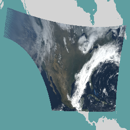
Все изображения облаков и влажности имеют разрешение 2 км. Каналы 1–6 являются отражательными. Безразмерная величина «коэффициента отражения» нормализована по зенитному углу Солнца. Эти каналы позволяют характеризовать облака, растительность, снег/лёд и аэрозоли. Каналы 7–16 являются излучательными. Яркостная температура… атмосфера аби идет идет-19 идет-восток идет-у Снимки облаков и влажности GOES-19 серии MCMIPF ABI уровня 2, полный диск 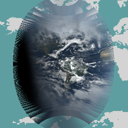
Все изображения облаков и влажности имеют разрешение 2 км. Каналы 1–6 являются отражательными. Безразмерная величина «коэффициента отражения» нормализована по зенитному углу Солнца. Эти каналы позволяют характеризовать облака, растительность, снег/лёд и аэрозоли. Каналы 7–16 являются излучательными. Яркостная температура… атмосфера аби идет идет-19 идет-восток идет-у Мезомасштабные изображения облаков и влажности серии GOES-19 MCMIPM ABI уровня 2 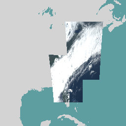
Все изображения облаков и влажности имеют разрешение 2 км. Каналы 1–6 являются отражательными. Безразмерная величина «коэффициента отражения» нормализована по зенитному углу Солнца. Эти каналы позволяют характеризовать облака, растительность, снег/лёд и аэрозоли. Каналы 7–16 являются излучательными. Яркостная температура… атмосфера аби идет идет-19 идет-восток идет-у
Datasets tagged goes-u in Earth Engine
[null,null,[],[],[]]