-
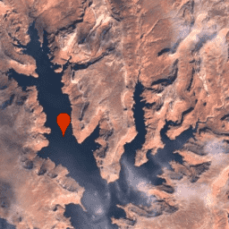
USGS Landsat 8 Collection 2 Tier 1 Raw Scenes
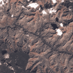
Wartości DN w ramach kolekcji 2 Landsat 8 poziomu 1, przedstawiające skalowane, skalibrowane natężenie promieniowania na czujniku. Sceny Landsat o najwyższej dostępnej jakości danych są umieszczane w poziomie 1 i uważane za odpowiednie do analizy przetwarzania sekwencji czasowych. Poziom 1 obejmuje przetworzone dane o terenie o dokładności poziomu 1 (L1TP), które … c2 global l8 landsat lc8 oli-tirs -
USGS Landsat 8 Collection 2 poziom 1 i dane w czasie rzeczywistym Raw Scenes
Wartości DN danych Landsat 8 Collection 2 poziomu 1 i w czasie rzeczywistym, przedstawiające skalowane, skalibrowane wartości promieniowania przy czujniku. Sceny Landsat o najwyższej dostępnej jakości danych są umieszczane w poziomie 1 i uważane za odpowiednie do analizy przetwarzania sekwencji czasowych. Poziom 1 obejmuje przetworzony teren o dokładności L1 (L1TP) … c2 global l8 landsat lc8 nrt -
USGS Landsat 8 Collection 2 Tier 1 i dane w czasie rzeczywistym TOA Reflectance
Dane Landsat 8 Collection 2 Tier 1 i dane w czasie rzeczywistym z wynikiem odbicia na górnej granicy atmosfery (TOA) skalibrowanym na podstawie danych TOA. współczynniki kalibracji są wyodrębniane z metadanych obrazu; Szczegółowe informacje o obliczaniu TOA znajdziesz w artykule Chander i in. (2009). Zdjęcia Landsat o najwyższej dostępnej jakości danych są umieszczane w poziomie 1. c2 global l8 landsat lc8 satellite-imagery -
USGS Landsat 8 Collection 2 Tier 2 Raw Scenes
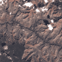
Wartości DN w ramach kolekcji 2 Landsat 8 poziomu 2, które stanowią skalowane, skalibrowane wartości promieniowania przy czujniku. Sceny, które nie spełniają kryteriów poziomu 1 podczas przetwarzania, są przypisywane do poziomu 2. Dotyczy to przetworzonych scen z przetwarzaniem systematycznym (L1GT) i systematycznym (L1GS), a także scen L1TP, które nie … c2 global l8 landsat lc8 oli-tirs
Datasets tagged l8 in Earth Engine
[null,null,[],[[["\u003cp\u003eThis page provides access to USGS Landsat 8 Collection 2 datasets, including Tier 1 and Tier 2 Raw Scenes, as well as Tier 1 and Real-Time data in both Raw and Top-of-Atmosphere (TOA) Reflectance formats.\u003c/p\u003e\n"],["\u003cp\u003eLandsat 8 Collection 2 Tier 1 data represents the highest quality scenes suitable for time-series analysis and includes Level-1 Precision Terrain (L1TP) processed data.\u003c/p\u003e\n"],["\u003cp\u003eLandsat 8 Collection 2 Tier 2 data contains scenes that did not meet Tier 1 criteria and includes Systematic Terrain (L1GT) and Systematic (L1GS) processed scenes.\u003c/p\u003e\n"],["\u003cp\u003eReal-Time data is available for Tier 1 scenes in both raw Digital Number (DN) values and calibrated TOA reflectance.\u003c/p\u003e\n"],["\u003cp\u003eAll datasets provide global coverage and are calibrated to at-sensor radiance or reflectance.\u003c/p\u003e\n"]]],["Landsat 8 Collection 2 data offers raw scenes in Tier 1 and Tier 2, with Tier 1 representing the highest quality data, suitable for time-series analysis and processed to Level-1 Precision Terrain (L1TP). Tier 2 includes lower quality scenes such as Systematic terrain (L1GT) and Systematic (L1GS). Additionally, Tier 1 and Real-Time data provide scaled, calibrated at-sensor radiance and calibrated top-of-atmosphere (TOA) reflectance.\n"],null,["# Datasets tagged l8 in Earth Engine\n\n-\n\n |---------------------------------------------------------------------------------------------------------------------------------------------------------------------------------------------------------------------------------------------------------------------------------------------------------------------------|\n | [### USGS Landsat 8 Collection 2 Tier 1 Raw Scenes](/earth-engine/datasets/catalog/LANDSAT_LC08_C02_T1) |\n | Landsat 8 Collection 2 Tier 1 DN values, representing scaled, calibrated at-sensor radiance. Landsat scenes with the highest available data quality are placed into Tier 1 and are considered suitable for time-series processing analysis. Tier 1 includes Level-1 Precision Terrain (L1TP) processed data that have ... |\n | [c2](/earth-engine/datasets/tags/c2) [global](/earth-engine/datasets/tags/global) [l8](/earth-engine/datasets/tags/l8) [landsat](/earth-engine/datasets/tags/landsat) [lc8](/earth-engine/datasets/tags/lc8) [oli-tirs](/earth-engine/datasets/tags/oli-tirs) |\n\n-\n\n |-------------------------------------------------------------------------------------------------------------------------------------------------------------------------------------------------------------------------------------------------------------------------------------------------------------------------------|\n | [### USGS Landsat 8 Collection 2 Tier 1 and Real-Time data Raw Scenes](/earth-engine/datasets/catalog/LANDSAT_LC08_C02_T1_RT) |\n | Landsat 8 Collection 2 Tier 1 and Real-Time data DN values, representing scaled, calibrated at-sensor radiance. Landsat scenes with the highest available data quality are placed into Tier 1 and are considered suitable for time-series processing analysis. Tier 1 includes Level-1 Precision Terrain (L1TP) processed ... |\n | [c2](/earth-engine/datasets/tags/c2) [global](/earth-engine/datasets/tags/global) [l8](/earth-engine/datasets/tags/l8) [landsat](/earth-engine/datasets/tags/landsat) [lc8](/earth-engine/datasets/tags/lc8) [nrt](/earth-engine/datasets/tags/nrt) |\n\n-\n\n |------------------------------------------------------------------------------------------------------------------------------------------------------------------------------------------------------------------------------------------------------------------------------------------------------------------|\n | [### USGS Landsat 8 Collection 2 Tier 1 and Real-Time data TOA Reflectance](/earth-engine/datasets/catalog/LANDSAT_LC08_C02_T1_RT_TOA) |\n | Landsat 8 Collection 2 Tier 1 and Real-Time data calibrated top-of-atmosphere (TOA) reflectance. Calibration coefficients are extracted from the image metadata. See Chander et al. (2009) for details on the TOA computation. Landsat scenes with the highest available data quality are placed into Tier 1 ... |\n | [c2](/earth-engine/datasets/tags/c2) [global](/earth-engine/datasets/tags/global) [l8](/earth-engine/datasets/tags/l8) [landsat](/earth-engine/datasets/tags/landsat) [lc8](/earth-engine/datasets/tags/lc8) [satellite-imagery](/earth-engine/datasets/tags/satellite-imagery) |\n\n-\n\n |------------------------------------------------------------------------------------------------------------------------------------------------------------------------------------------------------------------------------------------------------------------------------------------------------|\n | [### USGS Landsat 8 Collection 2 Tier 2 Raw Scenes](/earth-engine/datasets/catalog/LANDSAT_LC08_C02_T2) |\n | Landsat 8 Collection 2 Tier 2 DN values, representing scaled, calibrated at-sensor radiance. Scenes not meeting Tier 1 criteria during processing are assigned to Tier 2. This includes Systematic terrain (L1GT) and Systematic (L1GS) processed scenes, as well as any L1TP scenes that do not ... |\n | [c2](/earth-engine/datasets/tags/c2) [global](/earth-engine/datasets/tags/global) [l8](/earth-engine/datasets/tags/l8) [landsat](/earth-engine/datasets/tags/landsat) [lc8](/earth-engine/datasets/tags/lc8) [oli-tirs](/earth-engine/datasets/tags/oli-tirs) |"]]