সিএসপি জিএইচএম: গ্লোবাল হিউম্যান মডিফিকেশন 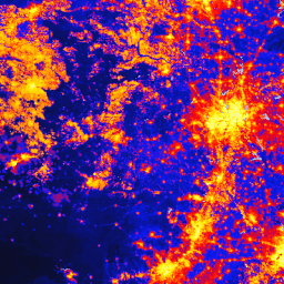
গ্লোবাল হিউম্যান মডিফিকেশন ডেটাসেট (gHM) বিশ্বব্যাপী ১ বর্গ-কিলোমিটার রেজোলিউশনে স্থলভাগে মানুষের করা পরিবর্তনের একটি ক্রমবর্ধমান পরিমাপ প্রদান করে। gHM-এর মান ০.০ থেকে ১.০ পর্যন্ত হয়ে থাকে এবং এটি কোনো নির্দিষ্ট স্থানের (পিক্সেল) পরিবর্তিত অংশের অনুপাত ও পরিবর্তনের আনুমানিক তীব্রতা অনুমান করে গণনা করা হয়… সিএসপি খণ্ডায়ন মানব-পরিবর্তন ভূমি আচ্ছাদন ভূদৃশ্য-ঢাল জনসংখ্যা FireCCI51: MODIS Fire_cci দগ্ধ এলাকা পিক্সেল পণ্য, সংস্করণ 5.1 
MODIS Fire_cci Burned Area পিক্সেল প্রোডাক্ট সংস্করণ 5.1 (FireCCI51) হলো একটি মাসিক বৈশ্বিক ~250m স্থানিক রেজোলিউশনের ডেটাসেট, যাতে দগ্ধ এলাকা সম্পর্কিত তথ্যের পাশাপাশি আনুষঙ্গিক ডেটাও রয়েছে। এটি MODIS যন্ত্রে থাকা নিয়ার ইনফ্রারেড (NIR) ব্যান্ডের ভূপৃষ্ঠের প্রতিফলনের উপর ভিত্তি করে তৈরি… পোড়া সিসিআই জলবায়ু-পরিবর্তন কোপারনিকাস ইএসএ আগুন টিএনসি গ্লোবাল হিউম্যান মডিফিকেশন ভি৩ (পরিবর্তন-সামঞ্জস্যপূর্ণ ৩০০মি) 
গ্লোবাল হিউম্যান মডিফিকেশন ভি৩ ডেটাসেটটি বৈশ্বিক স্থলজ বাস্তুতন্ত্রের (অ্যান্টার্কটিকা বাদে) উপর মানুষের ক্রমবর্ধমান চাপ পরিমাপ করে। এটি ১৯৯০ থেকে ২০২২ সাল পর্যন্ত তথ্য সংগ্রহ করে এবং এর উদ্দেশ্য হলো সংরক্ষণ পরিকল্পনা, নীতি-নির্ধারণ এবং গবেষণার জন্য মানুষের প্রভাবের পরিমাণ নির্ধারণে সহায়তা করা। এই ডেটাসেটটি হলো "পরিবর্তন-সামঞ্জস্যপূর্ণ" সিরিজ ("সি" সিরিজ)... খণ্ডায়ন, মানবসৃষ্ট পরিবর্তন, ভূমি আচ্ছাদন, ভূদৃশ্য-ঢাল, জনসংখ্যা, চাপ টিএনসি গ্লোবাল হিউম্যান মডিফিকেশন ভি৩ (স্ট্যাটিক স্ন্যাপশট ৯০মি) 
গ্লোবাল হিউম্যান মডিফিকেশন ভি৩ ডেটাসেটটি বৈশ্বিক স্থলজ বাস্তুতন্ত্রের (অ্যান্টার্কটিকা বাদে) উপর মানুষের ক্রমবর্ধমান চাপ পরিমাপ করে। এটি ১৯৯০ থেকে ২০২২ সাল পর্যন্ত তথ্য সংগ্রহ করে এবং এর উদ্দেশ্য হলো সংরক্ষণ পরিকল্পনা, নীতি নির্ধারণ এবং গবেষণার জন্য মানুষের প্রভাবের পরিমাণ নির্ধারণে সহায়তা করা। এটি হলো ২০২২ সালের স্থির চিত্র ("এস" সিরিজ)… খণ্ডায়ন, মানবসৃষ্ট পরিবর্তন, ভূমি আচ্ছাদন, ভূদৃশ্য-ঢাল, জনসংখ্যা, চাপ
Datasets tagged landscape-gradient in Earth Engine
[null,null,[],[],[]]