-
USGS Landsat 8 Collection 2 Tier 1 원시 장면
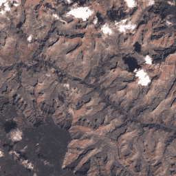
확장 및 보정된 센서 전 방사도를 나타내는 Landsat 8 컬렉션 2 Tier 1 DN 값입니다. 사용 가능한 데이터 품질이 가장 우수한 Landsat 장면은 Tier 1로 분류되며 시계열 처리 분석에 적합한 것으로 간주됩니다. Tier 1에는 다음과 같은 Level-1 Precision Terrain (L1TP) 처리 데이터가 포함됩니다. c2 global l8 landsat lc8 oli-tirs -
USGS Landsat 8 Collection 2 Tier 1 및 실시간 데이터 원시 장면
Landsat 8 Collection 2 Tier 1 및 실시간 데이터 DN 값으로, 확장 및 보정된 센서 전 방사도를 나타냅니다. 사용 가능한 데이터 품질이 가장 우수한 Landsat 장면은 Tier 1로 분류되며 시계열 처리 분석에 적합한 것으로 간주됩니다. Tier 1에는 처리된 1차 정밀도 지형 (L1TP)이 포함됩니다. c2 global l8 landsat lc8 nrt -
USGS Landsat 8 Collection 2 Tier 1 및 실시간 데이터 TOA 반사율
Landsat 8 Collection 2 Tier 1 및 실시간 데이터 보정 대기권 상단 (TOA) 반사율 보정 계수는 이미지 메타데이터에서 추출됩니다. TOA 계산에 관한 자세한 내용은 Chander et al. (2009)를 참고하세요. 사용 가능한 데이터 품질이 가장 높은 Landsat 장면은 Tier 1로 분류됩니다. c2 global l8 landsat lc8 satellite-imagery -
USGS Landsat 8 Collection 2 Tier 2 원시 장면
확장 및 보정된 감지기 광도를 나타내는 Landsat 8 컬렉션 2 Tier 2 DN 값입니다. 처리 중에 Tier 1 기준을 충족하지 않는 장면은 Tier 2에 할당됩니다. 여기에는 체계적 지형 (L1GT) 및 체계적 (L1GS) 처리된 장면과 L1TP 장면 중 … c2 global l8 landsat lc8 oli-tirs
Datasets tagged lc8 in Earth Engine
[null,null,[],[[["\u003cp\u003eThis page features various USGS Landsat 8 Collection 2 datasets, including Tier 1 and Tier 2, offering both raw Digital Numbers (DN) and Top-of-Atmosphere (TOA) reflectance.\u003c/p\u003e\n"],["\u003cp\u003eLandsat 8 Collection 2 Tier 1 data represents the highest quality scenes suitable for time-series analysis, including real-time data for immediate use.\u003c/p\u003e\n"],["\u003cp\u003eTier 2 data comprises scenes that did not meet Tier 1 criteria but still provide valuable information for less critical applications.\u003c/p\u003e\n"],["\u003cp\u003eAll datasets offer global coverage and are processed to Level-1 Precision Terrain (L1TP), Level-1 Systematic Terrain (L1GT) or Level-1 Systematic (L1GS) standards, depending on the dataset and individual scene.\u003c/p\u003e\n"]]],[],null,["# Datasets tagged lc8 in Earth Engine\n\n-\n\n |---------------------------------------------------------------------------------------------------------------------------------------------------------------------------------------------------------------------------------------------------------------------------------------------------------------------------|\n | [### USGS Landsat 8 Collection 2 Tier 1 Raw Scenes](/earth-engine/datasets/catalog/LANDSAT_LC08_C02_T1) |\n | Landsat 8 Collection 2 Tier 1 DN values, representing scaled, calibrated at-sensor radiance. Landsat scenes with the highest available data quality are placed into Tier 1 and are considered suitable for time-series processing analysis. Tier 1 includes Level-1 Precision Terrain (L1TP) processed data that have ... |\n | [c2](/earth-engine/datasets/tags/c2) [global](/earth-engine/datasets/tags/global) [l8](/earth-engine/datasets/tags/l8) [landsat](/earth-engine/datasets/tags/landsat) [lc8](/earth-engine/datasets/tags/lc8) [oli-tirs](/earth-engine/datasets/tags/oli-tirs) |\n\n-\n\n |-------------------------------------------------------------------------------------------------------------------------------------------------------------------------------------------------------------------------------------------------------------------------------------------------------------------------------|\n | [### USGS Landsat 8 Collection 2 Tier 1 and Real-Time data Raw Scenes](/earth-engine/datasets/catalog/LANDSAT_LC08_C02_T1_RT) |\n | Landsat 8 Collection 2 Tier 1 and Real-Time data DN values, representing scaled, calibrated at-sensor radiance. Landsat scenes with the highest available data quality are placed into Tier 1 and are considered suitable for time-series processing analysis. Tier 1 includes Level-1 Precision Terrain (L1TP) processed ... |\n | [c2](/earth-engine/datasets/tags/c2) [global](/earth-engine/datasets/tags/global) [l8](/earth-engine/datasets/tags/l8) [landsat](/earth-engine/datasets/tags/landsat) [lc8](/earth-engine/datasets/tags/lc8) [nrt](/earth-engine/datasets/tags/nrt) |\n\n-\n\n |------------------------------------------------------------------------------------------------------------------------------------------------------------------------------------------------------------------------------------------------------------------------------------------------------------------|\n | [### USGS Landsat 8 Collection 2 Tier 1 and Real-Time data TOA Reflectance](/earth-engine/datasets/catalog/LANDSAT_LC08_C02_T1_RT_TOA) |\n | Landsat 8 Collection 2 Tier 1 and Real-Time data calibrated top-of-atmosphere (TOA) reflectance. Calibration coefficients are extracted from the image metadata. See Chander et al. (2009) for details on the TOA computation. Landsat scenes with the highest available data quality are placed into Tier 1 ... |\n | [c2](/earth-engine/datasets/tags/c2) [global](/earth-engine/datasets/tags/global) [l8](/earth-engine/datasets/tags/l8) [landsat](/earth-engine/datasets/tags/landsat) [lc8](/earth-engine/datasets/tags/lc8) [satellite-imagery](/earth-engine/datasets/tags/satellite-imagery) |\n\n-\n\n |------------------------------------------------------------------------------------------------------------------------------------------------------------------------------------------------------------------------------------------------------------------------------------------------------|\n | [### USGS Landsat 8 Collection 2 Tier 2 Raw Scenes](/earth-engine/datasets/catalog/LANDSAT_LC08_C02_T2) |\n | Landsat 8 Collection 2 Tier 2 DN values, representing scaled, calibrated at-sensor radiance. Scenes not meeting Tier 1 criteria during processing are assigned to Tier 2. This includes Systematic terrain (L1GT) and Systematic (L1GS) processed scenes, as well as any L1TP scenes that do not ... |\n | [c2](/earth-engine/datasets/tags/c2) [global](/earth-engine/datasets/tags/global) [l8](/earth-engine/datasets/tags/l8) [landsat](/earth-engine/datasets/tags/landsat) [lc8](/earth-engine/datasets/tags/lc8) [oli-tirs](/earth-engine/datasets/tags/oli-tirs) |"]]