-
USGS Landsat 4 TM Collection 2 Tier 1 Raw Scenes
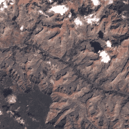
Wartości DN w ramach kolekcji 2 Landsat 4 TM, poziom 1, reprezentujące skalowane, skalibrowane natężenie promieniowania przy czujniku. Sceny Landsat o najwyższej dostępnej jakości danych są umieszczane w poziomie 1 i uważane za odpowiednie do analizy przetwarzania sekwencji czasowych. Poziom 1 obejmuje przetworzone dane o terenie o dokładności poziomu 1 (L1TP), które… c2 global l4 landsat lt4 radiance -
USGS Landsat 4 TM Collection 2 Tier 2 Raw Scenes
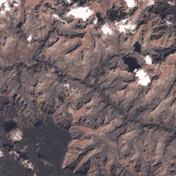
Wartości DN w ramach kolekcji 2 Landsat 4 TM, poziom 2, reprezentujące skalowane, skalibrowane natężenie promieniowania przy czujniku. Sceny, które podczas przetwarzania nie spełniają kryteriów poziomu 1, są przypisywane do poziomu 2. Dotyczy to przetworzonych scen L1GT i L1GS oraz scen L1TP, które nie zostały … c2 global l4 landsat lt4 radiance
Datasets tagged lt4 in Earth Engine
[null,null,[],[[["\u003cp\u003eLandsat 4 TM Collection 2 provides Tier 1 and Tier 2 raw scene data, representing scaled and calibrated at-sensor radiance.\u003c/p\u003e\n"],["\u003cp\u003eTier 1 data has the highest quality and is suitable for time-series analysis, including Level-1 Precision Terrain (L1TP) processed data.\u003c/p\u003e\n"],["\u003cp\u003eTier 2 data comprises scenes not meeting Tier 1 criteria, such as Systematic terrain (L1GT) and Systematic (L1GS) processed scenes, and any lower quality L1TP scenes.\u003c/p\u003e\n"],["\u003cp\u003eBoth datasets offer global coverage and are tagged with Collection 2 (C2), Landsat 4 (L4), and radiance.\u003c/p\u003e\n"]]],[],null,["# Datasets tagged lt4 in Earth Engine\n\n-\n\n |-------------------------------------------------------------------------------------------------------------------------------------------------------------------------------------------------------------------------------------------------------------------------------------------------------------------------|\n | [### USGS Landsat 4 TM Collection 2 Tier 1 Raw Scenes](/earth-engine/datasets/catalog/LANDSAT_LT04_C02_T1) |\n | Landsat 4 TM Collection 2 Tier 1 DN values, representing scaled, calibrated at-sensor radiance. Landsat scenes with the highest available data quality are placed into Tier 1 and are considered suitable for time-series processing analysis. Tier 1 includes Level-1 Precision Terrain (L1TP) processed data that ... |\n | [c2](/earth-engine/datasets/tags/c2) [global](/earth-engine/datasets/tags/global) [l4](/earth-engine/datasets/tags/l4) [landsat](/earth-engine/datasets/tags/landsat) [lt4](/earth-engine/datasets/tags/lt4) [radiance](/earth-engine/datasets/tags/radiance) |\n\n-\n\n |-----------------------------------------------------------------------------------------------------------------------------------------------------------------------------------------------------------------------------------------------------------------------------------------------------|\n | [### USGS Landsat 4 TM Collection 2 Tier 2 Raw Scenes](/earth-engine/datasets/catalog/LANDSAT_LT04_C02_T2) |\n | Landsat 4 TM Collection 2 Tier 2 DN values, representing scaled, calibrated at-sensor radiance. Scenes not meeting Tier 1 criteria during processing are assigned to Tier 2. This includes Systematic terrain (L1GT) and Systematic (L1GS) processed scenes, as well as any L1TP scenes that do ... |\n | [c2](/earth-engine/datasets/tags/c2) [global](/earth-engine/datasets/tags/global) [l4](/earth-engine/datasets/tags/l4) [landsat](/earth-engine/datasets/tags/landsat) [lt4](/earth-engine/datasets/tags/lt4) [radiance](/earth-engine/datasets/tags/radiance) |"]]