-
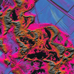
AHN 네덜란드 0.5m DEM, 보간
AHN DEM은 네덜란드를 포함하는 0.5m DEM입니다. 2007년에서 2012년 사이 봄에 촬영된 LIDAR 데이터에서 생성되었습니다. 지상 위의 모든 항목 (예: 건물, 다리, 나무 등)이 삭제된 지상 수준 샘플이 포함되어 있습니다. 이 버전은 … ahn dem elevation elevation-topography geophysical lidar -
AHN 네덜란드 0.5m DEM, 보간되지 않음
AHN DEM은 네덜란드를 포함하는 0.5m DEM입니다. 2007년에서 2012년 사이 봄에 촬영된 LIDAR 데이터에서 생성되었습니다. 지상 위의 모든 항목 (예: 건물, 다리, 나무 등)이 삭제된 지상 수준 샘플이 포함되어 있습니다. 이 버전은 … ahn dem elevation elevation-topography geophysical lidar -
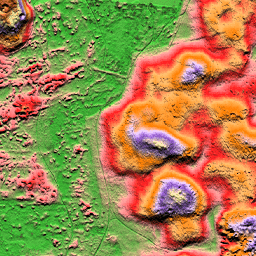
AHN 네덜란드 0.5m DEM, 원시 샘플
AHN DEM은 네덜란드를 포함하는 0.5m DEM입니다. 2007년에서 2012년 사이 봄에 촬영된 LIDAR 데이터에서 생성되었습니다. 이 버전에는 지상 수준 샘플과 지상 수준 위의 항목 (예: 건물, 다리, 나무 등)이 모두 포함됩니다. 포인트 클라우드는 … ahn dem elevation elevation-topography geophysical lidar -
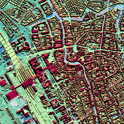
AHN3: 네덜란드 AHN 0.5m
Actueel Hoogtebestand Nederland (AHN)는 네덜란드 전체의 상세하고 정확한 고도 데이터가 포함된 데이터 세트입니다. 고도 정보는 헬리콥터와 항공기에서 수직 정확도가 5cm인 레이저 기술을 사용하여 수집되었습니다. AHN3 데이터 세트에는 네덜란드 AHN 0.5m DSM이 포함되어 있습니다. ahn dem elevation elevation-topography geophysical lidar -
AHN4: 네덜란드 AHN 0.5m
Actueel Hoogtebestand Nederland (AHN)는 네덜란드 전체의 상세하고 정확한 고도 데이터가 포함된 데이터 세트입니다. 고도 정보는 헬리콥터와 항공기에서 수직 정확도가 5cm인 레이저 기술을 사용하여 수집되었습니다. AHN4 데이터 세트에는 네덜란드 AHN 0.5m DSM이 포함되어 있습니다. ahn dem elevation elevation-topography geophysical lidar -
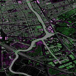
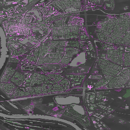
네덜란드 직교영상

네덜란드의 오르토포토는 컬러 오르토이미지 세트입니다. 연간 두 개의 전국 항공 사진이 수집됩니다. 봄에는 7.5cm 해상도의 잎이 없는 이미지, 여름에는 25cm 해상도의 나무에 잎이 있는 이미지가 수집됩니다. 자세한 내용은 다음을 참고하세요. netherlands orthophotos rgb
Datasets tagged netherlands in Earth Engine
[null,null,[],[],[]]