Page Summary
-
The GHSL dataset provides a 10m resolution spatial raster depicting human settlements and their functional and height characteristics of the built environment.
-
The TIGER dataset contains over 19 million road segments from the 2016 US Census release, covering the United States and its territories.
-
GHSL: Global settlement characteristics (10 m) 2018 (P2023A)
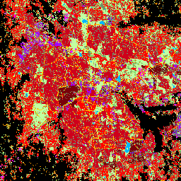
This spatial raster dataset delineates human settlements at 10 m resolution, and describes their inner characteristics in terms of the functional and height-related components of the built environment. More information about the GHSL data products can be found in the GHSL Data Package 2023 report … building built builtup copernicus ghsl height -
TIGER: US Census Roads
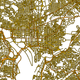
This United States Census Bureau TIGER dataset contains all road segments from the 2016 release, containing more than 19 million individual line features covering the United States, the District of Columbia, Puerto Rico, and the Island Areas. Each feature represents a road segment geometry (a … census infrastructure-boundaries roads table tiger us