-
BLM AIM TerrADat TerrestrialAIM Point v1
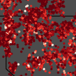
自 2011 年以来,土地管理局 (BLM) 一直通过其评估、清查和监测 (AIM) 策略收集实地信息,以了解土地健康状况。迄今为止,已在 BLM 土地上收集了 6,000 多个地面 AIM 实地样地。BLM AIM 数据归档是… blm 生态系统 水文 土壤 表格 植被 -
FLDAS:饥荒预警系统网络 (FEWS NET) 陆地数据同化系统

FLDAS 数据集(McNally 等人,2017 年)旨在帮助在数据稀疏的发展中国家环境中进行粮食安全评估。它包含许多与气候相关的变量的信息,包括含水量、湿度、蒸发蒸腾、平均土壤温度、总降水率等。FLDAS 数据集有多种不同的版本;… 气候 冰冻圈 蒸发蒸腾 湿度 ldas 月度 -
GLDAS-2.1:全球陆地数据同化系统

NASA 全球陆地数据同化系统第 2 版 (GLDAS-2) 包含三个组成部分:GLDAS-2.0、GLDAS-2.1 和 GLDAS-2.2。GLDAS-2.0 完全由普林斯顿气象强迫输入数据强迫,并提供 1948 年至 2014 年的时间上一致的序列。GLDAS-2.1 采用模型…的组合进行强制 每 3 小时 气候 冰冻圈 蒸发 强迫 地球物理 -
GLDAS-2.2:全球陆地数据同化系统

NASA 全球陆地数据同化系统第 2 版 (GLDAS-2) 包含三个组成部分:GLDAS-2.0、GLDAS-2.1 和 GLDAS-2.2。GLDAS-2.0 完全由普林斯顿气象强迫输入数据强迫,并提供 1948 年至 2014 年的时间上一致的序列。GLDAS-2.1 采用模型…的组合进行强制 每 3 小时 气候 冰冻圈 蒸发 强迫 地球物理 -
MERRA-2 M2T1NXLND:陆地表面诊断 V5.12.4

M2T1NXLND(或 tavg1_2d_lnd_Nx)是现代研究和应用回顾性分析版本 2 (MERRA-2) 中的每小时时间平均数据集合。此集合包含陆地表面诊断数据,例如基流通量、径流、地表土壤湿度、根区土壤湿度、地表层的水、… 气候 冰冻圈 蒸发 冰 merra 降水 -
NLDAS-2:北美陆地数据同化系统强迫场

陆地数据同化系统 (LDAS) 会结合多种观测源(例如降水测量仪数据、卫星数据和雷达降水测量数据),以生成地球表面或近地表的气候学属性估计值。此数据集是阶段 … 的主要(默认)强迫文件(文件 A) 气候 蒸发 强迫 地球物理 每小时 湿度 -
OpenLandMap 粘土含量

6 个标准深度(0、10、30、60、100 和 200 厘米)的黏土含量(以千克 / 千克为单位),分辨率为 250 米。基于对全球土壤剖面和样本的机器学习预测。您可以点击此处详细了解处理步骤。南极洲是… 粘土 envirometrix opengeohub openlandmap 土壤 usda -
OpenLandMap 预测的 Hapludalfs 概率

250 米处的预测 USDA 土壤大群组(概率)。基于全球土壤剖面汇编的机器学习预测结果的美国农业部土壤大组分布。如需详细了解土壤大类群,请参阅《Illustrated Guide to Soil Taxonomy - NRCS》(土壤分类图解指南 - NRCS)… envirometrix opengeohub openlandmap 土壤 -
OpenLandMap 沙含量

以 250 米分辨率表示的 6 个标准深度(0、10、30、60、100 和 200 厘米)的沙含量(以千克 / 千克为单位)基于对全球土壤剖面和样本的机器学习预测。您可以点击此处详细了解处理步骤。南极洲是… envirometrix opengeohub openlandmap 沙 土壤 usda -
OpenLandMap 土壤容重

土壤容重(细土)10 x kg / m3,在 6 个标准深度(0、10、30、60、100 和 200 厘米)下,分辨率为 250 米。您可以点击此处详细了解处理步骤。不包括南极洲。如需访问和直观呈现地球以外的地图… 密度 envirometrix opengeohub openlandmap 土壤 -
OpenLandMap 土壤有机碳含量

以 5 g / kg 为单位的土壤有机碳含量,分辨率为 250 米,根据全球土壤点汇编数据预测得出,位于 6 个标准深度(0、10、30、60、100 和 200 厘米)。您可以点击此处详细了解处理步骤。不包括南极洲。… carbon envirometrix opengeohub openlandmap soil -
OpenLandMap 土壤质地类别(美国农业部系统)

6 个土壤深度(0、10、30、60、100 和 200 厘米)的土壤质地类别(美国农业部系统),以 250 米为单位。根据使用 R 中的 soiltexture 包预测的土壤质地分数得出。您可以点击此处详细了解处理步骤。不包括南极洲。如需访问… envirometrix opengeohub openlandmap 土壤 usda -
OpenLandMap 33kPa(田间持水量)时的土壤含水量

在 6 个标准深度(0、10、30、60、100 和 200 厘米)下,以 250 米分辨率预测的 33kPa 和 1500kPa 吸力下的土壤含水量(体积百分比)。训练点基于全球土壤剖面汇编:USDA NCSS AfSPDB ISRIC WISE EGRPR SPADE… envirometrix opengeohub openlandmap 土壤 -
OpenLandMap 土壤 pH 值(在 H2O 中)

6 个标准深度(0、10、30、60、100 和 200 厘米)的土壤 pH 值(以 H2O 为单位),分辨率为 250 米。处理步骤在此处进行了详细说明。不包括南极洲。如需在 Earth Engine 之外访问和直观呈现地图,请使用此页面。如果您… envirometrix opengeohub openlandmap ph soil -
OpenLandMap USDA 土壤分类大群组

以 250 米为分辨率预测的美国农业部土壤大组概率。基于全球土壤剖面汇编的机器学习预测结果的美国农业部土壤大组分布。如需详细了解土壤大类群,请参阅《Illustrated Guide to Soil Taxonomy》- NRCS - … envirometrix opengeohub openlandmap 土壤 usda -
重新处理的 GLDAS-2.0:全球陆地数据同化系统

NASA 全球陆地数据同化系统第 2 版 (GLDAS-2) 包含三个组成部分:GLDAS-2.0、GLDAS-2.1 和 GLDAS-2.2。GLDAS-2.0 完全由普林斯顿气象强迫输入数据强迫,并提供 1948 年至 2014 年的时间上一致的序列。GLDAS-2.1 采用模型…的组合进行强制 每 3 小时 气候 冰冻圈 蒸发 强迫 地球物理 -
SLGA:澳大利亚土壤和景观网格(土壤属性)

澳大利亚土壤和景观网格 (SLGA) 是一个全面的数据集,包含澳大利亚各地 3 角秒分辨率(约 90 米像素)的土壤属性。地表是模型分析的结果,它使用现有的土壤数据和环境数据来描述土壤属性的空间分布… 澳大利亚 csiro 土壤 tern -
SPL3SMP_E.005 SMAP L3 Radiometer Global Daily 9 km Soil Moisture

NASA/SMAP/SPL3SMP_E/006 集合中提供了自 2023-12-04 起的数据。此 L3 级土壤湿度产品提供由土壤湿度主动被动 (SMAP) L 波段辐射计检索到的全球陆地表面状况的每日合成数据。此处显示的每日数据是从降序(本地… 干旱 nasa smap 土壤 土壤湿度 表面 -
SPL3SMP_E.006 SMAP L3 Radiometer Global Daily 9 km Soil Moisture
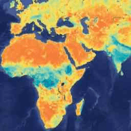
2023 年 12 月 4 日之前的数据可在旧版 NASA/SMAP/SPL3SMP_E/005 集合中找到。这些图片最终会重新处理并添加到此合集中。此 3 级 (L3) 土壤湿度产品提供由土壤湿度主动被动 (SMAP) L 波段检索到的全球陆地表面状况的每日合成数据… 干旱 nasa smap 土壤 土壤湿度 表面 -
SPL4SMGP.008 SMAP L4 全球 3 小时 9 公里地表和根区土壤湿度
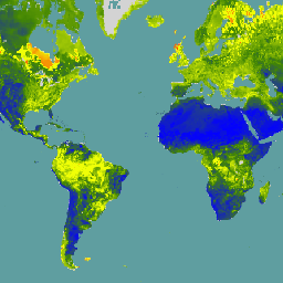
SMAP 4 级 (L4) 土壤湿度产品包括表层土壤湿度(0-5 厘米垂直平均值)、根区土壤湿度(0-100 厘米垂直平均值)和其他研究产品(未经过验证),包括地面气象强迫变量、土壤温度、蒸散和净辐射。此数据集正式称为… 干旱 nasa smap 土壤 土壤湿度 表面 -
SoilGrids250m 2.0 - 体积含水量
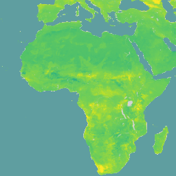
在 6 个标准深度(0-5 厘米、5-15 厘米、15-30 厘米、30-60 厘米、60-100 厘米、100-200 厘米)下,吸力为 10 千帕、33 千帕和 1500 千帕时的体积含水量(以 10^-3 立方厘米/立方厘米为单位,相当于 0.1 体积百分比或 1 毫米/米)。预测结果是根据基于分位数随机森林的数字土壤测绘方法得出的,该方法利用了全球… 土壤 土壤湿度 水 -
iSDAsoil 散装密度,<2mm 部分
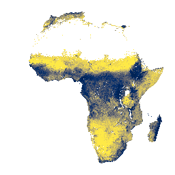
土壤深度为 0-20 厘米和 20-50 厘米时,<2 毫米部分的容重,预测的平均值和标准差。像素值必须通过 x/100 进行反向转换。在茂密丛林地区(通常是非洲中部),模型准确度较低,因此会出现条带状伪影(条纹)… 非洲 isda 土壤 -
iSDAsoil 粘土含量

土壤深度为 0-20 厘米和 20-50 厘米时的黏土含量,预测的平均值和标准差。在茂密丛林地区(通常位于非洲中部),模型准确度较低,因此可能会看到条带状伪影。土壤属性预测由 Innovative … 非洲 粘土 isda 土壤 -
iSDAsoil 深度到基岩

0-200 厘米深度的基岩深度,预测的平均值和标准差。由于用于生成数据的潜在农田掩码,许多裸露的岩石区域(基岩深度为 0 厘米)已被遮盖,因此显示为… 非洲 基岩 ISDA 土壤 -
iSDAsoil 有效阳离子交换容量

在 0-20 厘米和 20-50 厘米土壤深度下预测的有效阳离子交换容量平均值和标准差,像素值必须使用 exp(x/10)-1 进行反向转换。在茂密丛林地区(通常是非洲中部),模型准确度较低,因此会出现条带状伪影(条纹)… 非洲 铝 isda 土壤 -
iSDAsoil 可提取钙

土壤深度为 0-20 厘米和 20-50 厘米时的可提取钙,预测的平均值和标准差。像素值必须使用 exp(x/10)-1 进行反向转换。在茂密丛林地区(通常是非洲中部),模型准确度较低,因此可能会出现条带状伪影(条纹),… 非洲 isda 土壤 -
iSDAsoil 可提取铁

土壤深度为 0-20 厘米和 20-50 厘米时可提取的铁,预测的平均值和标准差。像素值必须使用 exp(x/10)-1 进行反向转换。在茂密丛林地区(通常是非洲中部),模型准确度较低,因此可能会出现条带状伪影(条纹),… 非洲 isda 土壤 -
iSDAsoil 可提取镁

土壤深度为 0-20 厘米和 20-50 厘米时的可提取镁,预测的平均值和标准差。像素值必须使用 exp(x/10)-1 进行反向转换。在茂密丛林地区(通常是非洲中部),模型准确度较低,因此可能会出现条带状伪影(条纹),… 非洲 isda 土壤 -
iSDAsoil 可提取磷

土壤深度为 0-20 厘米和 20-50 厘米时的可提取磷,预测的平均值和标准差。像素值必须使用 exp(x/10)-1 进行反向转换。在茂密丛林地区(通常是非洲中部),模型准确度较低,因此可能会出现条带状伪影(条纹),… 非洲 isda 土壤 -
iSDAsoil 可提取钾

0-20 厘米和 20-50 厘米土壤深度的可提取钾,预测的平均值和标准差。像素值必须使用 exp(x/10)-1 进行反向转换。在茂密丛林地区(通常是非洲中部),模型准确度较低,因此可能会出现条带状伪影(条纹),… 非洲 isda 土壤 -
iSDAsoil 可提取硫

土壤深度为 0-20 厘米和 20-50 厘米时的可提取硫,预测的平均值和标准差。像素值必须使用 exp(x/10)-1 进行反向转换。在茂密丛林地区(通常是非洲中部),模型准确度较低,因此可能会出现条带状伪影(条纹),… 非洲 isda 土壤 -
iSDAsoil 可提取锌

土壤深度为 0-20 厘米和 20-50 厘米的可提取锌,预测的平均值和标准差。像素值必须使用 exp(x/10)-1 进行反向转换。在茂密丛林地区(通常是非洲中部),模型准确度较低,因此可能会出现条带状伪影(条纹),… 非洲 isda 土壤 -
iSDAsoil 土壤肥力能力分类

使用坡度、化学和物理土壤属性得出的土壤肥力能力分类。如需详细了解此层,请访问此页面。“fcc”频段的类适用于必须使用 x modulo 3000 进行反向转换的像素值。在茂密的丛林地区… 非洲 isda 土壤 -
iSDAsoil 有机碳

0-20 厘米和 20-50 厘米土壤深度的有机碳,预测的平均值和标准差。像素值必须使用 exp(x/10)-1 进行反向转换。在茂密丛林地区(通常是非洲中部),模型准确度较低,因此可能会出现条带状伪影(条纹),… 非洲 碳 isda 土壤 -
iSDAsoil 沙含量

土壤深度为 0-20 厘米和 20-50 厘米时的沙含量,预测的平均值和标准差。在茂密丛林地区(通常位于非洲中部),模型准确度较低,因此可能会看到条带状伪影。土壤属性预测由 Innovative … 非洲 ISDA 沙 土壤 -
iSDAsoil 粉砂含量

土壤深度为 0-20 厘米和 20-50 厘米时的粉砂含量,预测的平均值和标准差。像素值必须使用 exp(x/10)-1 进行反向转换。在茂密丛林地区(通常是非洲中部),模型准确度较低,因此可能会出现条带状伪影(条纹),… 非洲 isda 土壤 -
iSDAsoil 石块含量

土壤深度为 0-20 厘米和 20-50 厘米时的石块含量,预测的平均值和标准差。像素值必须使用 exp(x/10)-1 进行反向转换。在茂密丛林地区(通常是非洲中部),模型准确度较低,因此可能会出现条带状伪影(条纹),… 非洲 isda 土壤 -
iSDAsoil 总碳

0-20 厘米和 20-50 厘米土壤深度的总碳量,预测的平均值和标准差。像素值必须使用 exp(x/10)-1 进行反向转换。在茂密丛林地区(通常是非洲中部),模型准确度较低,因此可能会出现条带状伪影(条纹),… 非洲 铝 isda 土壤 -
iSDAsoil 总氮

0-20 厘米和 20-50 厘米土壤深度的总氮,预测的平均值和标准差。像素值必须使用 exp(x/100)-1 进行反向转换。在茂密丛林地区(通常是非洲中部),模型准确度较低,因此可能会出现条带状伪影(条纹),… 非洲 isda 土壤 -
iSDAsoil USDA 质地类别
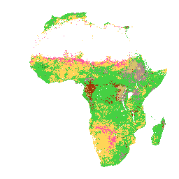
0-20 厘米和 20-50 厘米土壤深度的美国农业部质地类别。在茂密丛林地区(通常位于非洲中部),模型准确度较低,因此可能会看到条带状伪影。土壤属性预测由 Innovative Solutions for Decision … 非洲 铝 isda 土壤 -
iSDAsoil 可提取铝

土壤深度为 0-20 厘米和 20-50 厘米时的可提取铝,预测的平均值和标准差。像素值必须使用 exp(x/10)-1 进行反向转换。土壤属性预测由 Innovative Solutions for Decision Agriculture Ltd. (iSDA) 使用机器学习技术以 30 米像素大小进行,并结合了… 非洲 铝 isda 土壤 -
iSDAsoil pH

0-20 厘米和 20-50 厘米土壤深度的 pH 值、预测平均值和标准差。像素值必须通过 x/10 进行反向转换。在茂密丛林地区(通常位于非洲中部),模型准确度较低,因此可能会看到条带状伪影。… africa isda ph soil
Datasets tagged soil in Earth Engine
[null,null,[],[],[]]