Page Summary
-
The TIGER dataset from the US Census Bureau provides 2016 and 2018 boundaries for the primary governmental divisions of the United States.
-
This dataset includes boundaries for the fifty states, the District of Columbia, Puerto Rico, and various island areas.
-
Relevant tags associated with this data include census, infrastructure-boundaries, state, states, table, and tiger.
-
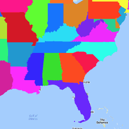
TIGER: US Census States 2016

The United States Census Bureau TIGER dataset contains the 2016 boundaries for the primary governmental divisions of the United States. In addition to the fifty states, the Census Bureau treats the District of Columbia, Puerto Rico, and each of the island areas (American Samoa, the … census infrastructure-boundaries state states table tiger -
TIGER: US Census States 2018
The United States Census Bureau TIGER dataset contains the 2018 boundaries for the primary governmental divisions of the United States. In addition to the fifty states, the Census Bureau treats the District of Columbia, Puerto Rico, and each of the island areas (American Samoa, the … census infrastructure-boundaries state states table tiger