TIGER: Перепись населения США 2016 года 
Набор данных TIGER Бюро переписи населения США содержит границы основных административно-территориальных единиц США по состоянию на 2016 год. Помимо пятидесяти штатов, Бюро переписи населения учитывает округ Колумбия, Пуэрто-Рико и каждую из островных территорий (Американское Самоа,… перепись инфраструктура-границы штаты штаты таблица тигр TIGER: Перепись населения США 2018 года 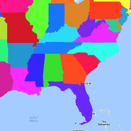
Набор данных TIGER Бюро переписи населения США содержит границы основных административно-территориальных единиц США по состоянию на 2018 год. Помимо пятидесяти штатов, Бюро переписи населения учитывает округ Колумбия, Пуэрто-Рико и каждую из островных территорий (Американское Самоа,… перепись инфраструктура-границы штаты штаты таблица тигр
Datasets tagged state in Earth Engine
[null,null,[],[],[]]