
-
CHIRPS 降水每日近乎实时数据:Climate Hazards Center InfraRed Precipitation With Station Data(第 3.0 版,基于 IMERG)

Climate Hazards Center Infrared Precipitation with Stations (CHIRPS v3) 是一个 40 多年的高分辨率准全球降雨数据集。它涵盖北纬 60 度到南纬 60 度之间的所有经度,提供从 1981 年到近期的降水数据。CHIRPS v3 将基于卫星的热红外降雨量估算值与实地观测站的观测数据相结合 … chc climate geophysical precipitation ucsb weather -
CHIRPS 降水每日再分析数据:Climate Hazards Center InfraRed Precipitation With Station Data(第 3.0 版,基于 ERA5)

Climate Hazards Center Infrared Precipitation with Stations (CHIRPS v3) 是一个 40 多年的高分辨率准全球降雨数据集。它涵盖北纬 60 度到南纬 60 度之间的所有经度,提供从 1981 年到近期的降水数据。CHIRPS v3 将基于卫星的热红外降雨量估算值与实地观测站的观测数据相结合 … chc climate geophysical precipitation ucsb weather -
CHIRPS 降水每日数据:Climate Hazards Center InfraRed Precipitation With Station Data(第 2.0 版最终版)

Climate Hazards Center InfraRed Precipitation with Station data (CHIRPS) 是一个 30 多年的准全球降雨数据集。CHIRPS 将分辨率为 0.05 度的卫星图像与实地观测站的数据相结合,创建网格化降雨时间序列,用于趋势分析和季节性干旱监测。 chg climate geophysical precipitation ucsb weather -
CHIRPS 降水五日数据:Climate Hazards Center InfraRed Precipitation With Station Data(第 2.0 版最终版)

Climate Hazards Center InfraRed Precipitation with Station data (CHIRPS) 是一个 30 多年的准全球降雨数据集。CHIRPS 将分辨率为 0.05 度的卫星图像与实地观测站的数据相结合,创建网格化降雨时间序列,用于趋势分析和季节性干旱监测。 chg climate geophysical precipitation ucsb weather -
CHIRPS 降水五日数据:Climate Hazards Center InfraRed Precipitation With Station Data(第 3.0 版)

Climate Hazards Center Infrared Precipitation with Stations (CHIRPS v3) 是一个 40 多年的高分辨率准全球降雨数据集。它涵盖北纬 60 度到南纬 60 度之间的所有经度,提供从 1981 年到近期的降水数据。CHIRPS v3 将基于卫星的热红外降雨量估算值与实地观测站的观测数据相结合 … chc chg climate geophysical precipitation ucsb -
CHIRTS 每日温度数据:Climate Hazards Center InfraRed Temperature with Stations 每日数据产品

Climate Hazards Center InfraRed Temperature with Stations 每日温度数据产品 (CHIRTS-daily; Verdin et al. 2020) 是一个准全球高分辨率网格化数据集(分辨率为 0.05° × 0.05°,涵盖南纬 60 度到北纬 70 度),提供每日最低气温 (Tmin) 和最高 2 米气温 (Tmax) 以及四个派生变量:饱和蒸汽 … chg climate daily era5 geophysical reanalysis -
Climate Hazards Center (CHC) Coupled Model Intercomparison Project Phase 6 (CHC-CMIP6)
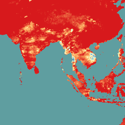
CHC-CMIP6 专门用于支持分析近期和近未来与气候相关的灾害。此气候预测数据集包含观测期(1983-2016 年)和预测期(2030 年和 2050 年)的全球每日网格化数据,用于识别和 … climate geophysical precipitation ucsb weather
Datasets tagged ucsb in Earth Engine
[null,null,[],[],["CHIRPS provides a 30+ year quasi-global rainfall dataset by combining 0.05° resolution satellite imagery with in-situ station data. It creates gridded rainfall time series for trend analysis and drought monitoring. CHIRTS-daily offers a quasi-global, high-resolution (0.05°) gridded dataset with daily minimum and maximum 2-meter temperatures (Tmin, Tmax), spanning 60°S to 70°N, along with four derived variables.\n"]]