-
CHIRPS Precipitation Daily Near-Real-Time: Climate Hazards Center InfraRed Precipitation With Station Data (Version 3.0, IMERG-based)

Climate Hazards Center Infrared Precipitation with Stations (CHIRPS v3), 40 yılı aşkın süredir kullanılan, yüksek çözünürlüklü, neredeyse küresel bir yağış veri kümesidir. 60°K ile 60°G arasında uzanır ve tüm boylamları kapsar. 1981'den günümüze kadar olan verileri sağlar. CHIRPS v3, uydu tabanlı termal kızılötesi yağış tahminlerini yerinde istasyon gözlemleriyle birleştirir… chc climate geophysical precipitation ucsb weather -
CHIRPS Precipitation Daily Reanalysis: Climate Hazards Center InfraRed Precipitation With Station Data (Version 3.0, ERA5-based) [CHIRPS Yağış Günlük Yeniden Analizi: İstasyon Verileriyle İklim Tehlikeleri Merkezi Kızılötesi Yağış (3.0 Sürümü, ERA5 tabanlı)]

Climate Hazards Center Infrared Precipitation with Stations (CHIRPS v3), 40 yılı aşkın süredir kullanılan, yüksek çözünürlüklü, neredeyse küresel bir yağış veri kümesidir. 60°K ile 60°G arasında uzanır ve tüm boylamları kapsar. 1981'den günümüze kadar olan verileri sağlar. CHIRPS v3, uydu tabanlı termal kızılötesi yağış tahminlerini yerinde istasyon gözlemleriyle birleştirir… chc climate geophysical precipitation ucsb weather -
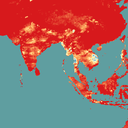
CHIRPS Precipitation Daily: Climate Hazards Center InfraRed Precipitation With Station Data (Version 2.0 Final)

Climate Hazards Center InfraRed Precipitation with Station data (CHIRPS), 30 yılı aşkın süredir kullanılan, neredeyse küresel bir yağış veri kümesidir. CHIRPS, trend analizi ve mevsimsel kuraklık izleme için ızgaralı yağış zaman serileri oluşturmak üzere 0,05° çözünürlüklü uydu görüntülerini yerinde istasyon verileriyle birleştirir. chg climate geophysical precipitation ucsb weather -
CHIRPS Precipitation Pentad: Climate Hazards Center InfraRed Precipitation With Station Data (Version 2.0 Final)

Climate Hazards Center InfraRed Precipitation with Station data (CHIRPS), 30 yılı aşkın süredir kullanılan, neredeyse küresel bir yağış veri kümesidir. CHIRPS, trend analizi ve mevsimsel kuraklık izleme için ızgaralı yağış zaman serileri oluşturmak üzere 0,05° çözünürlüklü uydu görüntülerini yerinde istasyon verileriyle birleştirir. chg climate geophysical precipitation ucsb weather -
CHIRPS Precipitation Pentad: Climate Hazards Center InfraRed Precipitation With Station Data (İstasyon Verileriyle İklim Tehlikeleri Merkezi Kızılötesi Yağış) (Sürüm 3.0)

Climate Hazards Center Infrared Precipitation with Stations (CHIRPS v3), 40 yılı aşkın süredir kullanılan, yüksek çözünürlüklü, neredeyse küresel bir yağış veri kümesidir. 60°K ile 60°G arasında uzanır ve tüm boylamları kapsar. 1981'den günümüze kadar olan verileri sağlar. CHIRPS v3, uydu tabanlı termal kızılötesi yağış tahminlerini yerinde istasyon gözlemleriyle birleştirir… chc chg climate geophysical precipitation ucsb -
CHIRTS Temperature Daily: Climate Hazards Center InfraRed Temperature with Stations günlük veri ürünü

The Climate Hazards Center InfraRed Temperature with Stations daily temperature data product (CHIRTS-daily; Verdin et al. 2020), günlük minimum (Tmin) ve maksimum 2 metrelik sıcaklıkları (Tmax) ve dört türetilmiş değişkeni sağlayan, küresel benzeri, yüksek çözünürlüklü bir ızgaralı veri kümesidir (0,05° × 0,05° çözünürlük, 60°G - 70°K): doygunluk buharı… chg climate daily era5 geophysical reanalysis -
The Climate Hazards Center (CHC) Coupled Model Intercomparison Project Phase 6 (CHC-CMIP6)
CHC-CMIP6, iklimle ilgili tehlikelerin yakın geçmişteki ve yakın gelecekteki analizini desteklemek için özel olarak geliştirilmiştir. Bu iklim projeksiyonu veri kümesi, gözlem (1983-2016) ve projeksiyon (2030 ve 2050) dönemlerine ait küresel, günlük ızgaralı veriler içerir. Bu veriler, tanımlama ve … climate geophysical precipitation ucsb weather
Datasets tagged ucsb in Earth Engine
[null,null,[],[],["CHIRPS provides a 30+ year quasi-global rainfall dataset by combining 0.05° resolution satellite imagery with in-situ station data. It creates gridded rainfall time series for trend analysis and drought monitoring. CHIRTS-daily offers a quasi-global, high-resolution (0.05°) gridded dataset with daily minimum and maximum 2-meter temperatures (Tmin, Tmax), spanning 60°S to 70°N, along with four derived variables.\n"]]