-
GLCF: Landsat Global Inland Water
מערך הנתונים Global Inland Water כולל גופי מים פנימיים, כולל אגמים, נהרות ומאגרי מים מתוקים ומלוחים. מהתקופה של GLS 2000 זוהו 3,650,723 קמ"ר של מים יבשתיים, כשליש מהם בצפון אמריקה ובאסיה. יערות טונדרה ויערות צפוניים … glcf landsat-derived nasa surface-ground-water umd water -
שינוי כיסוי יערות גלובלי (GFCC) – כיסוי צל העצים – נתונים גלובלים לטווח ארוך ברזולוציה של 30 מטר
שכבות כיסוי העצים של שדות הצמחייה הרציפים (VCF) של Landsat מכילות אומדנים של אחוז הקרקע האופקית בכל פיקסל של 30 מטר שמכוסה בצמחייה עץ בגובה של יותר מ-5 מטרים. מערך הנתונים זמין לארבעה תקופות (epochs) שמתמקדות בשנים 2000, 2005, 2010 וכו'. forest forest-biomass glcf landsat-derived nasa umd -
Hansen Global Forest Change v1.12 (2000-2024)
תוצאות מניתוח של סדרות זמן של תמונות Landsat, שמשמשות לתיאור היקף היער והשינויים בו ברחבי העולם. הערוצים 'ראשון' ו 'אחרון' הם תמונות עזר מרובות-ספקטרליות מהשנה הראשונה והשנה האחרונה הזמינות עבור הערוצים הספקטרליים של Landsat שתואמים לצבעים אדום, NIR, SWIR1 ו-SWIR2. תמונות עזר מורכבות מייצגות… forest forest-biomass geophysical landsat-derived umd -
יערות גשם טרופיים ראשוניים לחים
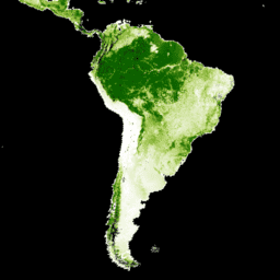
יערות טרופיים לחים ראשוניים מספקים מגוון רחב של שירותי סביבה גלובליים, אבל הם נמצאים בסכנה מתמדת של כריתה עקב גורמים כלכליים. כדי לסייע בתכנון השימוש בקרקע ברמה הלאומית ולשמור על איזון בין מטרות הפיתוח הכלכלי לבין שמירת שירותי המערכת האקולוגית, נוצרה מפה ראשית של יער טרופי לח … forest forest-biomass global landsat-derived umd -
WHRC Pantropical National Level Carbon Stock Dataset
מפה ברמת המדינה של צפיפות הביומסה של עצים חיים מעל הקרקע במדינות טרופיות בגובה 500 מ'. מערך הנתונים הזה מורכב משילוב של מדידות שדה במיקום זהה, תצפיות לייזר (LiDAR) ותמונות שתועדו על ידי מכשיר הספקטרומטר הרדיודיגיטלי לצילום ברזולוציה בינונית (MODIS). aboveground biomass carbon forest-biomass geophysical umd
Datasets tagged umd in Earth Engine
[null,null,[],[[["\u003cp\u003eThis webpage provides access to various datasets related to global forest cover, tree cover, and biomass.\u003c/p\u003e\n"],["\u003cp\u003eDatasets offer insights into forest change, including deforestation and primary forest identification.\u003c/p\u003e\n"],["\u003cp\u003eInformation on global inland water bodies, such as lakes and rivers, is also available.\u003c/p\u003e\n"],["\u003cp\u003eData is derived from sources like Landsat and MODIS imagery, offering high-resolution observations.\u003c/p\u003e\n"],["\u003cp\u003eThese datasets support research on carbon stock, land use planning, and ecosystem services.\u003c/p\u003e\n"]]],[],null,["# Datasets tagged umd in Earth Engine\n\n-\n\n |-------------------------------------------------------------------------------------------------------------------------------------------------------------------------------------------------------------------------------------------------------------------------------------------------------------|\n | [### GLCF: Landsat Global Inland Water](/earth-engine/datasets/catalog/GLCF_GLS_WATER) |\n | The Global Inland Water dataset shows inland surface water bodies, including fresh and saline lakes, rivers, and reservoirs. From the GLS 2000 epoch, 3,650,723 km2 of inland water were identified, around three quarters of which were in North America and Asia. Boreal forests and tundra ... |\n | [glcf](/earth-engine/datasets/tags/glcf) [landsat-derived](/earth-engine/datasets/tags/landsat-derived) [nasa](/earth-engine/datasets/tags/nasa) [surface-ground-water](/earth-engine/datasets/tags/surface-ground-water) [umd](/earth-engine/datasets/tags/umd) [water](/earth-engine/datasets/tags/water) |\n\n-\n\n |---------------------------------------------------------------------------------------------------------------------------------------------------------------------------------------------------------------------------------------------------------------------------------------------------|\n | [### Global Forest Cover Change (GFCC) Tree Cover Multi-Year Global 30m](/earth-engine/datasets/catalog/NASA_MEASURES_GFCC_TC_v3) |\n | The Landsat Vegetation Continuous Fields (VCF) tree cover layers contain estimates of the percentage of horizontal ground in each 30-m pixel covered by woody vegetation greater than 5 meters in height. The dataset is available for four epochs centered on the years 2000, 2005, 2010 ... |\n | [forest](/earth-engine/datasets/tags/forest) [forest-biomass](/earth-engine/datasets/tags/forest-biomass) [glcf](/earth-engine/datasets/tags/glcf) [landsat-derived](/earth-engine/datasets/tags/landsat-derived) [nasa](/earth-engine/datasets/tags/nasa) [umd](/earth-engine/datasets/tags/umd) |\n\n-\n\n |------------------------------------------------------------------------------------------------------------------------------------------------------------------------------------------------------------------------------------------------------------------------------------------------------------------------------------|\n | [### Hansen Global Forest Change v1.12 (2000-2024)](/earth-engine/datasets/catalog/UMD_hansen_global_forest_change_2024_v1_12) |\n | Results from time-series analysis of Landsat images in characterizing global forest extent and change. The 'first' and 'last' bands are reference multispectral imagery from the first and last available years for Landsat spectral bands corresponding to red, NIR, SWIR1, and SWIR2. Reference composite imagery represents ... |\n | [forest](/earth-engine/datasets/tags/forest) [forest-biomass](/earth-engine/datasets/tags/forest-biomass) [geophysical](/earth-engine/datasets/tags/geophysical) [landsat-derived](/earth-engine/datasets/tags/landsat-derived) [umd](/earth-engine/datasets/tags/umd) |\n\n-\n\n |-----------------------------------------------------------------------------------------------------------------------------------------------------------------------------------------------------------------------------------------------------------------------------------------------------------------------------------|\n | [### Primary Humid Tropical Forests](/earth-engine/datasets/catalog/UMD_GLAD_PRIMARY_HUMID_TROPICAL_FORESTS_v1) |\n | Primary humid tropical forests provide numerous global ecosystem services, but are under continuing threat of clearing from economic drivers. To facilitate national land use planning and balancing the goals of economic development and maintenance of ecosystem services, a primary humid tropical forest map was created ... |\n | [forest](/earth-engine/datasets/tags/forest) [forest-biomass](/earth-engine/datasets/tags/forest-biomass) [global](/earth-engine/datasets/tags/global) [landsat-derived](/earth-engine/datasets/tags/landsat-derived) [umd](/earth-engine/datasets/tags/umd) |\n\n-\n\n |---------------------------------------------------------------------------------------------------------------------------------------------------------------------------------------------------------------------------------------------------------------------------------------------------------------|\n | [### WHRC Pantropical National Level Carbon Stock Dataset](/earth-engine/datasets/catalog/WHRC_biomass_tropical) |\n | A national-level map of above-ground live woody biomass density for tropical countries at 500m. This dataset was assembled from a combination of co-located field measurements, LiDAR observations, and imagery recorded from the Moderate Resolution Imaging Spectroradiometer (MODIS). |\n | [aboveground](/earth-engine/datasets/tags/aboveground) [biomass](/earth-engine/datasets/tags/biomass) [carbon](/earth-engine/datasets/tags/carbon) [forest-biomass](/earth-engine/datasets/tags/forest-biomass) [geophysical](/earth-engine/datasets/tags/geophysical) [umd](/earth-engine/datasets/tags/umd) |"]]