-
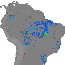
JRC Global River Flood Hazard Maps Version 1

The global river flood hazard maps are a gridded data set representing inundation along the river network, for seven different flood return periods (from 1-in-10-years to 1-in-500-years). The input river flow data for the new maps are produced by means of the open-source hydrological model … flood monitoring wri -
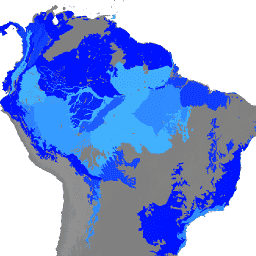
WRI Aqueduct Floods Hazard Maps Version 2

Aqueduct Floods data measures riverine and coastal food risks under both current baseline conditions and future projections in 2030, 2050, and 2080. In addition to providing hazard maps and assessing risks, Aqueduct Floods helps to conduct comprehensive cost-benefit analysis to evaluate the value of dike … flood monitoring wri -
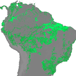
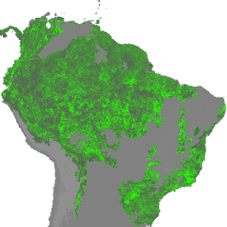
FORMA Alerts
NOTE from WRI: WRI decided to stop updating FORMA alerts. The goal was to simplify the Global Forest Watch user experience and reduce redundancy. We found that Terra-i and GLAD were more frequently used. Moreover, using GLAD as a standard, found that Terra-i outperformed FORMA … daily deforestation forest forma gfw modis -
FORMA Raw Output FIRMS
NOTE from WRI: WRI decided to stop updating FORMA alerts. The goal was to simplify the Global Forest Watch user experience and reduce redundancy. We found that Terra-i and GLAD were more frequently used. Moreover, using GLAD as a standard, found that Terra-i outperformed FORMA … daily deforestation forest forma gfw modis -
FORMA Raw Output NDVI
NOTE from WRI: WRI decided to stop updating FORMA alerts. The goal was to simplify the Global Forest Watch user experience and reduce redundancy. We found that Terra-i and GLAD were more frequently used. Moreover, using GLAD as a standard, found that Terra-i outperformed FORMA … daily deforestation forest forma gfw modis -
FORMA Alert Thresholds
NOTE from WRI: WRI decided to stop updating FORMA alerts. The goal was to simplify the Global Forest Watch user experience and reduce redundancy. We found that Terra-i and GLAD were more frequently used. Moreover, using GLAD as a standard, found that Terra-i outperformed FORMA … daily deforestation forest forma gfw modis -
FORMA Vegetation T-Statistics
NOTE from WRI: WRI decided to stop updating FORMA alerts. The goal was to simplify the Global Forest Watch user experience and reduce redundancy. We found that Terra-i and GLAD were more frequently used. Moreover, using GLAD as a standard, found that Terra-i outperformed FORMA … daily deforestation forest forma gfw modis -
Global Power Plant Database
The Global Power Plant Database is a comprehensive, open source database of power plants around the world. It centralizes power plant data to make it easier to navigate, compare and draw insights. Each power plant is geolocated and entries contain information on plant capacity, generation, … climate table wri -
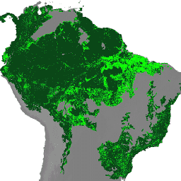
SBTN Natural Lands Map v1
The SBTN Natural Lands Map v1 is a 2020 baseline map of natural and non-natural land covers intended for use by companies setting science-based targets for nature, specifically the SBTN Land target #1: no conversion of natural ecosystems. "Natural" and "non-natural" definitions were adapted from … landcover wri
[]
[]
{}
[null,null,[]]