به دنبال ویژگی های پیشرفته برای اضافه کردن به نقشه های خود هستید؟ Maps SDK for iOS Utility Library در GitHub یک کتابخانه منبع باز از کلاس ها است که برای طیف وسیعی از برنامه ها مفید است. مخزن GitHub شامل کلاس های کاربردی و یک برنامه آزمایشی است که استفاده از هر کلاس را نشان می دهد.
آب و برق
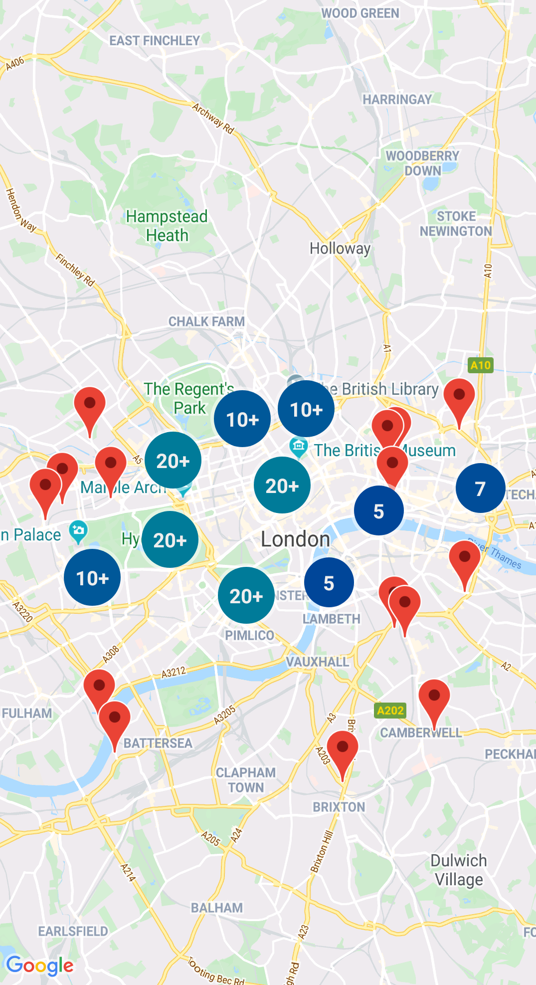
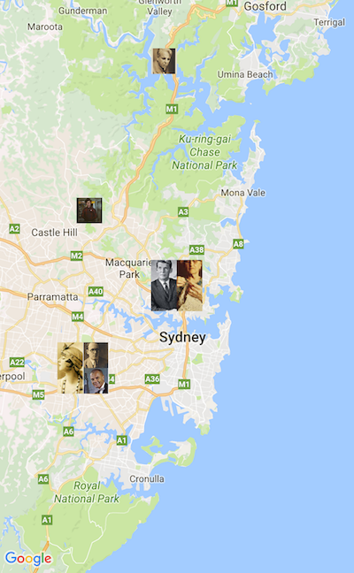
خوشه بندی نشانگر
GMUClusterManager به شما کمک می کند چندین نشانگر را در سطوح بزرگنمایی مختلف مدیریت کنید. این بدان معناست که شما می توانید تعداد زیادی نشانگر را روی نقشه قرار دهید بدون اینکه خوانش نقشه را سخت کند. وقتی کاربر نقشه را در سطح زوم بالا مشاهده می کند، نشانگرهای جداگانه روی نقشه نشان داده می شوند. هنگامی که کاربر به سطح زوم کمتری بزرگنمایی میکند، نشانگرها به صورت دستههایی جمع میشوند تا مشاهده نقشه را آسانتر کنند.
چهار درخت یک ساختار داده ای است که برای یافتن نقاط نزدیک به یک نقطه، با جستجو در منطقه اطراف نقطه مورد نظر مفید است.
برای جزئیات، به مستندات مربوط به Quadtree مراجعه کنید.
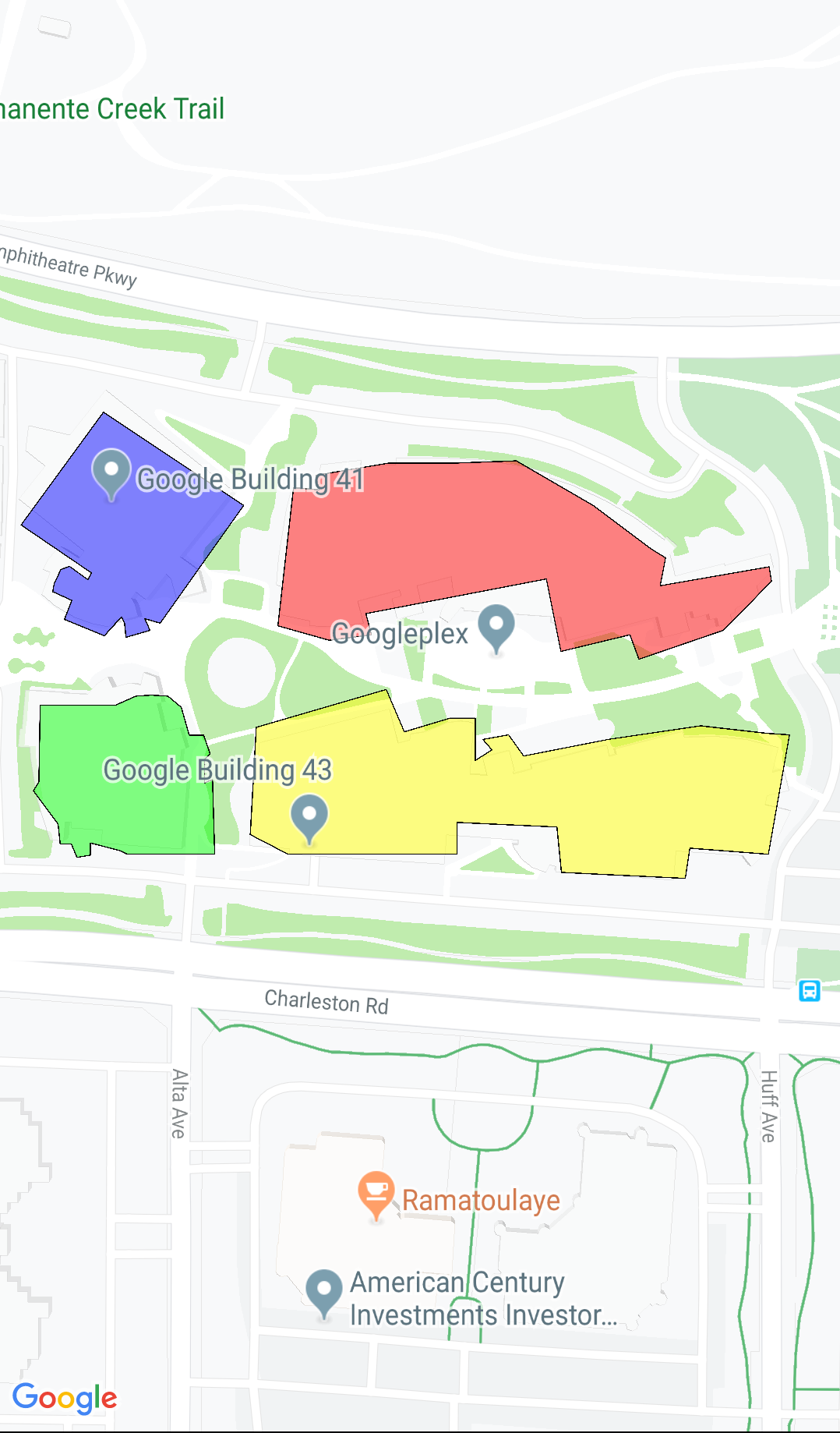
KML
KML یک فرمت محبوب برای ارائه داده های جغرافیایی مانند نقاط، خطوط و چند ضلعی ها است. GMUKMLParser به شما امکان می دهد داده های جغرافیایی را در قالب KML تجزیه و رندر کنید.
میتوانید ویژگیها را در قالب GeoJSON ذخیره کنید و از این ابزار برای رندر کردن آنها به صورت یک لایه در بالای نقشه استفاده کنید. داده های جغرافیایی را در قالب GeoJSON با استفاده از GMUGeoJSONParser در ارتباط با GMUGeometryRenderer ارائه دهید.
برای جزئیات، به مستندات مربوط به GeoJSON مراجعه کنید.
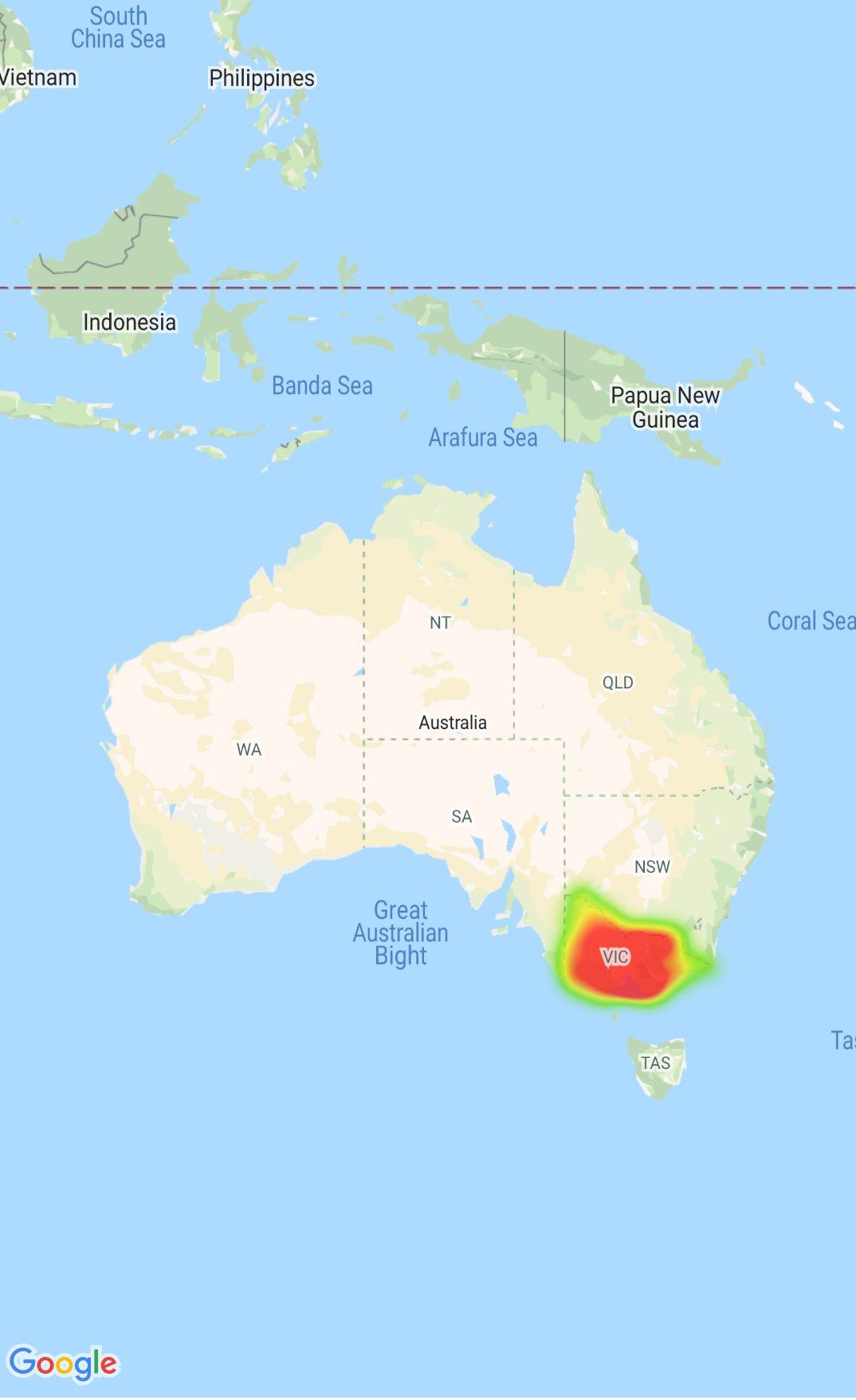
نقشه های حرارتی
نقشه های حرارتی درک توزیع و شدت نسبی نقاط داده روی نقشه را برای بینندگان آسان می کند. به جای قرار دادن نشانگر در هر مکان، نقشه های حرارتی از رنگ و شکل برای نمایش توزیع داده ها استفاده می کنند.
برای جزئیات، به مستندات مربوط به Heatmaps مراجعه کنید.
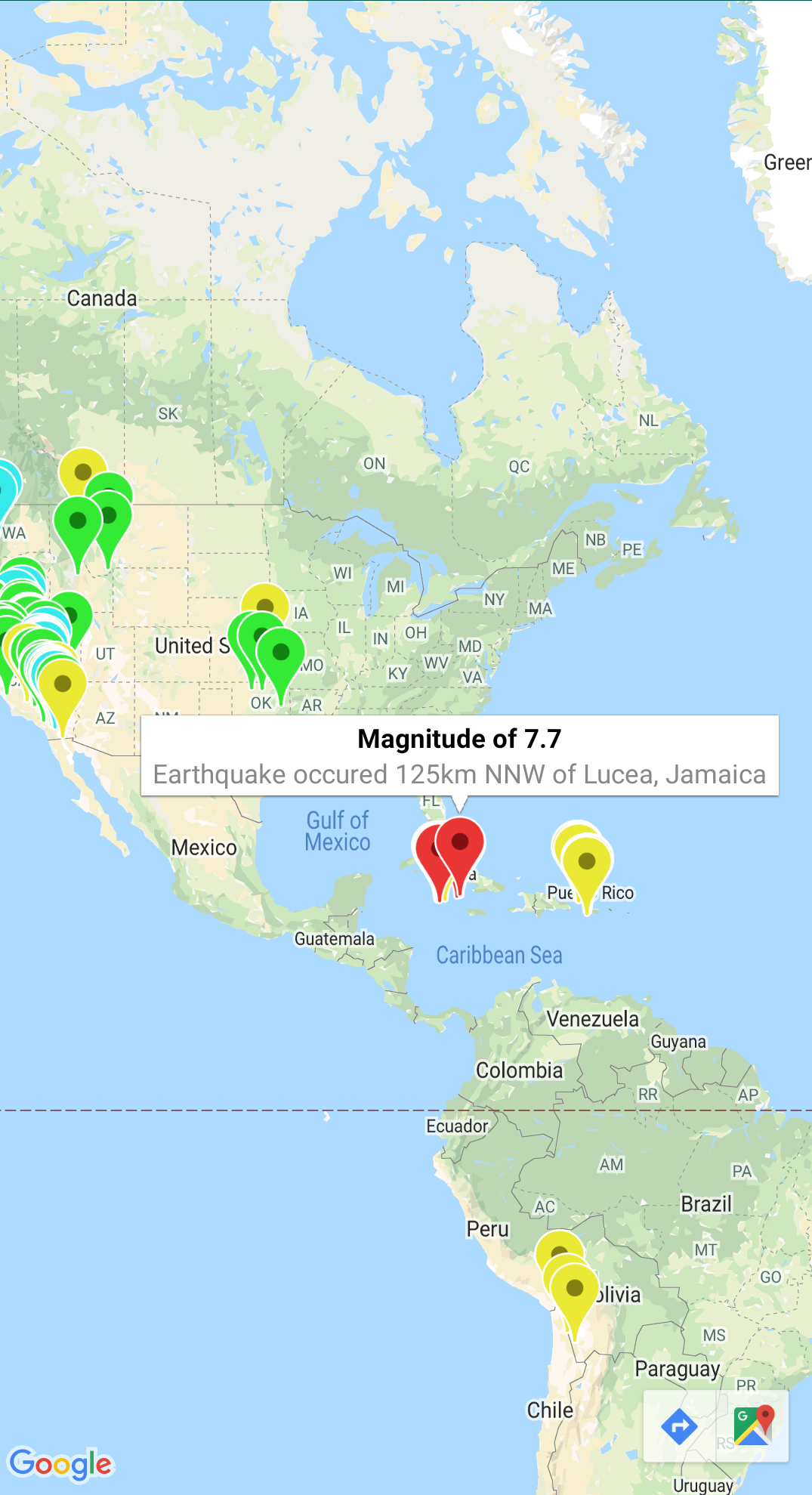
نشانگرهای سفارشی
از نماینده GMUClusterRendererDelegate در GMUDefaultClusterRenderer برای سفارشی کردن خصوصیات یک نشانگر قبل و بعد از اضافه شدن به نقشه استفاده کنید.
ابزارهای هندسه
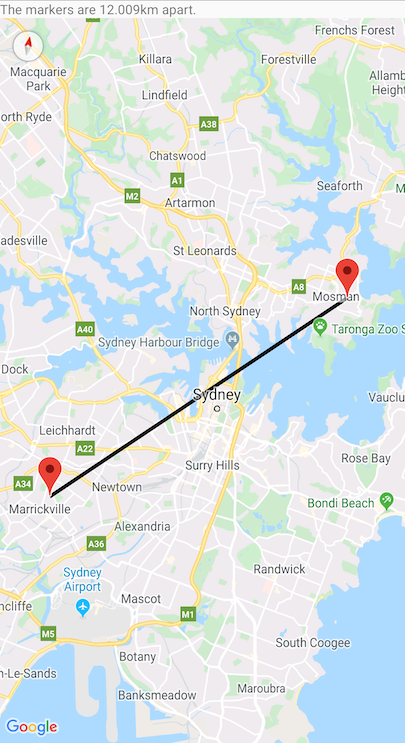
مجموعه ای از توابع کاربردی هندسه کروی Swift ماژول GMSGeometryUtils از Maps SDK برای iOS. از این پسوندها برای انجام بسیاری از عملیات هندسی استفاده کنید، از جمله:
فاصله دایره بزرگ بین مختصات را تعیین کنید
تعیین کنید که یک مختصات داخل یک چند ضلعی است یا خیر
تعیین کنید که آیا یک مختصات روی یک مسیر در یک تلورانس مشخص قرار دارد یا نزدیک
تاریخ آخرین بهروزرسانی 2025-11-02 بهوقت ساعت هماهنگ جهانی.
[null,null,["تاریخ آخرین بهروزرسانی 2025-11-02 بهوقت ساعت هماهنگ جهانی."],[],["The Maps SDK for iOS Utility Library offers tools for enhancing maps, including marker clustering via `GMUClusterManager` for managing numerous markers at different zoom levels. It also supports quadtrees for proximity searches, KML and GeoJSON format parsing for rendering geographic data, and heatmaps for visualizing data density. The library allows custom marker properties through `GMUClusterRendererDelegate` and provides geometry utilities (`GMSGeometryUtils`) for tasks like distance calculation and polygon analysis.\n"]]