Google Maps Platform 即将推出全新地图样式。此次地图样式更新包括全新默认调色板,以及地图体验和易用性方面的改进。所有地图样式将于 2025 年 3 月自动更新。如需详细了解适用范围以及如何提前选择启用,请参阅
全新 Google Maps Platform 地图样式。
仿真 3D 图块概览
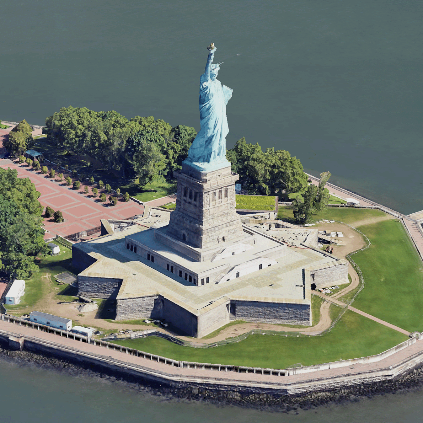
仿真 3D 图块是包含 OGC 3D 图块格式的 Google 3D 地理数据的地图图块。您可以使用自己的 3D 图块渲染器渲染 Google 的 3D 地图,也可以使用适用于 3D 地理空间可视化的开源库。
为什么要使用 3D 图块?
Google 提供 3D 图块,以满足新一代可视化用例的需求。您可以使用 3D 图块构建令人惊叹的 3D 透视图,就像使用 Google 地球一样。这些视图有助于用户更好地了解地理环境,改进导航方式,还可以展示故事情节发生的地点。您还可以使用自己选择的渲染程序,在场景中平滑地操控摄像头,从不同的角度查看场景。
覆盖区域
查看 Map Tiles API 的覆盖范围。Google 会定期更新和添加影像。
3D 解决方案
Google Maps Platform 架构中心包含 3D 解决方案示例,您可以查看这些示例,以便开始构建应用:
如未另行说明,那么本页面中的内容已根据知识共享署名 4.0 许可获得了许可,并且代码示例已根据 Apache 2.0 许可获得了许可。有关详情,请参阅 Google 开发者网站政策。Java 是 Oracle 和/或其关联公司的注册商标。
最后更新时间 (UTC):2025-02-06。
[null,null,["最后更新时间 (UTC):2025-02-06。"],[[["Photorealistic 3D Tiles are map tiles containing Google's 3D geodata in the OGC 3D Tiles format, allowing rendering with your own or open source 3D Tiles renderers."],["3D Tiles empowers next-generation visualization, enabling stunning 3D perspective views for enhanced geographic context, navigation, and storytelling."],["Google's 3D Tiles offer coverage detailed in the Map Tiles API documentation, with regular updates and imagery additions."],["Explore 3D solutions like the 3D Area Explorer for detailed virtual exploration and 3D Storytelling for immersive narratives using Photorealistic 3D Tiles on the Google Maps Platform Architecture Center."]]],[]]