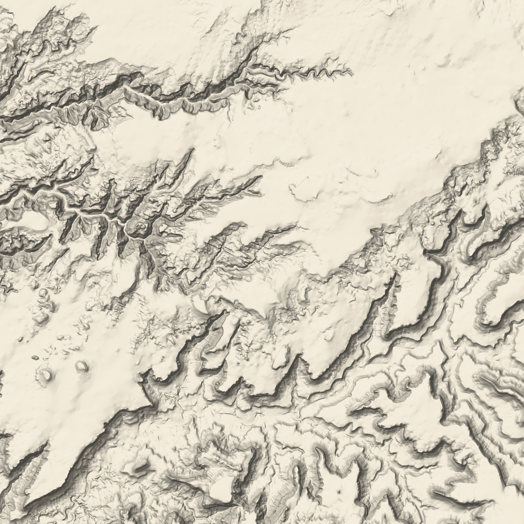
새로운 지도 스타일이 곧 Google Maps Platform에 제공될 예정입니다. 이 지도 스타일 지정 업데이트에는 새로운 기본 색상 팔레트와 지도 환경 및 사용성 개선사항이 포함됩니다. 모든 지도 스타일이 2025년 3월에 자동으로 업데이트됩니다. 사용 가능 여부 및 더 일찍 선택하는 방법에 대한 자세한 내용은
Google Maps Platform용 새로운 지도 스타일을 참고하세요.
지형 타일
지형 타일은 음영 지형지물 지도 및 등고선이 포함된 이미지 타일입니다. 여기에는 식물과 같은 자연 지형지물이 포함됩니다.
지형 타일 가져오기
세션 토큰을 가져온 후 지형 카드 요청을 시작할 수 있습니다.
세션 토큰은 전체 세션에 적용되므로 카드 요청에 지도 옵션을 지정할 필요가 없습니다.
다음 코드 샘플은 지형 카드의 일반적인 세션 토큰 요청을 보여줍니다.
curl -X POST -d '{
"mapType": "terrain",
"language": "en-US",
"region": "US",
"layerTypes": ["layerRoadmap"]
}' \
-H 'Content-Type: application/json' \
"https://tile.googleapis.com/v1/createSession?key=YOUR_API_KEY"
다음 예와 같이 HTTPS GET 요청을 실행하여 지형 타일을 가져옵니다.
curl "https://tile.googleapis.com/v1/2dtiles/z/x/y?session=YOUR_SESSION_TOKEN&key=YOUR_API_KEY"
카드 요청 예시
다음 예를 살펴보세요. 이 예에서는 x 및 y 좌표가 (192, 401)이고 확대/축소 수준이 10인 단일 지형 타일을 요청합니다.
curl "https://tile.googleapis.com/v1/2dtiles/10/192/401?session=YOUR_SESSION_TOKEN&key=YOUR_API_KEY" --output /tmp/example_tile.png
이 예시에서는 서버의 응답 메시지가 없습니다. 대신 카드가 로컬 파일에 다운로드됩니다.

응답 메시지 헤더에 대한 자세한 내용은 콘텐츠 프리패치, 캐싱 또는 저장을 참고하세요.
달리 명시되지 않는 한 이 페이지의 콘텐츠에는 Creative Commons Attribution 4.0 라이선스에 따라 라이선스가 부여되며, 코드 샘플에는 Apache 2.0 라이선스에 따라 라이선스가 부여됩니다. 자세한 내용은 Google Developers 사이트 정책을 참조하세요. 자바는 Oracle 및/또는 Oracle 계열사의 등록 상표입니다.
최종 업데이트: 2025-02-28(UTC)
[null,null,["최종 업데이트: 2025-02-28(UTC)"],[[["Terrain tiles are image tiles that visually represent geographical features like hills, contours, and vegetation."],["To request terrain tiles, you first need to obtain a session token using your API key and specifying map parameters."],["You can then retrieve individual terrain tiles using an HTTPS GET request, providing the session token, API key, and desired tile coordinates (zoom level, x, and y)."],["Terrain tiles are downloaded directly as image files without a server response message, allowing easy integration into mapping applications."]]],["Terrain tiles, which include hillshade mapping, contour lines, and natural features, are accessed by first obtaining a session token via a POST request specifying the map type, language, region, and layer types. Subsequently, tiles are retrieved with HTTPS GET requests, providing the zoom level (z), x and y coordinates, and the session token. An example demonstrates requesting a tile at zoom level 10, with coordinates (192, 401). The tile data downloads to a local file, without a server response message.\n"]]