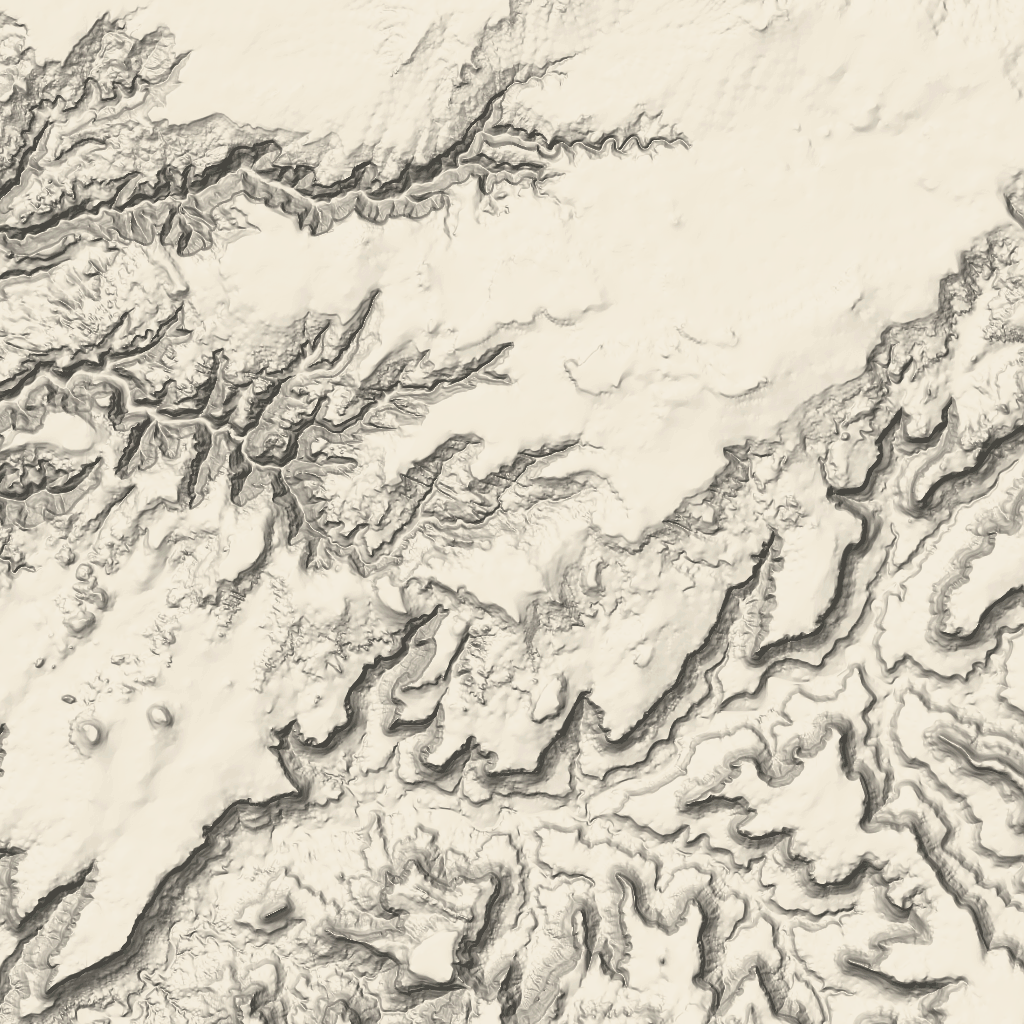
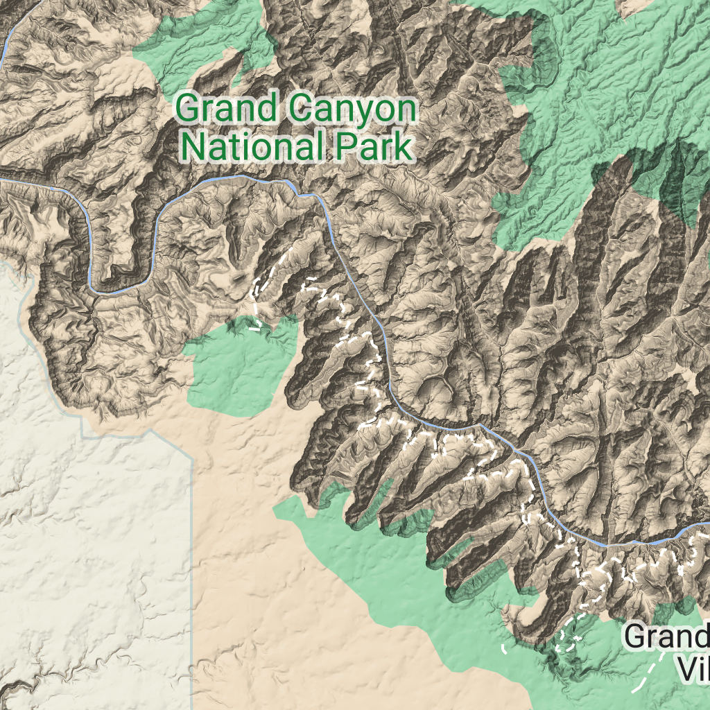
کاشی های زمین
با مجموعهها، منظم بمانید
ذخیره و طبقهبندی محتوا براساس اولویتهای شما.
توسعه دهندگان منطقه اقتصادی اروپا (EEA).
کاشیهای زمین، کاشیهای تصویری هستند که حاوی نقشههای سایه تپه و خطوط کانتور هستند. آنها شامل ویژگی های طبیعی مانند پوشش گیاهی هستند.
گرفتن کاشی های زمین
پس از دریافت رمز جلسه، میتوانید درخواستهای کاشی زمین را شروع کنید. از آنجا که نشانه جلسه برای کل جلسه اعمال می شود، لازم نیست گزینه های نقشه را با درخواست های کاشی خود مشخص کنید.
نمونه کد زیر یک درخواست نشانه جلسه معمولی برای کاشی های زمین را نشان می دهد.
curl -X POST -d '{
"mapType": "terrain",
"language": "en-US",
"region": "US",
"layerTypes": ["layerRoadmap"]
}' \
-H 'Content-Type: application/json' \
"https://tile.googleapis.com/v1/createSession?key=YOUR_API_KEY"
همانطور که در مثال زیر نشان داده شده است، با درخواست HTTPS GET، کاشی های زمین را دریافت می کنید.
curl "https://tile.googleapis.com/v1/2dtiles/z/x/y?session=YOUR_SESSION_TOKEN&key=YOUR_API_KEY"
نمونه درخواست کاشی
مثال زیر را در نظر بگیرید، که یک کاشی زمین با سطح زوم 10، با مختصات x و y از (192، 401) درخواست میکند.
curl "https://tile.googleapis.com/v1/2dtiles/10/192/401?session=YOUR_SESSION_TOKEN&key=YOUR_API_KEY" --output /tmp/example_tile.png
در این مثال هیچ پیام پاسخی از طرف سرور وجود ندارد. در عوض، کاشی فقط در یک فایل محلی دانلود می شود.

برای اطلاعات در مورد سرصفحههای پیام پاسخ، به Pre-Fetching، Caching یا Storage of Content مراجعه کنید.
جز در مواردی که غیر از این ذکر شده باشد،محتوای این صفحه تحت مجوز Creative Commons Attribution 4.0 License است. نمونه کدها نیز دارای مجوز Apache 2.0 License است. برای اطلاع از جزئیات، به خطمشیهای سایت Google Developers مراجعه کنید. جاوا علامت تجاری ثبتشده Oracle و/یا شرکتهای وابسته به آن است.
تاریخ آخرین بهروزرسانی 2025-08-29 بهوقت ساعت هماهنگ جهانی.
[null,null,["تاریخ آخرین بهروزرسانی 2025-08-29 بهوقت ساعت هماهنگ جهانی."],[[["\u003cp\u003eTerrain tiles are image tiles that visually represent geographical features like hills, contours, and vegetation.\u003c/p\u003e\n"],["\u003cp\u003eTo request terrain tiles, you first need to obtain a session token using your API key and specifying map parameters.\u003c/p\u003e\n"],["\u003cp\u003eYou can then retrieve individual terrain tiles using an HTTPS GET request, providing the session token, API key, and desired tile coordinates (zoom level, x, and y).\u003c/p\u003e\n"],["\u003cp\u003eTerrain tiles are downloaded directly as image files without a server response message, allowing easy integration into mapping applications.\u003c/p\u003e\n"]]],["Terrain tiles, which include hillshade mapping, contour lines, and natural features, are accessed by first obtaining a session token via a POST request specifying the map type, language, region, and layer types. Subsequently, tiles are retrieved with HTTPS GET requests, providing the zoom level (z), x and y coordinates, and the session token. An example demonstrates requesting a tile at zoom level 10, with coordinates (192, 401). The tile data downloads to a local file, without a server response message.\n"],null,["# Terrain tiles\n\n**European Economic Area (EEA) developers** If your billing address is in the European Economic Area, effective on 8 July 2025, the [Google\n| Maps Platform EEA Terms of Service](https://cloud.google.com/terms/maps-platform/eea) will apply to your use of the Services. [Learn more](/maps/comms/eea/faq). In addition, certain content from the Map Tiles API will no longer be returned. [Learn more](/maps/comms/eea/map-tiles).\n\nTerrain tiles are image tiles that contain hillshade mapping\nand contour lines. They include natural features such as vegetation.\n\nGetting terrain tiles\n---------------------\n\nYou can begin making terrain tile requests after you get a session token.\nBecause a session token applies to the entire session, you don't have to specify\nthe map options with your tile requests.\n\nThe following code sample demonstrates a typical session token request for\nterrain tiles. \n\n```json\ncurl -X POST -d '{\n \"mapType\": \"terrain\",\n \"language\": \"en-US\",\n \"region\": \"US\",\n \"layerTypes\": [\"layerRoadmap\"]\n}' \\\n-H 'Content-Type: application/json' \\\n\"https://tile.googleapis.com/v1/createSession?key=YOUR_API_KEY\"\n```\n\nYou get terrain tiles by making an HTTPS GET request, as shown in the following\nexample. \n\n```json\ncurl \"https://tile.googleapis.com/v1/2dtiles/\u003cvar class=\"apiparam\" translate=\"no\"\u003ez\u003c/var\u003e/\u003cvar class=\"apiparam\" translate=\"no\"\u003ex\u003c/var\u003e/\u003cvar class=\"apiparam\" translate=\"no\"\u003ey\u003c/var\u003e?session=\u003cvar class=\"apiparam\" translate=\"no\"\u003eYOUR_SESSION_TOKEN\u003c/var\u003e&key=YOUR_API_KEY\"\n```\n\nExample tile request\n--------------------\n\nConsider the following example, which requests a single terrain tile with zoom\nlevel 10, with x and y coordinates of (192, 401). \n\n```json\ncurl \"https://tile.googleapis.com/v1/2dtiles/10/192/401?session=\u003cvar class=\"apiparam\" translate=\"no\"\u003eYOUR_SESSION_TOKEN\u003c/var\u003e&key=YOUR_API_KEY\" --output /tmp/example_tile.png\n```\n\nThere is no response message from the server in this example. Instead, the tile\njust downloads to a local file.\n\nFor information about response message headers, see\n[Pre-Fetching, Caching, or Storage of Content](/maps/documentation/tile/policies#pre-fetching,-caching,-or-storage-of-content)."]]