Page Summary
-
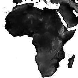
The CGIAR/SRTM90_V4 dataset provides consistent, high-quality digital elevation data from the Shuttle Radar Topography Mission, processed to fill voids and enhance usability.
-
This dataset, available for the period of February 11-22, 2000, includes an 'elevation' band in meters with a 90-meter pixel size.
-
Users are prohibited from commercial resale or redistribution without explicit permission from CIAT and should acknowledge CIAT as the source in any resulting work.
-
The dataset is available for analysis and visualization on the Google Earth Engine platform, free for research, education, and nonprofit use.
- Dataset Availability
- 2000-02-11T00:00:00Z–2000-02-22T00:00:00Z
- Dataset Producer
- NASA/CGIAR
- Tags
Description
The Shuttle Radar Topography Mission (SRTM) digital elevation dataset was originally produced to provide consistent, high-quality elevation data at near global scope. This version of the SRTM digital elevation data has been processed to fill data voids, and to facilitate its ease of use.
Bands
Bands
Pixel size: 90 meters (all bands)
| Name | Units | Min | Max | Pixel Size | Description |
|---|---|---|---|---|---|
elevation |
m | -444* | 8806* | 90 meters | Elevation |
Terms of Use
Terms of Use
DISTRIBUTION. Users are prohibited from any commercial, non-free resale, or redistribution without explicit written permission from CIAT. Users should acknowledge CIAT as the source used in the creation of any reports, publications, new datasets, derived products, or services resulting from the use of this dataset. CIAT also request reprints of any publications and notification of any redistributing efforts. For commercial access to the data, send requests to Andy Jarvis [a.jarvis@cgiar.org].
NO WARRANTY OR LIABILITY. CIAT provides these data without any warranty of any kind whatsoever, either express or implied, including warranties of merchantability and fitness for a particular purpose. CIAT shall not be liable for incidental, consequential, or special damages arising out of the use of any data.
ACKNOWLEDGMENT AND CITATION. Any users are kindly asked to cite this data in any published material produced using this data, and if possible link web pages to the CIAT-CSI SRTM website.
Citations
Jarvis, A., H.I. Reuter, A. Nelson, E. Guevara. 2008. Hole-filled SRTM for the globe Version 4, available from the CGIAR-CSI SRTM 90m Database: https://srtm.csi.cgiar.org.
Explore with Earth Engine
Code Editor (JavaScript)
var dataset = ee.Image('CGIAR/SRTM90_V4');
var elevation = dataset.select('elevation');
var slope = ee.Terrain.slope(elevation);
Map.setCenter(-112.8598, 36.2841, 10);
Map.addLayer(slope, {min: 0, max: 60}, 'slope');
import ee
import geemap.core as geemap
Colab (Python)
dataset = ee.Image('CGIAR/SRTM90_V4')
elevation = dataset.select('elevation')
slope = ee.Terrain.slope(elevation)

m = geemap.Map()
m.set_center(-112.8598, 36.2841, 10)
m.add_layer(slope, {'min': 0, 'max': 60}, 'slope')
m