-
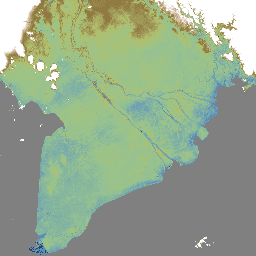
荷兰 AHN 0.5 米 DEM,插值

AHN DEM 是覆盖荷兰的 0.5 米 DEM。该地图是根据 2007 年至 2012 年春季采集的激光雷达数据生成的。它包含地面层级的样本,并移除了地面以上的所有其他物体(例如建筑物、桥梁、树木等)。此版本是… AHN DEM 海拔 海拔-地形 地球物理 激光雷达 -
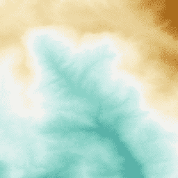
AHN 荷兰 0.5 米 DEM,非插值

AHN DEM 是覆盖荷兰的 0.5 米 DEM。该地图是根据 2007 年至 2012 年春季采集的激光雷达数据生成的。它包含地面层级的样本,并移除了地面以上的所有其他物体(例如建筑物、桥梁、树木等)。此版本是… AHN DEM 海拔 海拔-地形 地球物理 激光雷达 -
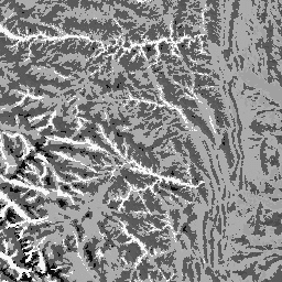
荷兰 AHN 0.5 米 DEM,原始样本

AHN DEM 是覆盖荷兰的 0.5 米 DEM。该地图是根据 2007 年至 2012 年春季采集的激光雷达数据生成的。此版本包含地面级样本和地面以上物体(例如建筑物、桥梁、树木等)。点云… AHN DEM 海拔 海拔-地形 地球物理 激光雷达 -
AHN3:荷兰 AHN 0.5 米

Actueel Hoogtebestand Nederland (AHN) 是一个数据集,其中包含荷兰全国范围内的详细精确的海拔数据。海拔信息是通过直升机和飞机使用激光技术收集的,垂直精度为 5 厘米。AHN3 数据集包含荷兰 AHN 0.5 米 DSM … AHN DEM 海拔 海拔-地形 地球物理 激光雷达 -
AHN4:荷兰 AHN 0.5 米

Actueel Hoogtebestand Nederland (AHN) 是一个数据集,其中包含荷兰全国范围内的详细精确的海拔数据。海拔信息是通过直升机和飞机使用激光技术收集的,垂直精度为 5 厘米。AHN4 数据集包含荷兰 AHN 0.5 米 DSM … AHN DEM 海拔 海拔-地形 地球物理 激光雷达 -
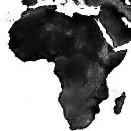
ALOS DSM:全球 30 米 v4.1
ALOS World 3D - 30m (AW3D30) 是一项全球数字地表模型 (DSM) 数据集,水平分辨率约为 30 米(1 角秒网格)。该数据集基于世界 3D 地形数据的 DSM 数据集(5 米网格版本)。更多详情… ALOS DEM 海拔 海拔-地形 地球物理 JAXA -
ArcticDEM Mosaic V4.1
ArcticDEM 是美国国家地理空间情报局 (NGA) 和美国国家科学基金会 (NSF) 共同发起的一项公私合作计划,旨在利用光学立体影像、高性能计算和开源摄影测量软件,自动生成北极的高分辨率、高质量数字表面模型 (DSM)。它包括植被、树冠、建筑物和… arctic dem elevation-topography geophysical pgc umn -
ArcticDEM 条带
ArcticDEM 是美国国家地理空间情报局 (NGA) 和美国国家科学基金会 (NSF) 共同发起的一项公私合作计划,旨在利用光学立体影像、高性能计算和开源摄影测量软件,自动生成北极的高分辨率、高质量数字表面模型 (DSM)。它包括植被、树冠、建筑物和… arctic dem elevation-topography geophysical pgc umn -
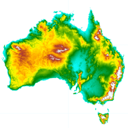
澳大利亚 5 米 DEM

澳大利亚的数字高程模型 (DEM) 5 米网格源自 LiDAR 模型,表示一个国家级 5 米(裸地)DEM,该模型源自 2001 年至 2015 年间进行的约 236 次单独 LiDAR 调查,覆盖面积超过 245,000 平方公里。… 澳大利亚 dem elevation elevation-topography ga geophysical -
加拿大数字高程模型

加拿大数字高程模型 (CDEM) 是加拿大自然资源部 (NRCan) 高程测量系统的一部分,源自现有的加拿大数字高程数据 (CDED)。在这些数据中,高程可以是地面高程,也可以是反射面高程。CDEM 由多个 DEM 组成,具有以下特征… 加拿大 DEM 海拔 海拔-地形 地球物理 地形 -
Copernicus DEM GLO-30:全球 30 米数字高程模型
哥白尼 DEM 是一种数字表面模型 (DSM),用于表示地球表面的地形,包含建筑物、基础设施和植被。此 DEM 源自名为 WorldDEM™ 的经过编辑的 DSM,即已纳入水体平坦化和河流的连贯流动。正在修改… 哥白尼 数字高程模型 海拔 海拔-地形 地球物理 -
CryoSat-2 南极洲 1 公里 DEM
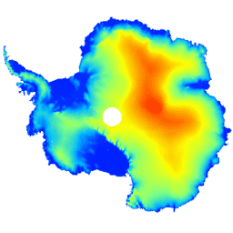
此数据集是南极冰盖和冰架的数字高程模型 (DEM),基于 CryoSat-2 卫星雷达高度计在 2010 年 7 月至 2016 年 7 月期间记录的观测数据。DEM 是根据在 1 天、2 天、3 天、4 天、5 天、6 天、7 天、8 天、9 天、10 天、11 天、12 天、13 天、14 天、15 天、16 天、17 天、18 天、19 天、20 天、21 天、22 天、23 天、24 天、25 天、26 天、27 天、28 天、29 天、30 天、31 天、32 天、33 天、34 天、35 天、36 天、37 天、38 天、39 天、40 天、41 天、42 天、43 天、44 天、45 天、46 天、47 天、48 天、49 南极洲 数字高程模型 海拔 海拔-地形 极地 -
DEM-H:澳大利亚 SRTM 水文强制数字高程模型

水文强制数字高程模型 (DEM-H) 源自 NASA 于 2000 年 2 月获取的 SRTM 数据。模型已进行水文条件调整和排水强制处理。DEM-H 基于 SRTM 高程和已映射的河流线捕获水流路径,并支持划定… 澳大利亚 dem elevation elevation-topography ga geophysical -
DEM-S:澳大利亚平滑数字高程模型
平滑数字高程模型 (DEM-S) 源自 NASA 于 2000 年 2 月获取的 SRTM 数据。DEM-S 表示地面地形(不包括植被特征),并且经过平滑处理,以减少噪声并改进地表形状的表示。一种自适应流程,应用了更多… 澳大利亚 dem elevation elevation-topography ga geophysical -
ETOPO1:全球 1 弧分高程

ETOPO1 是一个 1 分弧度的地球表面全球地形模型,集成了陆地地形和海洋测深数据。该模型基于众多全球和区域数据集构建而成。它包含两个海拔高度频段:ice_surface 和 bedrock。 基岩 DEM 海拔 海拔-地形 地球物理 冰 -
英格兰 1 米合成 DTM/DSM(环境署)
LIDAR 复合 DTM/DSM 是一种栅格地形模型,覆盖了英格兰约 99% 的区域,空间分辨率为 1 米,由英国环境署于 2022 年制作。该模型包含 3 个地形数据波段:数字地形模型 (DTM)、首次回波数字表面模型 (DSM)、… dem elevation elevation-topography lidar -
GMTED2010:2010 年全球多分辨率地形高程数据

全球多分辨率地形高程数据 2010 (GMTED2010) 数据集包含全球高程数据,这些数据以 7.5 角秒的分辨率从各种来源收集而来。如需了解详情,请参阅数据集报告。GMTED2010 的主要源数据集是 NGA 的 SRTM 数字地形高程数据 (DTED®,… dem elevation elevation-topography geophysical srtm topography -
GTOPO30:全球 30 角秒高程

GTOPO30 是一种全球数字高程模型 (DEM),水平网格间距为 30 角秒(约 1 公里)。DEM 源自多个地形信息栅格和矢量源。GTOPO30 于 1996 年底完成,历时三年开发而成,… dem 海拔 海拔-地形 地球物理 nasa 地形 -
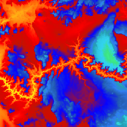
全球 ALOS CHILI(持续热能-日照负荷指数)

CHILI 是日照和地形阴影对蒸散影响的替代变量,通过计算初午时(即太阳高度相当于春分时)的日照来表示。该数据集基于 JAXA 的 ALOS DEM(在 EE 中以 JAXA/ALOS/AW3D30_V1_1 提供)的 30 米“AVE”波段。保护科学… 坡向 csp 海拔 海拔-地形 ergo 地球物理 -
全球 ALOS 地貌

ALOS 地貌数据集通过组合连续热日照负荷指数 (ALOS CHILI) 和多尺度地形位置指数 (ALOS mTPI) 数据集来创建地貌类别。该数据集基于 JAXA 的 ALOS DEM(在 EE 中以 JAXA/ALOS/AW3D30_V1_1 提供)的 30 米“AVE”波段。The Conservation … 坡向 csp 海拔 海拔-地形 ergo 地球物理 -
全球 ALOS 地形多样性

地形多样性 (D) 是一个替代变量,表示物种作为当地栖息地可获得的温度和湿度条件的多样性。它表达了这样一种逻辑:更多样的地形气候生态位应支持更高的多样性(尤其是植物),并支持物种在气候变化下的持续存在… 坡向 csp 海拔 海拔-地形 ergo 地球物理 -
全球 ALOS mTPI(多尺度地形位置指数)

mTPI 可区分山脊地形和山谷地形。它是通过从每个位置的海拔数据中减去邻域内的平均海拔来计算的。mTPI 使用半径(以公里为单位)为 115.8、89.9、35.5、13.1、5.6、2.8 和 1.2 的移动窗口。它基于 30 米分辨率的… 坡向 csp 海拔 海拔-地形 ergo 地球物理 -
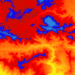
全球 SRTM CHILI(连续热能-日照负荷指数)

CHILI 是日照和地形阴影对蒸散影响的替代变量,通过计算初午时(即太阳高度相当于春分时)的日照来表示。它基于 30 米 SRTM DEM(在 EE 中以 USGS/SRTMGL1_003 的形式提供)。Conservation Science Partners (CSP) Ecologically Relevant … 坡向 csp 海拔 海拔-地形 ergo 地球物理 -
全球 SRTM 地貌

SRTM 地貌数据集提供通过组合连续热日照负荷指数 (SRTM CHILI) 和多尺度地形位置指数 (SRTM mTPI) 数据集创建的地貌类别。它基于 30 米 SRTM DEM(在 EE 中以 USGS/SRTMGL1_003 的形式提供)。The Conservation Science Partners (CSP) Ecologically … 坡向 csp 海拔 海拔-地形 ergo 地球物理 -
全球 SRTM 地形多样性

地形多样性 (D) 是一个替代变量,表示物种作为当地栖息地可获得的温度和湿度条件的多样性。它表达了这样一种逻辑:更多样的地形气候生态位应支持更高的多样性(尤其是植物),并支持物种在气候变化下的持续存在… 坡向 csp 海拔 海拔-地形 ergo 地球物理 -
全球 SRTM mTPI(多尺度地形位置指数)

mTPI 可区分山脊地形和山谷地形。它是通过从每个位置的海拔数据中减去邻域内的平均海拔来计算的。mTPI 使用半径(以公里为单位)为 115.8、89.9、35.5、13.1、5.6、2.8 和 1.2 的移动窗口。它基于 30 米分辨率的… 坡向 csp 海拔 海拔-地形 ergo 地球物理 -
格陵兰 DEM - 格陵兰地图绘制项目 (GIMP)
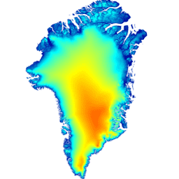
此数字高程模型 (DEM) 是由 ASTER 和 SPOT-5 DEM 组合而成,用于表示大约 82.5°N 以南的冰盖外围和边缘(即低于平衡线高程)以及冰盖内部和极北地区的 AVHRR 光度测斜术(Scambos 和 … 北极 海拔地形 GIMP 格陵兰 NASA 极地 -
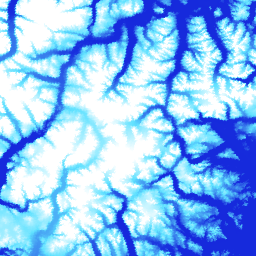
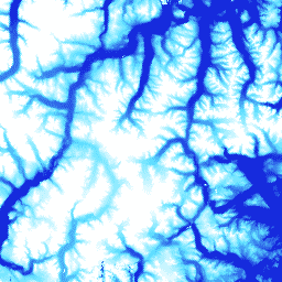
MERIT DEM:多重错误移除改进型地形 DEM
MERIT DEM 是一种高精度全球 DEM,分辨率为 3 弧秒(赤道处约为 90 米),通过消除现有 DEM(NASA SRTM3 DEM、JAXA AW3D DEM、Viewfinder Panoramas DEM)中的主要误差分量生成。MERIT DEM 可分离绝对偏差、条带噪声、斑点噪声和 … dem 海拔 海拔-地形 merit 地形 -
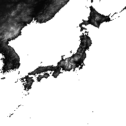
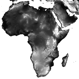
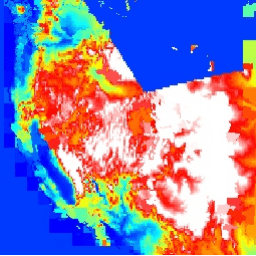
NASA SRTM 数字高程 30 米
航天飞机雷达地形测绘任务 (SRTM,参见 Farr 等人,2007 年) 数字高程数据是一项国际研究项目,旨在获取近乎全球范围的数字高程模型。此 SRTM V3 产品 (SRTM Plus) 由 NASA JPL 提供,分辨率为 1 角秒… dem 海拔 海拔-地形 地球物理 nasa srtm -
NASADEM:NASA 30 米数字高程模型
NASADEM 是对 SRTM 数据的重新处理,通过纳入来自 ASTER GDEM、ICESat GLAS 和 PRISM 数据集的辅助数据,提高了准确性。最重要的处理改进包括通过改进的相位解包裹来减少空隙,以及使用 ICESat GLAS 数据进行控制。文档:用户指南 dem 海拔 海拔-地形 地球物理 nasa srtm -
NEON 数字高程模型 (DEM)
根据 NEON LiDAR 数据得出的地表数字模型 (DSM) 和地形数字模型 (DTM)。DSM:地表特征(包含植被和人造结构的地形信息)。DTM:裸地高程(已移除植被和人造结构的地形信息)。图片中给出的高度单位为米,以平均海平面为基准。 机载 数字高程模型 海拔地形 森林 高分辨率 激光雷达 -
预览国家潮间带数字高程模型 25 米 1.0.0

国家潮间带数字高程模型 (NIDEM; Bishop-Taylor et al. 2018, 2019) 是澳大利亚裸露潮间带的大陆级高程数据集。NIDEM 首次以三维形式呈现了澳大利亚潮间带沙滩和海岸、潮滩以及岩石海岸和礁石,分辨率为 25 米… 澳大利亚 人口统计 海拔地形 GA -
REMA Mosaic

南极洲参考高程模型 (REMA) 是一种高分辨率、带时间戳的南极洲数字表面模型 (DSM),空间分辨率为 2 米和 8 米。镶嵌 DEM 文件由多个已共同注册、混合和羽化的条带编译而成,可减少边缘匹配伪影。 dem elevation-topography geophysical pgc rema umn -
REMA Strips 2m

南极洲参考高程模型 (REMA) 是一种高分辨率、带时间戳的南极洲数字表面模型 (DSM),空间分辨率为 2 米和 8 米。条带 DEM 文件对应于输入立体影像对条带的重叠区域,因为它们是由 DigitalGlobe 的 … dem elevation-topography geophysical pgc rema umn -
REMA Strips 8m

南极洲参考高程模型 (REMA) 是一种高分辨率、带时间戳的南极洲数字表面模型 (DSM),空间分辨率为 2 米和 8 米。条带 DEM 文件对应于输入立体影像对条带的重叠区域,因为它们是由 DigitalGlobe 的 … dem elevation-topography geophysical pgc rema umn -
RGE ALTI:IGN RGE ALTI 数字高程 1 米
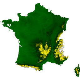
RGE ALTI 数据集描述了法国的数字高程模型 (DEM),像素大小为 1 米。它是根据通过机载激光雷达获得的测量结果或通过关联航拍图像创建的。Lidar 已部署在易发生洪灾的沿海地区和大型森林地区。纵向… dem elevation elevation-topography geophysical -
SRTM 数字高程数据版本 4

航天飞机雷达地形测绘任务 (SRTM) 数字高程数据集最初的目的是提供近乎全球范围内一致的高质量高程数据。此版本的 SRTM 数字高程数据经过处理,可填补数据空白,并提高易用性。 dem elevation elevation-topography geophysical srtm topography -
美国岩性
岩性数据集提供了地表土壤母质的一般类型。它并非源自任何 DEM。“Conservation Science Partners (CSP) Ecologically Relevant Geomorphology (ERGo) Datasets, Landforms and Physiography”包含有关地貌和地貌学的详细多尺度数据… 坡向 csp 海拔 海拔-地形 ergo 地球物理 -
美国 NED CHILI(连续热日照负荷指数)

CHILI 是日照和地形阴影对蒸散影响的替代变量,通过计算初午时(即太阳高度相当于春分时)的日照来表示。它基于 USGS 的 10 米 NED DEM(在 EE 中以 USGS/NED 的形式提供)。The Conservation Science Partners (CSP) Ecologically … 坡向 csp 海拔 海拔-地形 ergo 地球物理 -
美国 NED 地貌

ALOS 地貌数据集提供通过组合连续热日照负荷指数 (CHILI) 和多尺度地形位置指数 (mTPI) 数据集创建的地貌类别。它基于 USGS 的 10 米 NED DEM(在 EE 中以 USGS/NED 的形式提供)。Conservation Science Partners (CSP) Ecologically Relevant … 坡向 csp 海拔 海拔-地形 ergo 地球物理 -
美国 NED 地理地貌多样性
地形多样性数据集提供了地形类型多样性的指数。它是使用多种尺度(公里)下的香农多样性指数计算的:115.8、89.9、35.5、13.1、5.6、2.8 和 1.2。它基于 USGS 的 10 米 NED DEM(在 EE 中提供 … 坡向 csp 海拔 海拔-地形 ergo 地球物理 -
美国 NED 地形多样性

地形多样性 (D) 是一个替代变量,表示物种作为当地栖息地可获得的温度和湿度条件的多样性。它表达了这样一种逻辑:更多样的地形气候生态位应支持更高的多样性(尤其是植物),并支持物种在气候变化下的持续存在… 坡向 csp 海拔 海拔-地形 ergo 地球物理 -
美国 NED mTPI(多尺度地形位置指数)
mTPI 可区分山脊地形和山谷地形。它是通过从每个位置的海拔数据中减去邻域内的平均海拔来计算的。mTPI 使用半径(以公里为单位)为 115.8、89.9、35.5、13.1、5.6、2.8 和 1.2 的移动窗口。该模型基于美国地质调查局 (USGS) 的… 坡向 csp 海拔 海拔-地形 ergo 地球物理 -
美国地形
地形地貌数据集表示地形(在 EE 中以 ERGo/1_0/US/landforms 形式提供)和岩性(在 EE 中以 ERGo/1_0/US/lithology 形式提供)数据层的空间交集。它提供了 247 种独特的组合,而可能的组合总共有 270 种。每种类型的值是通过连接地貌和…形成的 坡向 csp 海拔 海拔-地形 ergo 地球物理 -
USGS 3DEP 10 米国家地图无缝(1/3 角秒)
这是美国无缝 3DEP DEM 数据集,全面覆盖美国本土 48 个州、夏威夷和美国属地。阿拉斯加州的部分地区现已覆盖,并且正在扩大覆盖范围,以实现全州覆盖,这是阿拉斯加州地图绘制计划的一部分。地面间距为… 3DEP DEM 海拔 海拔-地形 地球物理 地形 -
USGS 3DEP 1 米国家地图
这是 3D 高程计划 (3DEP) 提供的像素大小为 1 米的平铺图片集合。3DEP 数据集是美国国家地图的海拔图层,可为地球科学研究和美国境内的地图应用提供基础海拔信息。 3DEP DEM 海拔 海拔-地形 地球物理 地形 -
USGS 3DEP National Map Spatial Metadata 1/3 Arc-Second (10m)
此表包含 3DEP 10 米 DEM 资产的元数据。工作单元范围空间元数据 (WESM) 包含当前的激光雷达数据可用性和有关激光雷达项目的基本信息,包括激光雷达质量级别、数据采集日期以及指向项目级元数据的链接。查看更多详情… 3dep elevation-topography table usgs
Datasets tagged elevation-topography in Earth Engine
[null,null,[],[],[]]