تحتوي مجموعة البيانات هذه على تقدير لمساحة الأرض
بالكيلومتر المربّع لكل بكسل، باستثناء الجليد الدائم والمياه،
داخل كل بكسل، وقد تم استخدامها لحساب مجموعات بيانات الكثافة السكانية GPW v4.11.
يقدّم الإصدار 11 من "تعداد السكان في العالم" (GPWv4) توزيعًا
للسكان في العالم خلال الأعوام 2000 و2005 و2010 و2015 و2020
في خلايا شبكية تبلغ مساحتها 30 ثانية قوسية (كيلومتر واحد تقريبًا). يتم توزيع السكان على الخلايا باستخدام التوزيع النسبي للسكان من التعداد السكاني والوحدات الإدارية. يتم جمع بيانات السكان المدخلة بأعلى دقة مكانية متاحة من نتائج جولة التعدادات لعام 2010 التي أُجريت بين عامَي 2005 و2014. يتم استقراء بيانات الإدخال لإنتاج تقديرات عدد السكان لكل سنة تم وضع نموذج لها.
النطاقات
حجم البكسل 927.67 متر
النطاقات
الاسم
الحد الأدنى
الحد الأقصى
حجم البكسل
الوصف
land_area
0*
0.86*
أمتار
تقديرات لمساحة الأرض ضمن كل وحدة بكسل تبلغ 30 ثانية قوسية
مركز شبكة معلومات علوم الأرض الدولية (CIESIN) في "جامعة كولومبيا" 2018 Gridded Population of the World, Version 4
(GPWv4): Land Area, Revision 11. Palisades, NY: NASA Socioeconomic Data
and Applications Center (SEDAC). https://doi.org/10.7927/H4Z60M4Z.
تم الوصول إليه في DAY MONTH YEAR.
تحتوي مجموعة البيانات هذه على تقدير لمساحة الأرض بالكيلومتر المربّع لكل بكسل، باستثناء الجليد الدائم والمياه، ضمن كل بكسل، وقد تم استخدامها لحساب مجموعات بيانات الكثافة السكانية GPW v4.11. General Documentation The Gridded Population of World Version 4 (GPWv4), Revision 11 models the distribution …
[null,null,[],[[["\u003cp\u003eThe Gridded Population of the World Version 4 (GPWv4), Revision 11 dataset models the distribution of global human population for the years 2000, 2005, 2010, 2015, and 2020.\u003c/p\u003e\n"],["\u003cp\u003eThis dataset provides estimates of land area, excluding permanent ice and water, in square kilometers per pixel at a resolution of 927.67 meters.\u003c/p\u003e\n"],["\u003cp\u003ePopulation data is distributed to grid cells using proportional allocation from census and administrative units and extrapolated to produce estimates for each modeled year.\u003c/p\u003e\n"],["\u003cp\u003eThe dataset is provided by NASA SEDAC at the Center for International Earth Science Information Network and is licensed under CC-BY-4.0.\u003c/p\u003e\n"],["\u003cp\u003eThis land area dataset was specifically used to calculate the GPWv4 population density datasets.\u003c/p\u003e\n"]]],["The dataset, provided by NASA SEDAC, estimates land surface area per pixel (excluding permanent ice/water) from 2000 to 2020. It models global human population distribution using 30-arc-second grid cells. Data is extrapolated from census information collected between 2005-2014, with a pixel size of 927.67 meters. Users can access it via Earth Engine with the `ee.ImageCollection(\"CIESIN/GPWv411/GPW_Land_Area\")` snippet, under a CC-BY-4.0 license, and explore it using a provided JavaScript code.\n"],null,["# GPWv411: Land Area (Gridded Population of the World Version 4.11)\n\nDataset Availability\n: 2000-01-01T00:00:00Z--2020-01-01T00:00:00Z\n\nDataset Provider\n:\n\n\n [NASA SEDAC at the Center for International Earth Science Information Network](https://doi.org/10.7927/H4Z60M4Z)\n\nTags\n:\n[ciesin](/earth-engine/datasets/tags/ciesin) [gpw](/earth-engine/datasets/tags/gpw) [nasa](/earth-engine/datasets/tags/nasa) [population](/earth-engine/datasets/tags/population) \n\n#### Description\n\nThis dataset contains the estimate of the surface area of land\nin square kilometers per pixel, excluding permanent ice and water,\nwithin each pixel, and was used to calculate the GPW v4.11 population density\ndatasets.\n\n[General Documentation](https://beta.sedac.ciesin.columbia.edu/data/set/gpw-v4-quality-indicators/docs)\n\nThe Gridded Population of World Version 4 (GPWv4), Revision 11 models the distribution\nof global human population for the years 2000, 2005, 2010, 2015, and 2020\non 30 arc-second (approximately 1 km) grid cells. Population is distributed\nto cells using proportional allocation of population from census and\nadministrative units. Population input data are collected at the most\ndetailed spatial resolution available from the results of the 2010 round of\ncensuses, which occurred between 2005 and 2014. The input data are\nextrapolated to produce population estimates for each modeled year.\n\n### Bands\n\n\n**Pixel Size**\n\n927.67 meters\n\n**Bands**\n\n| Name | Min | Max | Pixel Size | Description |\n|-------------|-----|--------|------------|----------------------------------------------------------|\n| `land_area` | 0\\* | 0.86\\* | meters | Estimates for land area within each 30-arc second pixel. |\n\n\\* estimated min or max value\n\n### Terms of Use\n\n**Terms of Use**\n\n[CC-BY-4.0](https://spdx.org/licenses/CC-BY-4.0.html)\n\n### Citations\n\nCitations:\n\n- Center for International Earth Science Information Network - CIESIN -\n Columbia University. 2018. Gridded Population of the World, Version 4\n (GPWv4): Land Area, Revision 11. Palisades, NY: NASA Socioeconomic Data\n and Applications Center (SEDAC). \u003chttps://doi.org/10.7927/H4Z60M4Z\u003e.\n Accessed DAY MONTH YEAR.\n\n### DOIs\n\n- \u003chttps://doi.org/10.7927/H4Z60M4Z\u003e\n\n### Explore with Earth Engine\n\n| **Important:** Earth Engine is a platform for petabyte-scale scientific analysis and visualization of geospatial datasets, both for public benefit and for business and government users. Earth Engine is free to use for research, education, and nonprofit use. To get started, please [register for Earth Engine access.](https://console.cloud.google.com/earth-engine)\n\n### Code Editor (JavaScript)\n\n```javascript\n
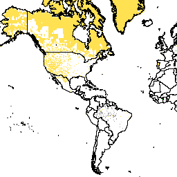
var dataset = ee.ImageCollection('CIESIN/GPWv411/GPW_Land_Area');\nvar raster = dataset.select('land_area');\nvar raster_vis = {\n 'min': 0.0,\n 'palette': [\n 'ecefb7',\n '745638'\n ],\n 'max': 0.86\n};\nMap.setCenter(26.4, 19.81, 1);\nMap.addLayer(raster, raster_vis, 'land_area');\n```\n[Open in Code Editor](https://code.earthengine.google.com/?scriptPath=Examples:Datasets/CIESIN/CIESIN_GPWv411_GPW_Land_Area) \n[GPWv411: Land Area (Gridded Population of the World Version 4.11)](/earth-engine/datasets/catalog/CIESIN_GPWv411_GPW_Land_Area) \nThis dataset contains the estimate of the surface area of land in square kilometers per pixel, excluding permanent ice and water, within each pixel, and was used to calculate the GPW v4.11 population density datasets. General Documentation The Gridded Population of World Version 4 (GPWv4), Revision 11 models the distribution ... \nCIESIN/GPWv411/GPW_Land_Area, ciesin,gpw,nasa,population \n2000-01-01T00:00:00Z/2020-01-01T00:00:00Z \n-90 -180 90 180 \nGoogle Earth Engine \nhttps://developers.google.com/earth-engine/datasets\n\n- [https://doi.org/10.7927/H4Z60M4Z](https://doi.org/https://doi.org/10.7927/H4Z60M4Z)\n- [https://doi.org/10.7927/H4Z60M4Z](https://doi.org/https://developers.google.com/earth-engine/datasets/catalog/CIESIN_GPWv411_GPW_Land_Area)"]]