Этот набор данных идентифицирует пиксели, соответствующие воде; пиксели, не соответствующие воде, маскируются. Маска воды использовалась для исключения областей, покрытых водой и постоянным льдом, из распределения популяции.
Модель населения мира с координатной сеткой версии 4 (GPWv4), редакция 11, моделирует распределение населения мира за 2000, 2005, 2010, 2015 и 2020 годы в ячейках сетки с шагом 30 угловых секунд (приблизительно 1 км). Население распределяется по ячейкам пропорционально, исходя из данных переписи и административных единиц. Входные данные о населении собираются с максимально возможным пространственным разрешением, доступным по результатам раунда переписей 2010 года, проводившихся с 2005 по 2014 год. Входные данные экстраполируются для получения оценок численности населения для каждого моделируемого года.
Центр международной информационной сети по наукам о Земле (CIESIN) — Колумбийский университет. 2018. Gridded Population of the World, версия 4 (GPWv4): Water Mask, редакция 11. Палисейдс, штат Нью-Йорк: Центр социально-экономических данных и приложений НАСА (SEDAC). https://doi.org/10.7927/H42Z13KG . Дата обращения: ДЕНЬ МЕСЯЦ ГОД.
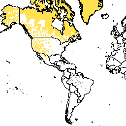
В этом наборе данных идентифицированы пикселы, относящиеся к воде; пикселы, не относящиеся к воде, маскируются. Маска, относящаяся к воде, использовалась для исключения областей, покрытых водой и постоянным льдом, из распределения населения. Общая документация. Модель населения мира с координатной сеткой версии 4 (GPWv4), редакция 11, моделирует распределение населения планеты в 2000, 2005 и т.д.
[null,null,[],[[["\u003cp\u003eThis dataset, provided by NASA SEDAC, identifies and masks water pixels, including permanent ice, for global coverage.\u003c/p\u003e\n"],["\u003cp\u003eIt is part of the Gridded Population of the World Version 4 (GPWv4) project and is based on a 30 arc-second (approximately 1km) grid.\u003c/p\u003e\n"],["\u003cp\u003eThe dataset aids in excluding water bodies from population distribution modeling and is available from 2000 to 2020.\u003c/p\u003e\n"],["\u003cp\u003eUsers can access and analyze the dataset through Google Earth Engine, with a provided code snippet for visualization.\u003c/p\u003e\n"],["\u003cp\u003eThe data is licensed under CC-BY-4.0 and has a resolution of 927.67 meters.\u003c/p\u003e\n"]]],["The dataset, provided by NASA SEDAC, models global human population distribution from 2000 to 2020 at approximately 1km resolution. It uses a water mask to exclude water and permanent ice from population data. The dataset, named GPWv4, Revision 11, allocates population proportionally from census data. The water mask identifies water pixels, differentiating between total and partial water, land, and ocean pixels. It can be accessed via an Earth Engine snippet and is freely available for research, education, and nonprofit use under CC-BY-4.0 license.\n"],null,["# GPWv411: Water Mask (Gridded Population of the World Version 4.11)\n\nDataset Availability\n: 2000-01-01T00:00:00Z--2020-01-01T00:00:00Z\n\nDataset Provider\n:\n\n\n [NASA SEDAC at the Center for International Earth Science Information Network](https://doi.org/10.7927/H42Z13KG)\n\nTags\n:\n[ciesin](/earth-engine/datasets/tags/ciesin) [gpw](/earth-engine/datasets/tags/gpw) [nasa](/earth-engine/datasets/tags/nasa) [population](/earth-engine/datasets/tags/population) [surface-ground-water](/earth-engine/datasets/tags/surface-ground-water) \n\n#### Description\n\nThis dataset identifies water pixels; non-water pixels are masked.\nThe water mask was used to exclude areas of water and permanent ice\nfrom the population allocation.\n\n[General Documentation](https://sedac.ciesin.columbia.edu/data/set/gpw-v4-basic-demographic-characteristics-rev11/docs)\n\nThe Gridded Population of World Version 4 (GPWv4), Revision 11 models the distribution\nof global human population for the years 2000, 2005, 2010, 2015, and 2020\non 30 arc-second (approximately 1 km) grid cells. Population is distributed\nto cells using proportional allocation of population from census and\nadministrative units. Population input data are collected at the most\ndetailed spatial resolution available from the results of the 2010 round of\ncensuses, which occurred between 2005 and 2014. The input data are\nextrapolated to produce population estimates for each modeled year.\n\n### Bands\n\n\n**Pixel Size**\n\n927.67 meters\n\n**Bands**\n\n| Name | Min | Max | Pixel Size | Description |\n|--------------|-----|-----|------------|-------------|---|---|---|---|---|---|---|---|---|---|---|---|---|---|---|---|---|---|---|---|---|---|---|---|---|---|---|---|---|---|---|---|---|---|---|---|---|---|---|---|---|---|---|---|---|---|---|---|---|---|---|---|---|---|---|---|---|---|---|---|---|---|---|---|---|---|---|---|---|---|---|---|---|---|---|---|---|---|---|---|---|---|---|---|---|---|---|---|---|---|---|---|---|---|---|\n| `water_mask` | | | meters | Water mask |\n| Bitmask for water_mask - Bits 0-1: Identifies water pixels; non-water pixels are masked - 0: Total water pixels that are completely water and/or permanent ice. - 1: Partial water pixels that also contain land. - 2: Total land pixels. - 3: Ocean pixels. ||||||||||||||||||||||||||||||||||||||||||||||||||||||||||||||||||||||||||||||||||||||||||||||||||||\n\n\\* estimated min or max value\n\n### Terms of Use\n\n**Terms of Use**\n\n[CC-BY-4.0](https://spdx.org/licenses/CC-BY-4.0.html)\n\n### Citations\n\nCitations:\n\n- Center for International Earth Science Information Network - CIESIN -\n Columbia University. 2018. Gridded Population of the World, Version 4\n (GPWv4): Water Mask, Revision 11. Palisades, NY: NASA Socioeconomic Data\n and Applications Center (SEDAC). \u003chttps://doi.org/10.7927/H42Z13KG\u003e.\n Accessed DAY MONTH YEAR.\n\n### DOIs\n\n- \u003chttps://doi.org/10.7927/H42Z13KG\u003e\n\n### Explore with Earth Engine\n\n| **Important:** Earth Engine is a platform for petabyte-scale scientific analysis and visualization of geospatial datasets, both for public benefit and for business and government users. Earth Engine is free to use for research, education, and nonprofit use. To get started, please [register for Earth Engine access.](https://console.cloud.google.com/earth-engine)\n\n### Code Editor (JavaScript)\n\n```javascript\nvar dataset = ee.ImageCollection('CIESIN/GPWv411/GPW_Water_Mask');\nvar raster = dataset.select('water_mask');\nvar raster_vis = {\n 'min': 0.0,\n 'palette': [\n '005ce6',\n '00ffc5',\n 'bed2ff',\n 'aed0f1'\n ],\n 'max': 3.0\n};\nMap.setCenter(-88.6, 26.4, 1);\nMap.addLayer(raster, raster_vis, 'water_mask');\n```\n[Open in Code Editor](https://code.earthengine.google.com/?scriptPath=Examples:Datasets/CIESIN/CIESIN_GPWv411_GPW_Water_Mask) \n[GPWv411: Water Mask (Gridded Population of the World Version 4.11)](/earth-engine/datasets/catalog/CIESIN_GPWv411_GPW_Water_Mask) \nThis dataset identifies water pixels; non-water pixels are masked. The water mask was used to exclude areas of water and permanent ice from the population allocation. General Documentation The Gridded Population of World Version 4 (GPWv4), Revision 11 models the distribution of global human population for the years 2000, 2005, ... \nCIESIN/GPWv411/GPW_Water_Mask, ciesin,gpw,nasa,population,surface-ground-water \n2000-01-01T00:00:00Z/2020-01-01T00:00:00Z \n-90 -180 90 180 \nGoogle Earth Engine \nhttps://developers.google.com/earth-engine/datasets\n\n- [https://doi.org/10.7927/H42Z13KG](https://doi.org/https://doi.org/10.7927/H42Z13KG)\n- [https://doi.org/10.7927/H42Z13KG](https://doi.org/https://developers.google.com/earth-engine/datasets/catalog/CIESIN_GPWv411_GPW_Water_Mask)"]]