- Dostępność zbioru danych
- 2006-01-24T00:00:00Z–2011-05-13T00:00:00Z
- Dostawca zbioru danych
- Conservation Science Partners
- Tagi
Opis
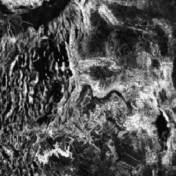
Różnorodność topograficzna (D) to zmienna zastępcza, która reprezentuje różnorodność warunków temperatury i wilgotności dostępnych dla gatunków jako lokalnych siedlisk. Wyraża ona logikę, że większa różnorodność nisz klimatyczno-topograficznych powinna sprzyjać większej różnorodności (zwłaszcza roślin) i trwałości gatunków w warunkach zmian klimatycznych.
Do obliczenia D wykorzystano wielowymiarową miarę rzeźby terenu (mTPI), która jest dominującym czynnikiem wpływającym na wilgotność gleby (T). Wartość mTPI została połączona z transformacją pierwiastkowa dla mTPI>0 (T') i ze standardowym odchyleniem indeksu obciążenia ciepłem i promieniowaniem słonecznym (CHILI) obliczonego na różnych skalach (C') w ten sposób: D = 1 – ((1-T') * (1-C'). Jest ono oparte na pasmie „AVE” 30 m z DEM ALOS JAXA (dostępne w EE jako JAXA/ALOS/AW3D30_V1_1).
Zbiory danych Ecologically Relevant Geomorphology (ERGo) partnerów Conservation Science Partners (CSP) dotyczące form terenu i fizjografii zawierają szczegółowe dane dotyczące form terenu i wzorów fizjograficznych (czyli aspektów terenu). Chociaż dane te można wykorzystywać na wiele sposobów, ich pierwotnym celem było opracowanie klasyfikacji i mapy form rzeźby terenu oraz klas fizjograficznych, które są odpowiednie do planowania adaptacji do zmian klimatu. W związku z dużą niepewnością związaną z przyszłościowymi warunkami klimatycznymi i jeszcze większą niepewnością dotyczącą reakcji ekologicznych, udostępnianie informacji o tym, co prawdopodobnie się nie zmieni, stanowi solidną podstawę dla menedżerów do tworzenia solidnych planów adaptacji do zmian klimatu. Ilościowe określenie tych cech krajobrazu zależy od rozdzielczości, dlatego podajemy najwyższą możliwą rozdzielczość, biorąc pod uwagę zasięg i charakterystykę danego indeksu.
Pasma
Rozmiar piksela
270 metrów
Pasma
| Nazwa | Minimum | Maks. | Opis |
|---|---|---|---|
constant |
0* | 1* | Różnorodność topograficzna określona na podstawie ALOS |
Warunki korzystania z usługi
Warunki korzystania z usługi
Cytaty
Theobald, D. M., Harrison-Atlas, D., Monahan, W. B., i Albano, C. M. (2015). mapy form terenu i różnorodności fizjograficznej w celu planowania adaptacji do zmian klimatu; PloS one, 10(12), e0143619
Odkrywanie za pomocą Earth Engine
Edytor kodu (JavaScript)
var dataset = ee.Image('CSP/ERGo/1_0/Global/ALOS_topoDiversity');
var alosTopographicDiversity = dataset.select('constant');
var alosTopographicDiversityVis = {
  min: 0.0,
  max: 1.0,
};
Map.setCenter(-111.313, 39.724, 6);
Map.addLayer(
    alosTopographicDiversity, alosTopographicDiversityVis,
    'ALOS Topographic Diversity');